Thursday 1st September 2016
Before this year I had not been to the top of a Scottish mountain for two years and even before that I had already begun favouring long distance walking as opposed to climbing mountains. However on my last holiday in Scotland, in May/June, I was fortunate to enjoy good weather that gave me the opportunity to go up a few mountains and I was in awe of the experience. I had forgotten how great it is to be at the top of a Scottish mountain in good weather, so when planning for this holiday I wanted to go up as many mountains as possible, but I have found that the reason why I had fallen out of favour of going up mountains in Scotland is because the weather is often poor. The top of a mountain in good weather is the best place that anyone can be, but in bad weather it can be the worst. On this holiday I got some rather poor weather that put my memories of good weather earlier in the year firmly into the dim and distant past. I was in Scotland specifically to go up mountains, but I was experiencing weather that didn’t make me want to be up there.
When I left Torridon at the beginning of this day the weather was pretty awful and after driving over several mountain passes on single track roads I eventually reached the delightful, but isolated coastal village of Arnisdale on the shores of Loch Hourn. It was still raining with low clouds everywhere, so there wasn’t a soul in sight. This is the sort of miserable weather where no one in their right mind would go out and I sat in my car also not wanting to go out into the terrible weather. I questioned my sanity as I finally got out of the car and set off up the footpath that begins near the village climbing the steep hillside above. My bold move was soon rewarded as the rain stopped and held off until the end of my walk and afforded me with a much better day than I had feared. I was climbing Beinn Sgritheall, a Munro that has very steep slopes that fall precipitously all the way down from the summit to the shores of Loch Hourn.
The path above Arnisdale was very steep, very boggy and badly eroded, which made this quite a struggle for me to climb the grassy slopes even as the views slowly began to improve across Loch Hourn towards the beautiful Knoydart peninsula. Ladhar Bheinn though, and the other Knoydart mountains, were firmly enclosed in clouds as I slowly dragged myself up the steep slopes into the mountain pass of Bealach Arnasdail. To my right were the steep, craggy slopes of the Corbett, Beinn na h-Eaglaise, but my attention was on the Munro, Beinn Sgritheall, to my left, that was showing me steep grassy slopes and looked impregnable. A thin path took a good route up the steep slopes until it deteriorated into a crawl straight up, but the climb was more than compensated by the improving views as the clouds lifted from the surrounding hills to reveal the quintessentially Scottish view of row upon row of mountains as far as the eye can see. By the time I reached the 906 metre eastern top of Beinn Sgritheall, the views east over the top of Beinn na h-Eaglaise and towards the mountains of Kintail were amazing.
The views all around me were fabulous despite the grey, overcast skies with even the Knoydart mountains now clear of clouds. Ahead of me Beinn Sgritheall beckoned me on with a seemingly easy ridge to traverse, but as I neared the bottom of the col between the two tops I was blasted by ferocious winds that knocked me off the top of the ridge northwards and forced me to desperately find some shelter in order to recover from the shock. I took this opportunity to have my lunch in this cold and windy location before girding my loins for another attempt at the summit. I may have had clear views but the weather was still very poor as I struggled against the tremendous winds on the narrowing ridge. I was still battling against the strong winds when I reached the spot where the ridge becomes precipitously narrow and exposed falling three thousand feet almost straight down to sea which forced me to be very careful as I fought against the wind up the steep, narrow ridge until eventually I reached the summit of the Munro of Beinn Sgritheall.
The best of the views were now west out to sea towards the Isle of Skye with the ridge below me descending steeply with a good path that weaves cunningly through the steep crags. It was an absolute pleasure for me to make my way slowly down this great path with those fabulous views before me. I was now sheltered from the wind so the hardships that I had endured during the ascent were forgotten as I basked in this wonderful descent down the craggy slopes with that great view towards Skye before me. Eventually I reached the small lake of Lochan Bhealach Ràrsaidh where I veered left off the ridge onto a path that heads down the steep slopes below Beinn Sgritheall. Initially this was a great path through gorgeous purple-flowering heather with good views looking up to the top of Beinn Sgritheall, which was dramatically showing off its sheer slopes, but it wasn’t long before the weather began to reassert itself with clouds slowly descending onto the top of Beinn Sgritheal again. I was fortunate to have had clear views from the summit on this poor weather day.
Lower down the path entered a young wood and weaveed a fascinating, though steep, course through the trees, but on the other side of the wood the path deteriorated becoming boggier and was dominated by bracken so that I was enormously relieved when I eventually reached the road some distance west of the village of Arnisdale. This had been a challenging walk on paths that were not in the best of conditions, though the descent was not as bad as the ascent. Many guidebook writers recommend doing the walk in the other direction, but I had decided to stick with Ralph Storer’s route and I’m glad that I did because the walk benefitted enormously by having that view across to the Isle of Skye on the descent. Beinn Sgritheall is a good mountain with a memorably steep climb and sheer slopes that were quite an experience, especially in strong winds. Poor weather at the start of this walk had not made me want to go, but once I was on this steeply-sided mountain I was richly rewarded with stunning views that reminded me that Scottish mountains can be great places to be even when the weather is poor.
This is a blog of my many walks around Britain and Ireland, usually published weekly
Showing posts with label Knoydart. Show all posts
Thursday, 20 October 2016
Thursday, 22 September 2016
Gleouraich and Spidean Mialach
Sunday 28th August 2016
I first started planning this holiday in Scotland last year before I even went to the Outer Hebrides. The original idea was to start walking along the Cape Wrath Trail that runs from Fort William all the way along the west coast of the Highlands to the north-western tip of Scotland at Cape Wrath. The plan evolved so that I would walk only as far as Glen Shiel on this holiday, about a quarter of the way along the trail, and climb as many mountains as I could on the way. Later I settled on starting from Glenfinnan and not Fort William, and to do the holiday at the end of May this year, but then problems with the trains forced me to radically change my plans and I went to the Cairngorms at the end of May instead. When I was finishing that holiday it wasn’t the Western Highlands that I was looking at for late summer but a return to the Western Isles to walk along the new Hebridean Way. However that trail has not been officially opened yet so I thought it best to wait another year for that and I turned my attention back to the Western Highlands. My memory of carrying a heavy rucksack was fresh in my mind when I booked this holiday so I decided to take my car to Scotland, which I hadn’t done since 2010.
Therefore, after an overnight stay in Crianlarich, I drove along the narrow twisty road through Glen Garry that led me to Loch Quoich where I parked at the foot of Gleouraich (this tongue-twister is probably best pronounced Glaw-reech), which is one of the mountains that had always been on my plan for this holiday. The walk started with a soaking while battling through the overgrown dew-covered rhododendrons that lined the road. Once I emerged onto the open hillside I was immediately awestruck by the stunning array of mountains that lie at the western end of Loch Quoich. The mountains of the Rough Bounds of Knoydart looked spectacular in the bright, sunny conditions clustered at the far end of the loch and kept drawing my attention all day even after the weather deteriorated. The footpath, which Ralph Storer describes as ‘perhaps the finest stalkers’ path in the country’, zigzags brilliantly up the hillside and was a pleasure to walk along, while that view kept my eyes away from the ground at my feet.
The purple flowers of heather and devil’s-bit scabious covered the ground as I sweated in the warm weather up the excellent path, stopping frequently to admire the view and wipe the sweat off my brow. Unfortunately the good weather didn’t last as clouds soon descended over the mountain and my views became restricted, even at its best, to the steep, grassy slopes below me that led all the way down to Loch Quoich. The path brought me to a narrow ridge and kept to the loch-side of the ridge around the grassy hump of Druim Seileach, and after crossing the saddle beyond I plunged into thick clouds as I climbed the steep, stony slopes of Geouraich. Upon reaching the western top I was astonished to suddenly come out of the clouds and have a clear view of the summit a short distance ahead of me along the ridge with Glen Loyne north of the mountain. Thick cloud continued to hold onto the western slopes, but to the east that cloud was just about high enough to afford me with views along the gloriously rocky ridge and down into the fabulously craggy northern corries.
I immediately started to think about lunch, however there wasn’t a breath of wind and this time of the year if I stopped I was soon plagued by midges, so I kept going, over the Munro and along the ridge. This was a great walk along the ridge with rock constantly underfoot and lots of interesting variations while the ridge undulated around the deeply indented crag-filled corries. The best hill-walking is ridge walking and the ridge between Gleouraich and Spidean Mialach is one of the best, but woefully far too short. It wasn’t long before I reached Creag Coire na Fiar Bhealaich where an excellent path zigzags ingeniously and gloriously down a steep, rocky slope. I loved this ridge and the path along it, but I longed for better weather so that I could fully appreciated the mountain views little knowing that this was going to be the best weather that I was going to get during my entire two weeks in Scotland. Despite the dull views from the thick cloud overhead, I had enjoyed my walk along the craggy ridge and as I reached the col, Fiar Bhealaich, the sun finally came out again just in time for my steep climb up the slopes of Spidean Mialach.
Once the terrain eased I made my way along the interesting ridge over several tops before finally arriving at the Munro of Spidean Mialach. A clear path can be seen leading from the summit steeply down the south-western slopes, however this is not up to the same high standards as the ascent path. The path disappeared into bogs that were a real trial for me to traverse. The guide book writers all recommend crossing the Allt a’ Mheill to the col with Meall nan Carn where another stalkers’ path completes the descent, however a wide track has recently been built up to a small dam on the Allt a’ Mheill for a small hydroelectric plant. This proved too tempting a lure and so I made my way through the boggy terrain in increasingly windy weather down to the dam where an easy, though steep, descent down the track led me to the road a kilometre east of my car. This was an awesome walk in weather that was probably as good as you can expect in the West Highlands. These two mountains make a great walk and was a great way to start my holiday in Scotland.
I first started planning this holiday in Scotland last year before I even went to the Outer Hebrides. The original idea was to start walking along the Cape Wrath Trail that runs from Fort William all the way along the west coast of the Highlands to the north-western tip of Scotland at Cape Wrath. The plan evolved so that I would walk only as far as Glen Shiel on this holiday, about a quarter of the way along the trail, and climb as many mountains as I could on the way. Later I settled on starting from Glenfinnan and not Fort William, and to do the holiday at the end of May this year, but then problems with the trains forced me to radically change my plans and I went to the Cairngorms at the end of May instead. When I was finishing that holiday it wasn’t the Western Highlands that I was looking at for late summer but a return to the Western Isles to walk along the new Hebridean Way. However that trail has not been officially opened yet so I thought it best to wait another year for that and I turned my attention back to the Western Highlands. My memory of carrying a heavy rucksack was fresh in my mind when I booked this holiday so I decided to take my car to Scotland, which I hadn’t done since 2010.
Therefore, after an overnight stay in Crianlarich, I drove along the narrow twisty road through Glen Garry that led me to Loch Quoich where I parked at the foot of Gleouraich (this tongue-twister is probably best pronounced Glaw-reech), which is one of the mountains that had always been on my plan for this holiday. The walk started with a soaking while battling through the overgrown dew-covered rhododendrons that lined the road. Once I emerged onto the open hillside I was immediately awestruck by the stunning array of mountains that lie at the western end of Loch Quoich. The mountains of the Rough Bounds of Knoydart looked spectacular in the bright, sunny conditions clustered at the far end of the loch and kept drawing my attention all day even after the weather deteriorated. The footpath, which Ralph Storer describes as ‘perhaps the finest stalkers’ path in the country’, zigzags brilliantly up the hillside and was a pleasure to walk along, while that view kept my eyes away from the ground at my feet.
The purple flowers of heather and devil’s-bit scabious covered the ground as I sweated in the warm weather up the excellent path, stopping frequently to admire the view and wipe the sweat off my brow. Unfortunately the good weather didn’t last as clouds soon descended over the mountain and my views became restricted, even at its best, to the steep, grassy slopes below me that led all the way down to Loch Quoich. The path brought me to a narrow ridge and kept to the loch-side of the ridge around the grassy hump of Druim Seileach, and after crossing the saddle beyond I plunged into thick clouds as I climbed the steep, stony slopes of Geouraich. Upon reaching the western top I was astonished to suddenly come out of the clouds and have a clear view of the summit a short distance ahead of me along the ridge with Glen Loyne north of the mountain. Thick cloud continued to hold onto the western slopes, but to the east that cloud was just about high enough to afford me with views along the gloriously rocky ridge and down into the fabulously craggy northern corries.
I immediately started to think about lunch, however there wasn’t a breath of wind and this time of the year if I stopped I was soon plagued by midges, so I kept going, over the Munro and along the ridge. This was a great walk along the ridge with rock constantly underfoot and lots of interesting variations while the ridge undulated around the deeply indented crag-filled corries. The best hill-walking is ridge walking and the ridge between Gleouraich and Spidean Mialach is one of the best, but woefully far too short. It wasn’t long before I reached Creag Coire na Fiar Bhealaich where an excellent path zigzags ingeniously and gloriously down a steep, rocky slope. I loved this ridge and the path along it, but I longed for better weather so that I could fully appreciated the mountain views little knowing that this was going to be the best weather that I was going to get during my entire two weeks in Scotland. Despite the dull views from the thick cloud overhead, I had enjoyed my walk along the craggy ridge and as I reached the col, Fiar Bhealaich, the sun finally came out again just in time for my steep climb up the slopes of Spidean Mialach.
Once the terrain eased I made my way along the interesting ridge over several tops before finally arriving at the Munro of Spidean Mialach. A clear path can be seen leading from the summit steeply down the south-western slopes, however this is not up to the same high standards as the ascent path. The path disappeared into bogs that were a real trial for me to traverse. The guide book writers all recommend crossing the Allt a’ Mheill to the col with Meall nan Carn where another stalkers’ path completes the descent, however a wide track has recently been built up to a small dam on the Allt a’ Mheill for a small hydroelectric plant. This proved too tempting a lure and so I made my way through the boggy terrain in increasingly windy weather down to the dam where an easy, though steep, descent down the track led me to the road a kilometre east of my car. This was an awesome walk in weather that was probably as good as you can expect in the West Highlands. These two mountains make a great walk and was a great way to start my holiday in Scotland.
Thursday, 20 September 2012
Inverie Woods and the Mallaig Circular Walk
Friday 8th June 2012
After four days in Knoydart it was sadly time for me to leave this fantastically wild and remote area. Before catching the ferry back to Mallaig I did a quick walk around the woods above Inverie where there is a good selection of paths above the small community and provided me with an entertaining walk while I waited. These paths took me up the steep hillside, climbing as high as I could get, until I reached a viewpoint near the top fence where I had views across the bay and out to sea, and then I dropped quickly down the hillside along a bike track having just as much fun running down as I would have done if I’d cycled down. On the pier I caught the ferry and nostalgically looked at the view of Knoydart behind me as the boat pulled away from Inverie. The Corbett and the three Munros that I had climbed during my time in Knoydart came into view as the boat pulled away from the shore: Ladhar Bheinn on the left, Sgurr Coire Choinnichean in the middle, standing guard over Inverie, and Luinne Bheinn and Meall Buidhe to the right. They could all be clearly seen as a reminder of my time in the area.
In Mallaig, due to the sparsity of trains on the West Highland Line, I had a five hour wait for the next train. Fortunately while waiting for the ferry to Knoydart on Monday I had seen a notice board that mentioned circular walks around Mallaig. The Mallaig Circular Walk climbs from the East Bay car park up a clear, well surfaced path to a viewpoint that overlooks the port. The circular walk then continues along this pleasant path down to Malaig Bheag and returns to the start along the road. This is listed as a two mile walk, which wasn’t going to last the five hours that I needed to fill, so at the top of the hill I turned right following a marker that pointed towards “Loch an Nostarie and Loch Eireagoraidh”. However, I think I must have immediately gone the wrong way as the faint path that I was following lead to a tall deer fence with no way over it. Turning left beside the fence I dropped down into a grassy gully where I found the correct path and a gate through the fence, which led me to another fence from where views could be seen across the seemingly unspoilt Loch an Nostarie.
Since I had plenty of time until my train was due I decided to start following some of the paths that are marked on my map that I could just about make out on the ground and headed east. The path I was walking along was very faint and difficult to follow, which made me feel like I was walking in some really wild and isolated location, but the illusion of unspoilt terrain was ruined when I realised that I was following a pipeline that goes from Loch Eireagoraidh past Loch an Nostarie to the coast near Mallaig (supplying water for the village). Two paths go either side of the small hill of Beinn nan Caorach to a narrow gully between the rocky peaks of Carn a’ Ghobhair and Carn Mhic a Ghille-chairn before eventually reaching Loch Eireagoraidh. I took the northern path past Beinn nan Caorach but I turned back along the southern path before reaching the gully. I suppose it might have been fun if I had gone through the gap and seen the loch, and maybe even climbed the rocky peaks to their summits. With hindsight I wish I had, but at the time I was just thinking about getting back to Mallaig for something to eat.
The path I was following led me briefly beside the An Leth-allt stream before descending to the shore of Loch an Nostarie. A pleasant walk along the shore led me all the way to Glasnacardoch on the main road near the coast, and a walk along the old road past a swimming pool and the secondary school brought me back into Mallaig where I had my lunch. The rest of my day in Mallaig was whittled away doing little else. It’s a shame I wasn’t able to do a bigger walk on my last full day in Scotland as my schedule dictated that I needed to catch a train south along the West Highland Line to Crianlarich where a short overnight stop would interrupt my journey home. I quite enjoyed my walk around the hills overlooking Mallaig. The weather was as good as I had enjoyed throughout my holiday and afforded me with good views out to sea, towards the mountains of Rùm and south towards Loch Morar. I can’t believe how lucky I was with the weather during this holiday. This summer has been infamous for its bad weather and yet I found the only spot in Britain to have escaped. Not since 2006 have I known such consistently good weather during a holiday.
The negatives from this holiday are partly a result of the good weather: by the end of the holiday I was covered in insect bites from the midges that always plague the West Highlands during the summer. The hot weather had brought them out in their billions and they all seem to have made a beeline for me! Another problem I had on this holiday was my seeming inability to go uphill without quickly getting out of breath and exhausted. I put on a lot of weight over the winter and I think I was finally paying the price for it. Finally, I think a problem I had on this holiday, and indeed on other holidays in Scotland, is a lack of flexibility. I plan my holidays so rigidly that unless I have planned them perfectly, which rarely happens, I end up with things like a five hour wait for a train in Mallaig. My planning for holidays needs to be better or just a little less rigid in that plan. I had attempted with this holiday to stop my dissatisfaction with my Scottish holidays, and I can’t say this holiday was disappointing as I had a fabulous time throughout the fortnight. I climbed twelve Munros and two Corbetts while staying in some adorably isolated locations. The unspoilt isolation of places like Loch Ossian and Knoydart is the highlight of this holiday.
After four days in Knoydart it was sadly time for me to leave this fantastically wild and remote area. Before catching the ferry back to Mallaig I did a quick walk around the woods above Inverie where there is a good selection of paths above the small community and provided me with an entertaining walk while I waited. These paths took me up the steep hillside, climbing as high as I could get, until I reached a viewpoint near the top fence where I had views across the bay and out to sea, and then I dropped quickly down the hillside along a bike track having just as much fun running down as I would have done if I’d cycled down. On the pier I caught the ferry and nostalgically looked at the view of Knoydart behind me as the boat pulled away from Inverie. The Corbett and the three Munros that I had climbed during my time in Knoydart came into view as the boat pulled away from the shore: Ladhar Bheinn on the left, Sgurr Coire Choinnichean in the middle, standing guard over Inverie, and Luinne Bheinn and Meall Buidhe to the right. They could all be clearly seen as a reminder of my time in the area.
In Mallaig, due to the sparsity of trains on the West Highland Line, I had a five hour wait for the next train. Fortunately while waiting for the ferry to Knoydart on Monday I had seen a notice board that mentioned circular walks around Mallaig. The Mallaig Circular Walk climbs from the East Bay car park up a clear, well surfaced path to a viewpoint that overlooks the port. The circular walk then continues along this pleasant path down to Malaig Bheag and returns to the start along the road. This is listed as a two mile walk, which wasn’t going to last the five hours that I needed to fill, so at the top of the hill I turned right following a marker that pointed towards “Loch an Nostarie and Loch Eireagoraidh”. However, I think I must have immediately gone the wrong way as the faint path that I was following lead to a tall deer fence with no way over it. Turning left beside the fence I dropped down into a grassy gully where I found the correct path and a gate through the fence, which led me to another fence from where views could be seen across the seemingly unspoilt Loch an Nostarie.
Since I had plenty of time until my train was due I decided to start following some of the paths that are marked on my map that I could just about make out on the ground and headed east. The path I was walking along was very faint and difficult to follow, which made me feel like I was walking in some really wild and isolated location, but the illusion of unspoilt terrain was ruined when I realised that I was following a pipeline that goes from Loch Eireagoraidh past Loch an Nostarie to the coast near Mallaig (supplying water for the village). Two paths go either side of the small hill of Beinn nan Caorach to a narrow gully between the rocky peaks of Carn a’ Ghobhair and Carn Mhic a Ghille-chairn before eventually reaching Loch Eireagoraidh. I took the northern path past Beinn nan Caorach but I turned back along the southern path before reaching the gully. I suppose it might have been fun if I had gone through the gap and seen the loch, and maybe even climbed the rocky peaks to their summits. With hindsight I wish I had, but at the time I was just thinking about getting back to Mallaig for something to eat.
The path I was following led me briefly beside the An Leth-allt stream before descending to the shore of Loch an Nostarie. A pleasant walk along the shore led me all the way to Glasnacardoch on the main road near the coast, and a walk along the old road past a swimming pool and the secondary school brought me back into Mallaig where I had my lunch. The rest of my day in Mallaig was whittled away doing little else. It’s a shame I wasn’t able to do a bigger walk on my last full day in Scotland as my schedule dictated that I needed to catch a train south along the West Highland Line to Crianlarich where a short overnight stop would interrupt my journey home. I quite enjoyed my walk around the hills overlooking Mallaig. The weather was as good as I had enjoyed throughout my holiday and afforded me with good views out to sea, towards the mountains of Rùm and south towards Loch Morar. I can’t believe how lucky I was with the weather during this holiday. This summer has been infamous for its bad weather and yet I found the only spot in Britain to have escaped. Not since 2006 have I known such consistently good weather during a holiday.
The negatives from this holiday are partly a result of the good weather: by the end of the holiday I was covered in insect bites from the midges that always plague the West Highlands during the summer. The hot weather had brought them out in their billions and they all seem to have made a beeline for me! Another problem I had on this holiday was my seeming inability to go uphill without quickly getting out of breath and exhausted. I put on a lot of weight over the winter and I think I was finally paying the price for it. Finally, I think a problem I had on this holiday, and indeed on other holidays in Scotland, is a lack of flexibility. I plan my holidays so rigidly that unless I have planned them perfectly, which rarely happens, I end up with things like a five hour wait for a train in Mallaig. My planning for holidays needs to be better or just a little less rigid in that plan. I had attempted with this holiday to stop my dissatisfaction with my Scottish holidays, and I can’t say this holiday was disappointing as I had a fabulous time throughout the fortnight. I climbed twelve Munros and two Corbetts while staying in some adorably isolated locations. The unspoilt isolation of places like Loch Ossian and Knoydart is the highlight of this holiday.
Thursday, 13 September 2012
Meall Buidhe
Thursday 7th June 2012
Despite expecting bad weather to finally break my holiday, bright sunshine continued as I once again set off alongside the Inverie River through the wild Knoydart peninsula. There are three Munros (mountains above three thousand feet in Scotland) in the Knoydart area, and I’d walked up two of them over the previous couple of daysm which left the final Munro, Meall Buidhe, for my last day in Knoydart. This is not a big mountain (in terms of area), and in fact its name translates as ‘yellow hill’. Nearby is a mountain that translates as ‘yellow mountain’, that being Beinn Bhuidhe, which is a much more expansive mountain even though it’s only a Corbett (a mountain in Scotland between two and a half and three thousand feet). I considered including Beinn Bhuidhe in this walk, but eventually abandoned the idea, and harmed what could have been a great walk. When planning for this holiday I had thought of making Beinn Bhuidhe one of my targets for a walk and I think it would have been a great walk, but not if I’d tried to tag it onto its neighbour Meall Buidhe. Ultimately this walk was decided the day before when I didn’t walk along the ridge between Luinne Bheinn and Meall Buidhe, and that was decided by not walking between Sgurr Coire Choinichean and Ladhar Bheinn. What a convoluted mess!
This walk started just like the previous two with a walk along Gleann an Dubh-Lochain, a stunning valley that I was beginning to appreciate in many ways. Before reaching Dubh-Lochain I branched off the main track onto a path that crosses the Inverie River before making its way over the Màm Meadail pass. I soon turned off the path and crossed the Allt Gleann Meadail stream making my way straight for the western tip of Meall Buidhe. My Harvey Map indicated a path up the steep ridge, but I had difficulty following it at first, and even needed to consult my GPS at one point. Eventually, I managed to find the slender path that climbs the steep ridge of Druim Righeanaich and finally reached the top of the crags, only to see what lay ahead of me: long grassy slopes that led all the way up to the summit. This is the sort of thing I love in descent but in ascent I find it just too tedious as they seem to drag, so I was soon thinking that I should have done this walk in the other direction. The views behind me along the lush-green valley to Inverie and out to sea were stunning, but I would have appreciated them more if I was looking at them all the time rather than only when I stopped and turned around.
The clear skies were a soft blue while the sea was a lovely deep blue across the Inner Sound all the way to the mountains of Rùm on the horizon. The views were enchanting in the good weather. Very slowly I made my way along the grassy ridge all the way up to the summit. This holiday started with me having a lot of problems with fatigue while going uphill, possibly due to lack of sleep or simply because of the heat. Despite getting plenty of sleep and with cooler temperatures I was still not climbing the hills as quickly as I once did. Rejecting the possibility that I’m getting old, I assume I’m just not as fit as I once was. My legs were lacking the strength to haul myself up the hills very quickly, which is probably due to a lack of exercise, particularly of the hill-walking variety, when I’m not on holiday. My walking companion around Loch Ossian did a lot of running and despite being a little older than me was easily able to climb the mountains. Maybe age does have something to do with it – if I want to continue going up mountains in the way that I’m used to, I can no longer get away with sporadic walks up hills. I may even have to take up running …
Very, very slowly I made my way up to the summit of Meall Buidhe where I had my lunch with the typical stunning Scottish mountain panorama all around me. I couldn’t help thinking that this was the last Munro of my Scottish holiday this year; I wouldn’t be seeing the sweep of Scottish mountains as far as the eye could see again until next year. Not far from where I was sitting, just across the Carnach valley, are the Munros of Sgurr na Ciche and Garbh Chioch Mhor where I went for a long tiring walk in 2008. These are difficult to reach mountains that required a long drive beside Loch Arkaig before a long walk along Glen Dessary. I managed to get as far as Garbh Chioch Mhor in poor weather but had been forced to to turn back before reaching Sgurr na Ciche because of time and the remoteness of the location. On that occasion I never saw the illusive Munro, but now I could clearly see the sharp-peaked mountain. I wonder if I will ever finally reach the top. There are people who would not be happy until they have bagged every Munro in the area, but I’ve never been that concerned about bagging Munros. All I’m interested in is a good walk over good terrain with good views.
On leaving the summit of Meall Buidhe I crossed over to the south-east top, a Munro Top, and had a quick look along the ridge to Luinne Bheinn. I’ve heard that the ridge between Meall Buidhe and Luinne Bheinn is a navigational challenge, even in good weather. I might have had a great walk along that ridge, which I should really have done the day before, but should I have corrected that by turning left at this moment onto the steep rugged ridge? We’ll never know. I turned right down the south-eastern ridge towards Sgurr Sgeithe. After the ground levelled off the path I was following disappeared and I was left with a steep, pathless, crag-filled slope all the way down to Màm Meadail, so gingerly I made my way down the ridiculously steep grassy slope. By the time I got down to the pass I didn’t feel like prolonging the walk over Beinn Bhuidhe, where there appeared to be no path, so I just followed the good path all the way back to Inverie. I was just too tired to want to attempt the broad ridge. Beinn Bhuidhe should be climbed as the sole target of the day and not tagged onto another. It’s just a shame that I didn’t plan this walk better as the walk that I did would have been much better done in the opposite direction. My walks in Knoydart could all have been better organised, but I still managed to climb all three Munros in the area, plus a Corbett, and all in brilliant weather. I shouldn’t complain.
Despite expecting bad weather to finally break my holiday, bright sunshine continued as I once again set off alongside the Inverie River through the wild Knoydart peninsula. There are three Munros (mountains above three thousand feet in Scotland) in the Knoydart area, and I’d walked up two of them over the previous couple of daysm which left the final Munro, Meall Buidhe, for my last day in Knoydart. This is not a big mountain (in terms of area), and in fact its name translates as ‘yellow hill’. Nearby is a mountain that translates as ‘yellow mountain’, that being Beinn Bhuidhe, which is a much more expansive mountain even though it’s only a Corbett (a mountain in Scotland between two and a half and three thousand feet). I considered including Beinn Bhuidhe in this walk, but eventually abandoned the idea, and harmed what could have been a great walk. When planning for this holiday I had thought of making Beinn Bhuidhe one of my targets for a walk and I think it would have been a great walk, but not if I’d tried to tag it onto its neighbour Meall Buidhe. Ultimately this walk was decided the day before when I didn’t walk along the ridge between Luinne Bheinn and Meall Buidhe, and that was decided by not walking between Sgurr Coire Choinichean and Ladhar Bheinn. What a convoluted mess!
This walk started just like the previous two with a walk along Gleann an Dubh-Lochain, a stunning valley that I was beginning to appreciate in many ways. Before reaching Dubh-Lochain I branched off the main track onto a path that crosses the Inverie River before making its way over the Màm Meadail pass. I soon turned off the path and crossed the Allt Gleann Meadail stream making my way straight for the western tip of Meall Buidhe. My Harvey Map indicated a path up the steep ridge, but I had difficulty following it at first, and even needed to consult my GPS at one point. Eventually, I managed to find the slender path that climbs the steep ridge of Druim Righeanaich and finally reached the top of the crags, only to see what lay ahead of me: long grassy slopes that led all the way up to the summit. This is the sort of thing I love in descent but in ascent I find it just too tedious as they seem to drag, so I was soon thinking that I should have done this walk in the other direction. The views behind me along the lush-green valley to Inverie and out to sea were stunning, but I would have appreciated them more if I was looking at them all the time rather than only when I stopped and turned around.
The clear skies were a soft blue while the sea was a lovely deep blue across the Inner Sound all the way to the mountains of Rùm on the horizon. The views were enchanting in the good weather. Very slowly I made my way along the grassy ridge all the way up to the summit. This holiday started with me having a lot of problems with fatigue while going uphill, possibly due to lack of sleep or simply because of the heat. Despite getting plenty of sleep and with cooler temperatures I was still not climbing the hills as quickly as I once did. Rejecting the possibility that I’m getting old, I assume I’m just not as fit as I once was. My legs were lacking the strength to haul myself up the hills very quickly, which is probably due to a lack of exercise, particularly of the hill-walking variety, when I’m not on holiday. My walking companion around Loch Ossian did a lot of running and despite being a little older than me was easily able to climb the mountains. Maybe age does have something to do with it – if I want to continue going up mountains in the way that I’m used to, I can no longer get away with sporadic walks up hills. I may even have to take up running …
Very, very slowly I made my way up to the summit of Meall Buidhe where I had my lunch with the typical stunning Scottish mountain panorama all around me. I couldn’t help thinking that this was the last Munro of my Scottish holiday this year; I wouldn’t be seeing the sweep of Scottish mountains as far as the eye could see again until next year. Not far from where I was sitting, just across the Carnach valley, are the Munros of Sgurr na Ciche and Garbh Chioch Mhor where I went for a long tiring walk in 2008. These are difficult to reach mountains that required a long drive beside Loch Arkaig before a long walk along Glen Dessary. I managed to get as far as Garbh Chioch Mhor in poor weather but had been forced to to turn back before reaching Sgurr na Ciche because of time and the remoteness of the location. On that occasion I never saw the illusive Munro, but now I could clearly see the sharp-peaked mountain. I wonder if I will ever finally reach the top. There are people who would not be happy until they have bagged every Munro in the area, but I’ve never been that concerned about bagging Munros. All I’m interested in is a good walk over good terrain with good views.
On leaving the summit of Meall Buidhe I crossed over to the south-east top, a Munro Top, and had a quick look along the ridge to Luinne Bheinn. I’ve heard that the ridge between Meall Buidhe and Luinne Bheinn is a navigational challenge, even in good weather. I might have had a great walk along that ridge, which I should really have done the day before, but should I have corrected that by turning left at this moment onto the steep rugged ridge? We’ll never know. I turned right down the south-eastern ridge towards Sgurr Sgeithe. After the ground levelled off the path I was following disappeared and I was left with a steep, pathless, crag-filled slope all the way down to Màm Meadail, so gingerly I made my way down the ridiculously steep grassy slope. By the time I got down to the pass I didn’t feel like prolonging the walk over Beinn Bhuidhe, where there appeared to be no path, so I just followed the good path all the way back to Inverie. I was just too tired to want to attempt the broad ridge. Beinn Bhuidhe should be climbed as the sole target of the day and not tagged onto another. It’s just a shame that I didn’t plan this walk better as the walk that I did would have been much better done in the opposite direction. My walks in Knoydart could all have been better organised, but I still managed to climb all three Munros in the area, plus a Corbett, and all in brilliant weather. I shouldn’t complain.
Thursday, 6 September 2012
Sgurr Coire Choinnichean and Luinne Bheinn
Wednesday 6th June 2012
While the rest of the country was suffering from torrential rain in June, the west coast of Scotland was escaping it all so I was once again setting off for a good walk in brilliant weather. Although it clouded over later in the day, the weather for this walk never deteriorated so much that it prevented me from walking up a Corbett and a Munro in the stunning scenery of the Knoydart peninsula. This walk was dictated by the need to return to Inverie in the middle of the day to buy some food, specifically the local venison from the community shop that was not open early or late enough for me to visit before or after a walk. Two shorter walks were therefore required rather than one long walk. To start I climbed the Corbett that I’d failed to include in my ascent of Ladhar Bheinn the previous day. Sgurr Coire Choinnichean is the steep mountain that overlooks Inverie Bay and I had decided that the best route to take up it would be straight up the ridge from Inverie, and did I soon regret that?!! This was a ridiculously steep climb through lush-green bracken and past-their-prime bluebells up a sort of a path, but was really just a struggle up an impossibly steep slope.
As I climbed higher and higher I stopped frequently for a breath, but also to get a glimpse of the increasingly stunning view that was appearing behind me. By the time the gradient eased the ridge was narrowing and the view across Inverie Bay was awe-inspiring. In the superb weather and after climbing so high so quickly I had stunning views across the bay towards Loch Nevis and out to sea. As the ridge narrowed it grew craggier and more exciting with steep drops down either side to the valley floors far below me. There was a fabulous path along the glorious ridge with stunning views under blue skies and above blue seas that made every step a joy. When I reached the summit of the Corbett I bathed in the awesome scenery and stunning views and then turned around to enjoy that great ridge all over again. Beyond the summit the ridge widens as it undulates tediously over Meall an Ullt-fhearna down to the col where I’d joined the ridge the day before, so I felt there was no hardship in missing out on this grassy ridge. Instead I returned along the narrow ridge over the western top and turned right once the ridge broadened again and descended the wide grassy slopes around the top of Slochd a’Mhogha.
The grassy slopes above Inverie Woods took me to a forest track that led me all the way back into Inverie where I bought some venison stakes, and took them to the bunkhouse where I was staying, before setting off along the track I’d taken the day before beside the Inverie River. After having my lunch beside Dubh-lochain while dark clouds began to spread across the sky I slowly made my way along the well-made path that leads all the way over the pass of Màm Barrisdale. For those walking into Knoydart this would have been the main route into the area, starting from Kinloch Hourn and passing Barrisdale Bay before climbing over the pass. This was a very well-made path, well-graded and with clever, subtle engineering in places, but is sadly now in need of repair. At the top of the pass I turned right onto a narrow path that follows a broken line of fence posts across the southern face of the Munro, Luinne Bheinn. Despite dull, overcast views, this was a great walk with great craggy scenery, but it soon became obvious to me that the path I was on was not going up to the top of Luinne Bheinn. A quick check of the map confirmed that the line of fence posts that I was following would soon start to descend into Coire Odhair, so I abandoned the faint path and climbed up a steep grassy rake.
This strenuous climb brought me near to the eastern top of Luinne Bheinn, which has three prominent tops. I was fascinated by this and enjoyed exploring the complex summit ridge. The western top, which overlooks the Dubh-lochain valley, has a fine cairn at the top, but is not the Munro, it is not the summit. My map indicated that the middle top is the highest, so I set off along the ridge until I reached a much smaller cairn that is actually the summit of the Munro. The eastern top is slightly smaller than the other two, but there is a bit of a drop before a small scramble leads up to the top. In addition to Munros there is such a thing as Munro Tops. These are Scottish Mountains above three thousand feet with a drop of more than thirty metres, but not distinct enough to make them Munros. The western top doesn’t count, despite its cairn and its prominent view from Gleann an Dubh-lochain. The central top is a Munro, but the eastern top, thanks to its drop, is a Munro Top. I’m not actually interested in Munro Tops (I’m not really interested in Munros), but the path across to the eastern top seemed too good to ignore and the views from this top, along the summit ridge of Luinne Bheinn and across Barrisdale, were worth the effort.
With rain looking likely I passed back over the summit of Luinne Bheinn and descended the steep rocky north-western slopes to the col with Bachd Mhic an Tosaich. I found a great path down the craggy slopes but it faded into nothing at the bottom of the crags so, deciding that the fence-post path I had used earlier was a sure guide back, I descended the grassy slopes until I reached my outward route. It was now straight forward for me to return to the excellent Barrisdale path and follow that all the way back into Gleann an Dubh-lochain. The rain that had looked imminent from the top of Luinne Bheinn never really materialised, despite the heavy rain that was plaguing the rest of the country. This was a long day with two great walks up two great mountains in the fantastic Knoydart area. Both mountains have interesting summit ridges, which made up for the long walk-in required to get to Luinne Bheinn. After my second day in Knoydart I was really beginning to appreciate the fun that can be had on the mountains in the area.
While the rest of the country was suffering from torrential rain in June, the west coast of Scotland was escaping it all so I was once again setting off for a good walk in brilliant weather. Although it clouded over later in the day, the weather for this walk never deteriorated so much that it prevented me from walking up a Corbett and a Munro in the stunning scenery of the Knoydart peninsula. This walk was dictated by the need to return to Inverie in the middle of the day to buy some food, specifically the local venison from the community shop that was not open early or late enough for me to visit before or after a walk. Two shorter walks were therefore required rather than one long walk. To start I climbed the Corbett that I’d failed to include in my ascent of Ladhar Bheinn the previous day. Sgurr Coire Choinnichean is the steep mountain that overlooks Inverie Bay and I had decided that the best route to take up it would be straight up the ridge from Inverie, and did I soon regret that?!! This was a ridiculously steep climb through lush-green bracken and past-their-prime bluebells up a sort of a path, but was really just a struggle up an impossibly steep slope.
As I climbed higher and higher I stopped frequently for a breath, but also to get a glimpse of the increasingly stunning view that was appearing behind me. By the time the gradient eased the ridge was narrowing and the view across Inverie Bay was awe-inspiring. In the superb weather and after climbing so high so quickly I had stunning views across the bay towards Loch Nevis and out to sea. As the ridge narrowed it grew craggier and more exciting with steep drops down either side to the valley floors far below me. There was a fabulous path along the glorious ridge with stunning views under blue skies and above blue seas that made every step a joy. When I reached the summit of the Corbett I bathed in the awesome scenery and stunning views and then turned around to enjoy that great ridge all over again. Beyond the summit the ridge widens as it undulates tediously over Meall an Ullt-fhearna down to the col where I’d joined the ridge the day before, so I felt there was no hardship in missing out on this grassy ridge. Instead I returned along the narrow ridge over the western top and turned right once the ridge broadened again and descended the wide grassy slopes around the top of Slochd a’Mhogha.
The grassy slopes above Inverie Woods took me to a forest track that led me all the way back into Inverie where I bought some venison stakes, and took them to the bunkhouse where I was staying, before setting off along the track I’d taken the day before beside the Inverie River. After having my lunch beside Dubh-lochain while dark clouds began to spread across the sky I slowly made my way along the well-made path that leads all the way over the pass of Màm Barrisdale. For those walking into Knoydart this would have been the main route into the area, starting from Kinloch Hourn and passing Barrisdale Bay before climbing over the pass. This was a very well-made path, well-graded and with clever, subtle engineering in places, but is sadly now in need of repair. At the top of the pass I turned right onto a narrow path that follows a broken line of fence posts across the southern face of the Munro, Luinne Bheinn. Despite dull, overcast views, this was a great walk with great craggy scenery, but it soon became obvious to me that the path I was on was not going up to the top of Luinne Bheinn. A quick check of the map confirmed that the line of fence posts that I was following would soon start to descend into Coire Odhair, so I abandoned the faint path and climbed up a steep grassy rake.
This strenuous climb brought me near to the eastern top of Luinne Bheinn, which has three prominent tops. I was fascinated by this and enjoyed exploring the complex summit ridge. The western top, which overlooks the Dubh-lochain valley, has a fine cairn at the top, but is not the Munro, it is not the summit. My map indicated that the middle top is the highest, so I set off along the ridge until I reached a much smaller cairn that is actually the summit of the Munro. The eastern top is slightly smaller than the other two, but there is a bit of a drop before a small scramble leads up to the top. In addition to Munros there is such a thing as Munro Tops. These are Scottish Mountains above three thousand feet with a drop of more than thirty metres, but not distinct enough to make them Munros. The western top doesn’t count, despite its cairn and its prominent view from Gleann an Dubh-lochain. The central top is a Munro, but the eastern top, thanks to its drop, is a Munro Top. I’m not actually interested in Munro Tops (I’m not really interested in Munros), but the path across to the eastern top seemed too good to ignore and the views from this top, along the summit ridge of Luinne Bheinn and across Barrisdale, were worth the effort.
With rain looking likely I passed back over the summit of Luinne Bheinn and descended the steep rocky north-western slopes to the col with Bachd Mhic an Tosaich. I found a great path down the craggy slopes but it faded into nothing at the bottom of the crags so, deciding that the fence-post path I had used earlier was a sure guide back, I descended the grassy slopes until I reached my outward route. It was now straight forward for me to return to the excellent Barrisdale path and follow that all the way back into Gleann an Dubh-lochain. The rain that had looked imminent from the top of Luinne Bheinn never really materialised, despite the heavy rain that was plaguing the rest of the country. This was a long day with two great walks up two great mountains in the fantastic Knoydart area. Both mountains have interesting summit ridges, which made up for the long walk-in required to get to Luinne Bheinn. After my second day in Knoydart I was really beginning to appreciate the fun that can be had on the mountains in the area.
Thursday, 23 August 2012
Ladhar Bheinn
Tuesday 5th June 2012
Upon leaving Loch Ossian I travelled to the port of Mallaig and got onto a small boat to the isolated community of Inverie in the great wilderness of the Knoydart peninsula. Although still on the British mainland, the easiest way of getting to Knoydart is by boat, since there are no roads into the area. A long walk by mountain path is the only other way in. Aside from the small coastal village of Inverie, where I was staying, and a couple of other coastal dwellings, there is little trace of civilisation throughout the peninsula, which has resulted in an area with a delightfully wild and unspoilt atmosphere. Loch Ossian felt even more isolated, though thanks to the railway station it is more accessible. I had a bit of a culture shock when I caught the train at Corrour after such a tranquil weekend away from everything. Thankfully after braving the crush of tourists at sunny Mallaig I was able to get away from it all once again. Inverie can also be quite a busy place at times, especially at the popular Old Forge Inn, but a short walk up a path soon took me into stunning unspoilt countryside.
At the start of my first walk in the area, I took the path that climbs away from Inverie beside the Inverie River past grazing highland cattle until I had almost reahed Dubh-Lochain. Just before reaching the lake I turned off the track and started to climb steep bracken-covered slopes all the way up to Màm Suibheig. This was a difficult climb through tall bracken with no sign of a path to ease my way, but my efforts were rewarded by sights of many wild flowers amongst the bracken that included bluebells, primroses and foxgloves. It is just a pity that the bracken was gradually smothering out all these spring flowers. Eventually I managed to get above the bracken and onto the top of the ridge at the col between the Corbett, Sgurr Coire Choinnichean, and the complex ridges of the Munro, Ladhar Bheinn. Larven (as it is pronounced) is the highest point in the Knoydart peninsula so it was an obvious first target for me during my stay in the area. Turning right onto the complex ridge I began a thoroughly entertaining and challenging walk along the top of the undulating, craggy ridge on a good path that bypasses all difficulties as it slowly climbs towards the Munro.
The ridge narrows and levels off along Aonach Sgoilte, which provided me with easy walking and stunning views of the awesome mountain scenery that was arrayed all around me. The centre-piece of the scene though was Larven, looking dark and brooding under heavy clouds. The weather had started well, but had quickly deteriorated, though it never got any worse than being heavily overcast. Everywhere else in the country that day was being lashed with heavy rain, but by some miracle I escaped it all, so in relatively good weather I turned left at the top of Aonach Sgoilte and followed the path down off the top. With awesome scenery all around me I descended to Bealach Coire Dhorrcail before climbing the fabulously craggy ridge that led me all the way up to the summit of Ladhar Bheinn. An excellent path took me safely up the complex and immensely satisfying ridge, including a little scrambling along the way, until I reached the triple-topped summit ridge.
The eastern top is the most interesting as this was the point where I reached the summit ridge and a complex side ridge branches off to the right at this point which would have been my route of descent if I had climbed Larven from Kinloch Hourn. The scenery to the north of Larven is stunning as it drops steeply down to Loch Hourn and made me wonder how much better this walk would have been if I’d started from remote Kinloch Hourn. The central top of the summit ridge is the Munro, the highest point on Larven. The western top contains an old Ordnance Survey Triangulation Point (known as a trig point) that has now half disintegrated with a big pointed rock stuck in the middle of it. I had my lunch at the summit on the narrow ridge before making my way down the grassy western slopes of the mountain. Larven has two faces; the eastern one is craggy with narrow ridges, but the western face has broad grassy slopes so I was able to have an easy, pleasant descent down the steep southern slopes into Gleann na Guiserein.
While walking along the track at the bottom of the valley I kept turning around and looking back at Larven thinking that my walk over the mountain had been too short. It was a great climb while it lasted but once I reached the summit all the excitement had ended and I was left with a straight forward descent and return to Inverie along forest tracks. It may have been better if I’d started the walk by climbing the Corbett at the start of the ridge that overlooks Inverie Bay, Sgurr Coire Choinnichean. I joined the ridge after this mountain, but maybe a more satisfying walk would have been to have done the Corbett first, but I don’t want to take anything away from the greatness of Ladhar Bheinn. This mountain typifies all that is great about Knoydart: complex craggy mountains amongst beautiful unspoilt scenery.
Upon leaving Loch Ossian I travelled to the port of Mallaig and got onto a small boat to the isolated community of Inverie in the great wilderness of the Knoydart peninsula. Although still on the British mainland, the easiest way of getting to Knoydart is by boat, since there are no roads into the area. A long walk by mountain path is the only other way in. Aside from the small coastal village of Inverie, where I was staying, and a couple of other coastal dwellings, there is little trace of civilisation throughout the peninsula, which has resulted in an area with a delightfully wild and unspoilt atmosphere. Loch Ossian felt even more isolated, though thanks to the railway station it is more accessible. I had a bit of a culture shock when I caught the train at Corrour after such a tranquil weekend away from everything. Thankfully after braving the crush of tourists at sunny Mallaig I was able to get away from it all once again. Inverie can also be quite a busy place at times, especially at the popular Old Forge Inn, but a short walk up a path soon took me into stunning unspoilt countryside.
At the start of my first walk in the area, I took the path that climbs away from Inverie beside the Inverie River past grazing highland cattle until I had almost reahed Dubh-Lochain. Just before reaching the lake I turned off the track and started to climb steep bracken-covered slopes all the way up to Màm Suibheig. This was a difficult climb through tall bracken with no sign of a path to ease my way, but my efforts were rewarded by sights of many wild flowers amongst the bracken that included bluebells, primroses and foxgloves. It is just a pity that the bracken was gradually smothering out all these spring flowers. Eventually I managed to get above the bracken and onto the top of the ridge at the col between the Corbett, Sgurr Coire Choinnichean, and the complex ridges of the Munro, Ladhar Bheinn. Larven (as it is pronounced) is the highest point in the Knoydart peninsula so it was an obvious first target for me during my stay in the area. Turning right onto the complex ridge I began a thoroughly entertaining and challenging walk along the top of the undulating, craggy ridge on a good path that bypasses all difficulties as it slowly climbs towards the Munro.
The ridge narrows and levels off along Aonach Sgoilte, which provided me with easy walking and stunning views of the awesome mountain scenery that was arrayed all around me. The centre-piece of the scene though was Larven, looking dark and brooding under heavy clouds. The weather had started well, but had quickly deteriorated, though it never got any worse than being heavily overcast. Everywhere else in the country that day was being lashed with heavy rain, but by some miracle I escaped it all, so in relatively good weather I turned left at the top of Aonach Sgoilte and followed the path down off the top. With awesome scenery all around me I descended to Bealach Coire Dhorrcail before climbing the fabulously craggy ridge that led me all the way up to the summit of Ladhar Bheinn. An excellent path took me safely up the complex and immensely satisfying ridge, including a little scrambling along the way, until I reached the triple-topped summit ridge.
The eastern top is the most interesting as this was the point where I reached the summit ridge and a complex side ridge branches off to the right at this point which would have been my route of descent if I had climbed Larven from Kinloch Hourn. The scenery to the north of Larven is stunning as it drops steeply down to Loch Hourn and made me wonder how much better this walk would have been if I’d started from remote Kinloch Hourn. The central top of the summit ridge is the Munro, the highest point on Larven. The western top contains an old Ordnance Survey Triangulation Point (known as a trig point) that has now half disintegrated with a big pointed rock stuck in the middle of it. I had my lunch at the summit on the narrow ridge before making my way down the grassy western slopes of the mountain. Larven has two faces; the eastern one is craggy with narrow ridges, but the western face has broad grassy slopes so I was able to have an easy, pleasant descent down the steep southern slopes into Gleann na Guiserein.
While walking along the track at the bottom of the valley I kept turning around and looking back at Larven thinking that my walk over the mountain had been too short. It was a great climb while it lasted but once I reached the summit all the excitement had ended and I was left with a straight forward descent and return to Inverie along forest tracks. It may have been better if I’d started the walk by climbing the Corbett at the start of the ridge that overlooks Inverie Bay, Sgurr Coire Choinnichean. I joined the ridge after this mountain, but maybe a more satisfying walk would have been to have done the Corbett first, but I don’t want to take anything away from the greatness of Ladhar Bheinn. This mountain typifies all that is great about Knoydart: complex craggy mountains amongst beautiful unspoilt scenery.
Thursday, 30 October 2008
Garbh Chioch Mhor
Friday 19th September 2008
This was a really challenging walk, right from the start and all the way until the end. Just to get to the car park I had to drive for an hour down a single track road to the end of Loch Arkaig and from there I had to walk for another two hours through Glen Dessary just to get to the foot of the mountain. And of course once I had been over the mountain I had to repeat the process all over again, two hours back to the car, and then one hour back to Fort William. There was a sign near the start of the walk that proclaimed that this was remote, sparsely populated, potentially dangerous mountain country. I was advised to only proceed if I was adequately experienced and properly equipped to be able to manage without assistance. Since I obviously did manage to return safely, even in the poor weather, I guess that means I am. In addition to the remote location I had another problem to contend with: on the previous walk I had finished the day with an aching ankle. An overnight rest failed to ease the pain and this tough walk would put my ankle under tremendous strain. On previous occasions when I had this sort of trouble I found that my inner sole was to blame. In 2001 I had just bought a new pair of boots and the inner sole in them was useless and it actually ruined the holiday. In 2006 I had problems while walking in Glen Coe due to worn out inner soles. This may have been the cause of my problems at the end of this holiday, but first I had a walk to do, whatever pain I may have been in.
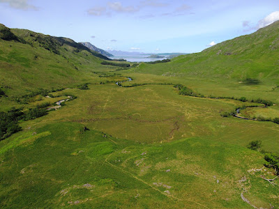
After a particularly tricky crossing of the stream, Allt Coire nan Uth, I started climbing the steep hillside up to the first Munro of the day, Sgurr nan Coireachan. During the climb I plunged into the clouds and at one point I seemed to emerge above them with views to the east. Briefly I even had some sunshine and blue skies, which is something I hadn’t seen all week, unfortunately it didn't last long as the clouds soon closed in, the weather grew worse, and normal service was resumed. When I finally reached the summit of Sgurr nan Coireachan I had my lunch and the mist was now so thick it had become a drenching. After eating I dropped down to Bealach nan Gall and climbed back up to start the fantastic ridge across fabulously rugged terrain over the Garbh Chiochs. This was great fun, despite the bad weather, as the terrain was really rocky and complex, and there was a good path that follows a dry stone wall along the top of the ridge. The path gradually climbed up to the broad top of Garbh Chioch Beag before weaving around mighty outcrops beside the sheer drops into Coire nan Gall to my right. Eventually the summit of the Munro was reached at the top of Garbh Chioch Mhor, which given the isolated nature of this location must have amazing views with nothing to see but mountains as far as the eye can see. Even without a view the awesome rocky landscape was an awe-inspiring place, despite the weather's drenching mist and howling wind.
This was an immensely fun walk, but there was an extra treat to come. After passing over the summit I dropped down to the bottom of the pass, Feadan na Ciche, the Whistler, where the wind howls through the narrow gap. I had originally planned to go up the next Munro on the ridge, Sgurr na Ciche, but the weather was so poor and with time advancing I decided it would be prudent to miss it out. While crossing the ridge I hadn’t forgotten that once I finished walking along the ridge I would have to walk all the way back to the car along the bottom of the valley, which was going to take me so long it was would be dark by the time I got back to Fort William. With the final Munro missed out I now had to descend from the top of the pass through a wonderfully steep, narrow and wet gully that was so narrow and with so much water in the stream that the path was frequently covered by water. It was very challenging, but great fun, and over all too quickly. Once down from there my fun was over as I had a long walk back along Glen Dessary back to my car. It was very wet, very muddy and very tiring as I hobbled along on my aching ankle, and of course once back at my car I still had to drive back to Fort William. This was a good walk, but only because of the quality of the ridge and that gully. The exhausting walk in and out and the bad weather were such negative points that it could never be considered great. Nevertheless it was a good walk to end my holiday and the walking season.
This was a really challenging walk, right from the start and all the way until the end. Just to get to the car park I had to drive for an hour down a single track road to the end of Loch Arkaig and from there I had to walk for another two hours through Glen Dessary just to get to the foot of the mountain. And of course once I had been over the mountain I had to repeat the process all over again, two hours back to the car, and then one hour back to Fort William. There was a sign near the start of the walk that proclaimed that this was remote, sparsely populated, potentially dangerous mountain country. I was advised to only proceed if I was adequately experienced and properly equipped to be able to manage without assistance. Since I obviously did manage to return safely, even in the poor weather, I guess that means I am. In addition to the remote location I had another problem to contend with: on the previous walk I had finished the day with an aching ankle. An overnight rest failed to ease the pain and this tough walk would put my ankle under tremendous strain. On previous occasions when I had this sort of trouble I found that my inner sole was to blame. In 2001 I had just bought a new pair of boots and the inner sole in them was useless and it actually ruined the holiday. In 2006 I had problems while walking in Glen Coe due to worn out inner soles. This may have been the cause of my problems at the end of this holiday, but first I had a walk to do, whatever pain I may have been in.
After a particularly tricky crossing of the stream, Allt Coire nan Uth, I started climbing the steep hillside up to the first Munro of the day, Sgurr nan Coireachan. During the climb I plunged into the clouds and at one point I seemed to emerge above them with views to the east. Briefly I even had some sunshine and blue skies, which is something I hadn’t seen all week, unfortunately it didn't last long as the clouds soon closed in, the weather grew worse, and normal service was resumed. When I finally reached the summit of Sgurr nan Coireachan I had my lunch and the mist was now so thick it had become a drenching. After eating I dropped down to Bealach nan Gall and climbed back up to start the fantastic ridge across fabulously rugged terrain over the Garbh Chiochs. This was great fun, despite the bad weather, as the terrain was really rocky and complex, and there was a good path that follows a dry stone wall along the top of the ridge. The path gradually climbed up to the broad top of Garbh Chioch Beag before weaving around mighty outcrops beside the sheer drops into Coire nan Gall to my right. Eventually the summit of the Munro was reached at the top of Garbh Chioch Mhor, which given the isolated nature of this location must have amazing views with nothing to see but mountains as far as the eye can see. Even without a view the awesome rocky landscape was an awe-inspiring place, despite the weather's drenching mist and howling wind.
Subscribe to:
Posts (Atom)


