Showing posts with label 2006. Show all posts

January 2 (1977, 1981, 1984, 1985, 1987, 2006, 2007)
Miscellany

“1/2/77   well. a rainy day here in the sierra, clouds right here upon us, winds, a real storm. the Big Window is in, lynn and steve and steve helped me.

seeing the big window in has inspired me, i would like to have the time and money to finish it right away, the cabin i mean. but i don't. should go down to año nuevo soon—pescadero rather—and get back to work.”

Russell Towle's journal


“1/2/81   Before dawn. Waning crescent moon hangs low in the east. Venus not up yet.

[...]

Today I'm going to take Charles and Charlotte and Jim and Mindy up to Big Valley Bluff.”

Russell Towle's journal


“1/2/84   Life is rich, and I am left-handed. Not rich myself, there is only one 12-volt light in this small cabin. So I am askew, trying to keep the shadow of my left hand at bay while I write. A cunning paradigm of my psychic stance these days? At any rate, the morbid depression (shadow of the left-hand, sinister somber) I used to dread in the winter has been kept at bay by Lovers Leap.”

Russell Towle's journal


“January 2, 1985

Morning, foggy and cool. Yesterday I went into Alta for breakfast and found Charles and. Char engaged in the same; later I joined them at their house and got involved in grading out the basement driveway with Charlie. Then we proceeded to get his truck stuck and spent about an hour extricating it.

From there I went to Shelley Yamamoto’s New Years party and gorged myself on sushi etc. I hung around for the rest of the day and watched a movie with Shelley and Carla. Carla is still living at the Rawhide. She is such a strange woman. An artist, a recluse, an attractive woman but never a boyfriend. Now her life is lived in much different terms. Without Jim, her father, she is faced with suddenly being on her own. The situation at Rawhide is not a good one for her; she never bothered to learn to drive until recently, and now must negotiate that horrendous jeep trail winding for miles along the rugged canyon wall. Yesterday she walked the five miles into Shelley's for the party rather than drive.”

Russell Towle's journal


“1/2/87

1:55 A.M. Contrary to what I wrote above [on 1/1/ 87], I mounted the bicycle and went into Shelley's and had sushi after all and then rode to the McClungs [...]

I have been starving, and a sort of hole is in my stomach, it's as though I can never really fill it. I did eat well at Shelley's tonight. Skies have cleared; maybe go skiing tomorrow with Charlie.

Night. Skies clouded back over, and I never went skiing today. No. I rode Bill's bicycle into Bill's and drank some coffee with him, showed him Larson's letter, […]

Bill gave me a ride down to Colfax today to get the rebuild kit for my slave cylinder, and kindly brought me home and waited until I fixed it; he's really been very friendly to me lately, so nice.

A big storm is said to be on its way. I cut a little firewood today. So, car is parked out on the road today.

After fifteen minutes on the stove [referring to the typewriter], the "a" has stopped sticking. If it's a lubrication problem this could only make it worse, by further drying and outgassing of the lubricant; but for awhile, the decreased viscosity compensates…”


Date: Mon Jan 02 2006 04:58:24
To: Michael Joyce
From: Russell Towle
Subject: North Fork Dam


Have you ever visited North Fork Dam?

Take Foresthill Road across the bridge, in a mile or less you reach hard left onto Lower Lake Clementine Road, follow it until it bears hard right and down towards the boat launch.

Park as soon as you can and look into the canyon beside you. You will see the dam.

Then find use trails which lead down to the viewpoint.

It is like Niagara Falls, right here in Placer County!


Date: Mon Jan 02 2006 05:13:47
To: Dan
From: Russell Towle
Subject: Re: Sailor Meadow
Cc: Patrick Kavanaugh
>I bring this up because the County is agressively building at Dewitt and I am not sure this site is safe. Just want it to be set aside if possible  but My name is "mud" at the County. Any thoughts?        Dan
My thoughts? We are paving over Indian sites every day. I made my own efforts to get the County aware of Indian sites, in the mid-80s. I failed.

I understand that new state legislation, tho, is far more protective of arch sites than anything before. I have cc'd this to Patrick Kavanaugh, who knows a lot about these issues.

However.

Most people don't know history. The whites (Europeans) stole California from the Indians. We even admitted it in 1852 when we (Europeans) negotiated treaties with the CA Indians, called the Barbour Treaties.

Among these is that negotiated with the Maidu and Chief Weimar, who made his mark on the 1852 treaty at Storms Ranch, over by what would become Chicago Park.

These treaties would have made the theft of California legal; the Indians would trade title to most of the lands in exchange for big chunks here and there ("reservations"). The Maidu reservation would have been huge, from the Bear to the South Yuba, from the Valley to Storms Ranch. Roughly.

But the U.S. Senate put the Barbour Treaties in a sealed secret archive not to be opened for fifty years.

So legal title was never obtained from the CA Indians. The treaties were forgotten as most of the Indians soon died from disease.

Finally, in 1938, the BIA renegotiated treaties with surviving CA Indians and they signed away title.

In theory, that was the legal instrument by which the theft of CA became legal.


Miscellany
[North Fork Trails blogpost, January 2, 2007:
http://northforktrails.blogspot.com/2007/10/miscellany.html ]
Happy new year, 2007 should be a good one!

The other day I approached my teenage son with an excellent idea: "I will first put the chainsaw in my old backpack; next, I'll put that old backpack on your broad shoulders; then, away we will go, down and down and down, into the depths of Green Valley, there to clear brush from the High Ditch."

To which he replied in a series of rather emphatic and mostly monosyllabic negatives, scarcely comprehensible, exclaimed in his curious teenage slang.

I decided not to press the issue, just then. Perhaps a negative would ripen into a maybe. A day later I recalled that the Green Valley Trail itself is getting so badly overhung by manzanita, that this business of carrying chainsaws in backpacks is maybe not an idea worthy of the brightest star in the heavens. So I rephrased my Plan: now he would carry the chainsaw a short distance, very short, really, and I would cut the gnarled deep red branches, and he would toss them off the trail.

Another series of foreign-sounding exclamations, all negative. Sigh.

So this morning I put the damn saw in the damn pack, and carried it down to the uppermost bad section all by myself. I worked over a reach of about two hundred yards and achieved something, less than I had imagined, better than nothing. The day was grey and cool and good for trail work.

Ron Gould suggests that we should round up a real work party and hit the whole trail. A good idea. The manzanita is getting worse and worse in a number of different trail reaches. Supposing we were to carry some of the dratted garbage up and out, from the end of the West Trail, down by the river, well, a frame backpack is the best tool for garbage, and the manzanita would drag and catch and claw at our packs and turn an already tiresome task into a bitter fight. So a bit of manzanita trimming is definitely in order. There are, also, one or two new trees down on the trail, which need cutting into pieces before they can be moved.

Life is more than trails and saws.

Music, music, music. Antonio Carlos Jobim! I rec'd a CD for Christmas, titled "Elis & Tom," the amazing Elis Regina singing the songs of the amazing Tom Jobim. One song especially excited my interest, Águas de Março, or Waters of March; here Jobim joins Elis in a duet. I Googled around in search of more information, for it seemed such an exceptional performance, and found a video of the actual recording session, in Los Angeles, in 1974!

What? How could that be?

It was on YouTube, of which I had heard but not seen. I naturally avoid such sites because I have such a poor internet connection, it takes forever to download content. For the Waters of March, however, forever was fine. I waited, I waited, I waited, and at last I watched.

Really really great!

So. I saw that anyone in the world can upload videos to YouTube. I quickly assembled a few short pieces of geometrical animations I had made years ago. See

https://www.youtube.com/user/rufus16180339887


 Links
Elis Regina and Tom Jobim recording Águas de Março (Waters of March) in Los Angeles in 1974: http://www.youtube.com/watch?v=jYLoxMtnUDE

About the song on Wikipedia:
http://en.wikipedia.org/wiki/Waters_of_March

Jobim's own beautiful re-write of the lyrics into English can be found about 1/3 down this page, (after the parallel version):
http://www.brazzil.com/p08sep01.htm


January 1 (1986, 1987, 2002, 2003, 2006)
Mild and Wild: New Years Days in the North Fork Canyon

“January 1, 1986
A lovely morning, the canyon awash with fog, clinging and crawling about its ridges and ravines. The rising sun kindled a flaming gap in the fog, which I ran out to the cliffs to watch.

Last night I went into the Monte Vista, but found the band uninspiring and returned home to usher in the New Year alone. 1985 was a difficult year for me [...]

However, 1985 saw the granting of a preliminary injunction which opened the Smarts Crossing road up to the public. That was tremendously satisfying to me. Also, I had an exciting year intellectually, pursuing algebra and geometry into recondite regions of great beauty and symmetry.”

Russell Towle's journal


“January 1, 1987 [...]

~ Later; the sunset hours; it has rained all day, the most rain since I don't remember when—October? I'm debating the merits of riding into town, [...] but it's too wet, and so I'll just stay here. Wish I could go by Shelley's and have some sushi, today's her party-day…

A slight coloration hints that the clouds then, the storm dwindles. Yes, it stops raining; but to ride the bike in now, in the dark… I don't know.

I'll stay home. But I'm sad and lonely, in the mood for self-pity. Broke, starving, alone, [...] It's intolerable but somehow I contrive to tolerate it.”

Russell Towle's journal


Sunrise, January 1, 2002


A Mild, Sunny, New Years Day at the River, 2003

New Year's Day 2003, the N. Fk. American River, via the Stevens Trail, from Colfax.


Date: 1 Jan 2006
To: North_Fork_Trails
From: Russell Towle
Subject: When Rivers Run Wild

I wish you all the happiest and most enjoyable of New Years.

Recent weeks brought many storms and little hiking. Yesterday I finally broke free and dropped into the North Fork from Garrett Road, at Gold Run. This was a marvelous adventure, and involved getting very wet, and crashing through brush, and tip-toeing over slippery cliffs, and peering through wind-whipped fog at distant and tremendous waterfalls.

Geomorphology has been on my mind, geomorphology, and philosophy. There has been much in the way of heavy labor, leaving me tired: I fall asleep early, arise at two or three in the morning, read and write and play music until just before dawn, and then sleep again, for a final hour or two.

This morning I arose at 2:30 and made my first, and soon my second, cups of coffee. Rain had started the 29th and gradually increased in intensity all through Friday the 30th. By nightfall a steady downpour had set in, and at 2:30 in the morning, it continued.

I had been learning to play, by ear, Jobim's "O Nosso Amor," from the movie "Black Orpheus," and hours went by, in part, fruitlessly searching the internet for a MIDI file of this song.

Eventually, I thought to check the internet automated stream gauge for the North Fork American at Lake Clementine, near Auburn [link below]; the number of cubic feet per second is updated every few minutes, as is the depth of water flowing over the top of the dam.

It was 5:15 in the morning. As I scrolled down the page, I saw first that the depth of water flowing over the top of the dam had reached eight feet.

Eight feet, over a width of perhaps a hundred!

Scrolling down further, the cfs column came into view, and I saw the whole succession, from the morning of the 30th, when the North Fork carried little more than 4000 cfs; sunset on the 30th, it had risen to 6000 cfs; and then — then the wild river ran wild.

Suddenly it was 10,000 cfs, 15,000, 20,000, and at 5:15 a.m., 35,400 cfs!

Now this meant that the night's rainfall had been an epochal event, a real rarity in rainfall intensity and duration. This May 19 I had seen the North Fork at 20,000 cfs, when Ron Gould and I slogged right down the Canyon Creek Trail to the river. It was running grey with sand on that day. And the bridge across Canyon Creek, which I had built in 1998 with the help of John Krogsrud, had only barely escaped being swept away; driftwood was found on the rocks at bridge level, when we crossed.

So. On May 19th, when the North Fork ran at 20,000 cfs, the bridge at Canyon Creek had almost washed away. Now, today, at 5:15 a.m., here was the North Fork, roaring along at 35,000 cfs and climbing. There could be only one conclusion.

The bridge was gone.

And there could be no merry romp down the Canyon Creek Trail to the river.

Nonetheless I shot off an email to Ron and suggested a visit to the river was in order. I turned in for my last hour of sleep and then, soon enough, we were talking on the phone, and Ron had the idea to go to Diving Board Ridge.

This remarkable spur ridge flares from the canyon wall between Indiana Ravine on the west, and Canyon Creek on the east. Its crest plunges steeply and then levels off for a long run to the south, into the canyon depths, but almost a thousand feet above the river; so it puts you in the center of the canyon immediately downstream from the great cliffs of Giant Gap, and within direct view of the largest waterfall on Canyon Creek, a 150-footer which lives in a kind of crater all hemmed around by sheer cliffs.

Big Waterfall on Canyon Creek
So, when much water is flowing, a special thunder booms out of this monstrous hollow in the solid rock of the canyon wall. The North Fork, with dozens of times the flow, does not make these kinds of deep booms and thuds. The North Fork does not have the magical resonating chamber of the Big Waterfall.

Of course there is also plenty of sounds in higher frequencies coming from the Big Waterfall, hissings, and sharp slapping sounds.

We drove south on Garrett Road until BLM lands were reached and parked on a side road. The rain had slowed and yet everything was drenched and soggy. I had hardly walked ten yards when the red clay jumped up from the very earth and bit me in the butt, or, I should say, there was a graceful skiing motion on the right foot, followed by a rotation of the torso, and a sudden decrease in elevation, and the Red Badge of Clumsiness adorned my posterior.

We had scarcely entered the Diggings when Giant Gap burst into view through the trees, adorned with many lacy streaks of white water, waterfalls and cascades filling every ravine and crevice in the rain-dark cliffs. We whooped and hollered a bit but hurried on through the sticky clays and the millions of white quartz cobbles, following an almost strangely circuitous and indirect route, until finally we reached the rim of the North Fork canyon and the Indiana Hill Ditch, constructed in 1852 to supply the new diggings at the head of Indiana Ravine.


Here we passed the tiny trail down to the Diving Board for a quick jaunt up the old canal to an overlook. There was the North Fork, fifteen hundred feet below, churned almost white in a frenzied maelstrom of rushing water, but clearly carrying much sediment. It was also visibly higher than it had been, on May 19th.

We took photographs and admired the fine vistas into Giant Gap, and across Canyon Creek to the Blasted Digger Overlook, before turning back to the Diving Board Trail.

The CCT, in the stretch by the Inner Gorge, Gorge Point, the spot where the Six-Inch Trail
forks away, and you can even see the North Fork, down at the confluence. Picture taken
from west side of creek, opposite side from the CCT.
There used to be huge sluice boxes in both Canyon Creek and Indiana Ravine, to trap the fine gold in the tailings from mines far above; sawn lumber had to be delivered, somehow, to these remote and cliff-bound canyons.

So the Diving Board was pressed into service as a lumber slide, of which there are many in the North Fork canyon, tho probably almost always unrecognized. The idea is simple: lash a thousand pounds of lumber into a big bale, tie a mule in front, and start dragging it right down the canyon wall, letting it slide on its own if possible.

Over the course of a very little time, a groove is worn into the canyon wall along the line of the slide.

Now stop using the slide, and let one hundred and twenty-five years pass.

A groove remains. But trees grow from it, and leaves and dirt have washed into it and partly filled it; now, people only rarely recognize the old lumber slides.

Ron, feeling the spray

 In this case, the slide follows the very crest of the ridge, on a gradient too steep for any reasonable trail, yet perforce men had to go down there, and eventually, wrestle the lumber from the ridge-crest down to Canyon Creek or Indiana Ravine. Hence a trail developed, possibly merely from use.

This is the Diving Board Trail.

We hurried down, pausing only to photograph waterfalls and so on... and reached the final level area, with its absolutely superb views both up and down the North Fork canyon.

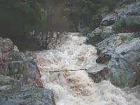
Visual comparison of flow levels.
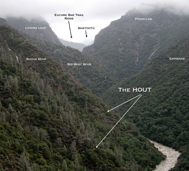
While gazing up into Giant Gap we saw that even Bogus Gully had become a river in its own right, huge masses of white water leaping briefly into view. If the bridge had not washed out, and if we had hiked east on the HOUT, well, we might have gone no farther than Bogus Gully. Too much water to cross, by the looks of it.


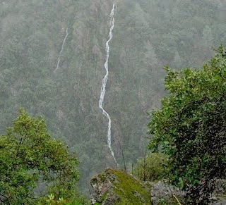
Near The Eminence, a cliff on the south canyon wall, a narrow streak-waterfall dropped two thousand feet from the canyon rim to the river. A half-dozen others graced the cliffs nearby.

Many photos were taken, but a fog began to settle lower from the canyon rim, and strong winds stirred, and rain began to fall. We crossed to the western, windward side of the Diving Board, and were astounded by the North Fork as it swept in tight curves around the spur ridges at Pickering Bar. Big trees were floating down. Boulders the size of small cabins were underwater and throwing giant rooster tails of white water skyward. It was as though geysers were erupting from the river, in many places. The rain intensified, the wind flailed and whipped the trees and us alike, and soon enough we sought the shelter of the Canyon Live Oaks and the lee side of things.

Looking west to Pickering Bar
The Big Waterfall was putting on an incredible show, semi-permanent protuberances of whitewater, marking ledges where tons of water were suddenly changing directions, sent flying away from the cliff. So the whole monstrous mass of white water, a hundred and fifty feet high, was indeed monster-like, with groping arms and pointed knees and elbows of froth, always in motion. Above the falls, a dim grotto in the inner gorge was filled with a blue glow, made from the reflection of white water within and out of our view, on the glistening sheer walls of the chasm; and, perhaps like the sky itself, this reflected whitewater was robbed of other colors, leaving blue.

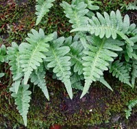
California polypody
(Polypodium californicum
)
Or perhaps some sort of blue star was being forged right there within the rock-shrouded chasm, only just out of our view, by elves unimaginable, or fairies, or by dragons, the spirits of the waterfall.

Sheets of rain fell; one could actually watch the wind pushing these wavering rain curtains up the canyon. We grew cold, and a sure cure for that is to start walking uphill. So we slowly trudged up the narrow ridge crest in a pouring rain.

At the Indiana Hill Ditch we bent our steps east and then north, finally dropping down through brush and grassy openings to the Canyon Creek Trail. The rain diminished again, but every gopher hole on the mountain had become an artesian well, and really wherever we looked there were springs of water gushing direct from either rock or soil, it made no difference; the whole world was leaking, as it seemed.

We reached the bridge site and saw what we knew we must see: the complete and utter absence of a bridge.

Arrow marks where the bridge used to be!
Yes, the good old thing is probably in Folsom right now; it will reach the Delta tomorrow, pass the Golden Gate on Tuesday, and then make for Mexico South.

After a time we wandered south towards the first big waterfall, and eventually met a ridge which let us descend to a fine overlook. Canyon Creek was gigantic and muddy and rampant. Quite scary. We stepped rather carefully on those steep rocks perched a hundred feet above the creek.

Then it was time to start up and out. Along the way, I found other overlooks with remarkable views of the Canyon Creek Trail, across the creek to the east. We marched back through the Diggings in wet clothes but good spirits. During a time of rarely high flows, we had been able to visit the great canyon, in one of its wildest areas.

Links:
Real-time water level data generated at the North Fork Dam, lower end of Lake Clementine:
http://waterdata.usgs.gov/nwis/uv?11427000

A National Weather Service review of this "Heavy Precipitation Event" (Southwest Oregon, Northern California, and Western Nevada) from December 24, 2005 - January 3, 2006:
http://www.cnrfc.noaa.gov/storm_summaries/dec2005storms.php


April 8 (1982, 2003, 2006)
Deep Snow on Moody Ridge; Rawhide Mine

4/8/82 Dawn. A clear, or at least partly so, day is on tap.

The storms finally stopped. In the high country, a near-record snowpack. Here, three feet of heavily consolidated snow are still on the ground. My ski track is packed, fast and icy.

I dug my Toyota out and was putting gas in it when Dana Pope drove up with two lady friends, Tina and Tina. We rented some skis in Colfax and they came out to my cabin for the night. the next day we skied out to Casa Loma. Last night I skied out to Casa Loma in the moonlight.

[Russell Towle's journal]


Date: Tue, 8 Apr 2003 08:34:52 -0800
To: Jay Shuttleworth
From: Russell Towle
Subject: Re: Rawhide Mine: Public access
Cc: NFT

Hi Jay Shuttleworth, you wrote,
>The Rawhide access has been a personal interest of mine for years. I first hiked into Rawhide from Sawtooth Ridge. We wanted to go to the structures, but my friend Steve Hunter (whom you met on our Canyon Creek and High Trail walk) told me of dogs and unfriendly caretakers.
>
>So, let's pursue this. From my experience with securing public right-of-way for the Iowa Hill trailhead of Stevens Trail, I think taking the personal approach is the best bet. I think a minimal "gentleman's agreement" would be our lowest goal, and at best, he could offer a legal right-of-way. I think approaching this person as a "fellow outdoorsman/naturalist" might offer the best results.
>
>Tell me what you think.
I agree, Jay; and I have met the owner, Harry Mayo, who is a high school teacher, as I recall, in the Sacramento area.

I want to emphasize that the old mine buildings along the North Fork of the North Fork, including the mine cookhouse and bunkhouse, and the powerhouse, are on TNF land; and so is the mine portal, the ball mill, and the mule barnlet. Taken altogether, these buildings and the associated equipment constitute a fascinating portrait of a working hard-rock gold mine in Placer County. The site might well be managed as an open-air museum of sorts. One of the problems is to dissuade visitors from walking off with artifacts.

Also, it is at least conceivable that the Rawhide Road could become part of a trans-Sierran trail, even a multi-use trail: from Casa Loma to Iron Point to Rawhide Mine to Sawtooth Ridge to Big Valley Bluff, to Big Valley to Pelham Flat to Four Horse Flat; then a problem, crossing upper Big Granite Creek; thence past Devils Peak on its north side, to Cascade Lakes, and on to Pahatsi Road. All except upper Big Granite Creek and the short reach of trail from Rawhide Mine would be on existing roads. I consider existing roads to be, at the least, reasonable candidates for multiple-use (including bikes) trails.

Finally, one of the private parcels just west of the Rawhide parcel, in the northeast part of Section 5, just barely touches the North Fork of the North Fork, downstream from the Rawhide. A new road has been bulldozed down to the river from the Rawhide road, and a cabin built beside the river. I wonder whether this road was made with a permit, or the cabin.

Ideally, Tahoe National Forest should look towards the purchase of these private parcels, including the one directly above Iron Point, also in Section 5, which will vie with the parcels out on Lovers Leap Road for the dishonor of ruining the viewshed, in this most remarkable part of the North Fork canyon.

Let's contact the Rawhide owner!

Cheers,

Russell Towle


Date: Tue, 8 Apr 2003 15:24:28 -0800
To: "Bill Slater"
From: Russell Towle
Subject: Re: Rawhide Mine: Public access
Cc: NFT

With respect to the Rawhide Mine, Bill Slater of Tahoe National Forest wrote:
>hey Russ. I discussed this w/David Michael. I have been working w/Mike
>Nevius (265-2592) on mine interpretation projects. He is associated with
>Northstar Mine in GV and various groups. He is currently setting up a mine
>interpretive project on BLM property. I have worked with Mike by providing
>the Heritage Resource/FS management aspects (evaluations) for these kinds
>of projects when they involve FS sites. He would be interested in the
>Rawhide mine.
>
>Bill Slater
>Archaeologist
>Nevada City RD
>Tahoe National Forest
Thanks Bill!

Since the mine and buildings are on TNF property, perhaps a formal inventory of heritage resources, is in order? Shouldn't we—I mean, you, TNF—document what is there? Photographs, GPS, lists of equipment and buildings?

Cheers,

Russell Towle


Date: Tue, 8 Apr 2003 18:57:57 -0800
To: "Bill Slater"
From: Russell Towle
Subject: Re: Rawhide Mine: Public access
Cc: NFT

Hi Bill, you wrote,
>Russ. When the FS plans a project involving specific acreage the need for
>a heritage resource inventory kicks in. A trails project involving Rawhide
>Mine would necessitate an inventory (and site recordation). If the site
>was threatened by adverse effects, as would be likely for the kinds of
>projects you envision, we would have to evaluate the site for the National
>Register and mitigate potential adverse effects if the site was found
>eligible. If adverse effects to a site are occurring as a result of
>unregulated public activities or erosion I can also check out the site and
>evaluate it.
So far as the trans-Sierran trail I mentioned: this is just an idea which has occurred to me as a possible (partial) trail alignment, for the Capitol-to-Capitol Trail proposed by the Placer County BOS, which, as laid out in their brochure, would very closely parallel to North Fork American river itself, from Auburn to the Sierra crest. I oppose the BOS alignment, but have been trying to imagine alternatives.

So don't take the trans-Sierran idea too seriously; I don't really want it myself.

However, Bill, there is an existing, historic trail on TNF lands there; it climbs from the North Fork of the North Fork to the crest of Sawtooth Ridge; it does not show on the TNF version of the Westville 7.5 minute quadrangle, but it does show on the usual USGS version of that map. Forget the trans-Sierran trail; I want to walk on the Rawhide-Sawtooth Trail, just as our grandfathers did, without anyone blocking my way with a gate or a "no trespassing" sign. I don't want to ride a motorcycle on the trail, I don't want to ride a bike on the trail. I want to walk on the trail.

Finally, you write "If adverse effects to a site are occurring as a result of
>unregulated public activities or erosion I can also check out the site and
>evaluate it."
The only discernible adverse effects are garbage strewn beside the river, suction dredging on the river, and use of buildings on TNF property for storage, of what, I do not know. Well, to attempt to block public use of a historic trail is also an "adverse effect." We are going to see if anything can be worked out with the owner.

Thanks much for your comments, Bill, they are helpful. Let's go in there and take a look!

Cheers,

Russell Towle

Pipevine Swallowtail, on vetch blossoms.
April 8, 2006


April 4 (2004, 2005, 2006)
Giant's Sidewalk. Captain Weimar

The High Ditch Trail
[North Fork Trails blogpost, April 4, 2004:
http://northforktrails.blogspot.com/2004/04/high-ditch-trail.html ]
Saturday morning, Catherine O'Riley and Dave Lawler kindly picked me up and we drove to the Euchre Bar Trail (EBT), on our way to the High Ditch Trail (HDT) leading away upcanyon from the Bar, where we would meet Julie and her sister, Kasa, and Ron Gould.

Sun bright and sky blue, clear and cool, shrubs a-flower, and work to be done. We carried loppers and small saws. I struck off fast down the trail, GPS unit in hand, with propitious satellites favoring high accuracy, aiming to pause at the invisible trail to East Green Valley, and scout its route. It leaves the EBT at the top of the switchback section, where a grove of Kellogg's Black Oak (Quercus kelloggii) adorns the ridge crest. I recorded a waypoint on the GPS (I was very close to the 3080' contour) and slung my pack off.

This trail is always hard to find, and where the Dutch Flat quadrangle would have it running straight, it actually switches sharply back and forth through oak woods, and these switchbacks easily become lost in the accumulating litter of leaves and branches, and are even guarded aggressively by poison oak. I kicked leaves and rotten old limbs around, threw bigger branches off the trail, lopped poison oak, and then, hearing voices above, left, content to have restored not the bed of the trail itself, but at least its line, over the first few switchbacks.

More work is needed. This trail drops down to the pass between Green Valley's East Knoll (a fine viewpoint) and the main canyon wall, and then descends a broad, poison-oak-infested ravine to the Valley itself. Its course becomes again confused in these lower reaches.

I rejoined Dave and Catherine and, GPS unit tracking my course, immediately left them again on an intermittent jog down the EBT. I found that it is less than one mile down to the house site near the base of the trail, at the 2200' contour, and covered the distance in fourteen minutes, or a little less. The true course of the trail is perhaps a sixth of a mile north from where depicted on the Dutch Flat quadrangle. I recorded a waypoint and continued towards the bridge.

A hundred yards or so down the EBT brings one to the trail forking left to the High Ditch Trail. I put my pack down and did some serious lopping. Hundreds of small conifers are sprouting up in an area largely given to Canyon Live Oak over recent centuries; and now, without wildifire, about to become a crowded stand of Douglas Fir with a weakening Canyon Live Oak understory. I felt little remorse at felling some dozens of these coniferous weeds. A distinct trail connects the EBT to the HDT alog the shortest possible route, and in a few minutes, with Catherine and Dave and I all lopping away, we had this old trail exposed to view and easily passable.

The HDT itself has benefited from lopping, much, recently, by Julie, and we added our mite while making good time on the easy, nearly level ditch. This ditch was blasted out from cliffs in places; it is rather large, and yet appears only to have brought water to the diggings at Euchre Bar itself. It must have cost someone, or more likely some company of someones, quite dearly in its day. I wonder whether their golden harvest ever settled that expense. The HDT very nearly coincides with the 2000' contour.

About a quarter mile on the HDT brings one to the confluence of the NFAR, and the NFNFAR. The latter stream suddenly appears directly beside the HDT, and near 100' below, blending an emerald crystalline clarity with foaming white rapids. In general, the HDT traverses steep slopes studded with rocky outcrops and draped with a fine old gnarled forest of Canyon Live Oak (Quercus chrysolepsis).

We caught up with Kasa and Julie just past a springy area where trees have fallen and blocked the HDT. Julie found a way to lop through masses of shrubs and avoid the trees, and she and Kasa had just then roughed in an excellent path, through what had been a major obstacle.

A half mile in on the HDT brings one to a major garbage site, a gravel bar gold miner's camp with all kinds of gear and garbage and strange debris. The magnitude of the problem is shocking and sickening. One despairs of every carrying all that mess out. A helicopter?

A well-defined old trail drops down the steeps above the HDT to this bar.

But we forged ahead, towards the upstream end of the ditch, and soon arrived at a long broad pool roiled by a small waterfall, and found sunny boulders beside the pool, and had lunch. The ditch was still all of 25 feet above the river, but just there a rocky eminence jutted into the canyon, making sheer cliffs along the line of the ditch, and no trace at all of a blasted ledge, or any continuation.

Julie and Kasa left us soon after Ron Gould (who had hiked to Humbug Canyon) joined us.

Ouzels zoomed up and down the river, chattering. Sawtooth Ridge soared 2000' above us, across the NFNFAR.

We decided to scout upstream, having heard from the good Steve Hunter that a road dropped down to the NFNFAR about a quarter mile up, from the Rawhide Mine Road. Perhaps we could pull off a loop. Turning the base of the cliff through dense willows and alders and over large boulders, we broke free onto a long and broad expanse of bedrock. The up-ended quasi-slates of the Shoo Fly Complex had been planed nearly flat, like a giant's sidewalk, and we could just stroll along and admire the view. A marvelous little stretch of river. A giant boulder of white quartz marked the beginning of the Giants' Sidewalk.

It looks much as tho the High Ditch took its water from the NFNFAR in the Giants' Sidewalk area, and carried it in a wooden flume down around Cliff Corner to where the ditch itself began.

Passing a side canyon, really a ravine, we saw an old bridge, with massive dry-laid stone abutments, a little ways above. We climbed to inspect it and found Steve's road, a curious little thing, just barely too narrow for a jeep, and often bolstered with old-looking dry-laid stone walls, along the downhill side. The bridge itself is made from three tree trunks, decked with two-by-fours nailed across. Following the road down, to the north, we reached some minor miner shacks, in a fairyland of dry-laid stone retaining walls, strangely perfect and made with an artistic flair, all overhung and hidden within the live oak forest. We dropped our packs and explored up and down and sideways.

Several gold dredges were in the area, and we found evidence that this is a mining claim on Tahoe National Forest lands. We were near a section line, as I found later, when I plotted my GPS track data on the Dutch Flat quadrangle, on my computer, at home. A rope and cable spanned the river just upstream, with a kind of trolley hanging from pulleys. Glacial outwash deposits across the river had been mined for gold in days long gone by.

After a time we hit the road and followed the narrow little thing on up the canyon wall, occasionally observing traces of an older mule trail, and in less than half a mile reached the Rawhide road, the last few hundred yards looking like nothing more than someone's aimless exercise with a bulldozer. We had stumbled upon a historic trail, or trail-and-road, one I had really never heard of, tho long suspecting the aimless bulldozing must really have aimed at the river.

Afternoon shadows lengthened and sheltered us from the sun as we slowly climbed the rough road. I observed little patches of glacial outwash, or maybe re-worked till, in two locations during our climb, at elevations 2400 and 3000 feet. The river below is at about 2000 feet.

Soon enough we passed the Rawhide gate and then another half mile brought us to our cars. On the way out, Catherine and Dave and I stopped at Casa Loma and walked down to the railroad tracks to enjoy the view of Giant Gap in the afternoon. It is one of the greatest views in California.

All in all, a very nice day, and I must say, that High Ditch Trail is a real winner. Thanks Julie!


North Fork Canyon, view southward, from Moody Ridge, April 4, 2005

Captain Weimar
[North Fork Trails blogpost, April 4, 2006:
http://northforktrails.blogspot.com/2006/04/captain-weimar.html ]
Recently I shared with you Stephen Powers' 1873 article about the Nisenan Maidu, as it appeared in the Overland Monthly. In another message, I mentioned that Chief Weimar had "made his mark" on the 1851 treaty negotiated with the Maidu, in which they gave up all claims to their ancestral lands in exchange for one rather large reservation, extending from the Sacramento Valley on the west to Chicago Park on the east, and from Bear River on the south, to Deer Creek and the South Yuba on the north.

That is one of the treaties with the California Indians which, when sent to the U.S. Senate for ratification, was instead placed in a sealed secret archive, not to be opened for fifty years, in 1903; the Barbour Treaties.

So, who is this Chief Weimar? A Nisenan, for whom the town of Weimar was named. He appears in several Gold Rush diaries and books, almost always referred to as "Captain" Weimar, although the spelling of his name varies widely. Alonzo Delano wrote a nice Weimar story, in which he and Weimar and Simmons Peña Strong ventured into the local high country on a camping trip, in 1853.

In the excerpts below, he is named "Captain Wemah," and I can't refrain from remarking about the significance of that title.

It is really Spanish—he was "capitan" Wemah. And why is that?

The Spanish and Mexican influence in California was confined almost entirely to the coastal region. Indian who escaped from the Missions made their way into the Central Valley and Sierra foothills. When Captain Wemah was a child, there well may have been escapees from the Missions sheltering with his very tribe. Among these Indians of different tribes, Spanish would have become a lingua franca, just as Stephen Powers remarks that English had become their lingua franca, in the 1870s.

But that is the 1870s. Consider the 1830s and 1840s. Sutter builds his fort near the confluence of the American River and the Sacramento River. He hires many Indian laborers. Of all these Indians, there are those fresh from the hills, who know nothing of modern civilization, and there are those with some kind of background with the Spanish and Mexicans. These latter will speak Spanish, and perhaps some English. They will ride horses and dress as Europeans. They will often be the bosses who manage the wilder Indians, on the job.

Within the broader more tenuous parts of the sphere of influence of Sutter's Fort, was much of the territory of the Nisenan. This is illustrated by the experiences of some of the Donner Party, the Forlorn Hope group, who, when at last they staggered down into the foothils below Greenhorn Creek and north of Bear River, on the old trans-Sierran Indian trail we call the Donner Trail, encountered a village of Indians. Among them was one who was mounted and spoke some Spanish.

Spanish is also spoken by the Nisenan in the excerpts below.

So. although we cannot know for sure, a couple of possibilities occur to me, about Captain Weimar.

1. He was an actual employee of Sutter, who parlayed his position at the Fort into the chieftaincy of the Nisenan.

2. He was a foothills Nisenan not involved at all with Sutter, but was thrown together with hordes of Mexicans, other Indians who spoke some Spanish, and the motley crew of Americans and Europeans in California in 1848, when Indians thronged the brand new diggings. He was already a Nisenan "chief" and, because all Indians of any degree of civilization (and thus, a degree of Spanish) were accorded the honorific, "capitan," Weimar assumed it as his right.

Well, at any rate. From "Sketches of travels in South America, Mexico and California," by S.M. Schaeffer, I will extract passages which bear upon the Nisenan and Captain Wemah. Schaeffer was mining for gold near Grass Valley at the time.
*******

January 1, 1851. There were several encampments around here of native Indians, (the Digger tribe;) and one day, when working alone, some distance from my cabin, I was honored with a visit from several squaws, nearly every one of whom had a ''papoose'' strapped to her back. They were out hunting and digging wild onions and tender roots, which grew there; and they laughed heartily at my incessant digging and washing dirt, and signified that Indian no work, but ''American much work, ugh,'' Their faces were besmeared with tar, which I was informed indicated the decease of a friend or relative.

Whilst I enjoyed a laugh at their expense, they were equally merry at the appearance I presented, so we were all pleased. Finally they went off, and I could hear them laughing at the idea of a man working and earning his support ''by the sweat of his brow.''

*******

Thursday, January 30th. Five or six young men and myself agreed to take a short walk through the woods, ostensibly for ''prospecting,'' but in reality to visit ''Capt.'' Wemah's Indian camp. Our ''prospecting amounted to the figure 0,'' but our visit to the Indians was interesting and highly gratifying. Their encampment was located in a lovely valley, through which ran a never-failing stream. Their council house was in the centre of the camp; around it were the wigwams, constructed of bark, each having a hole in the centre of the roof, through which issued the smoke from the fire beneath.

The entrance to their palatial mansions was an aperture just large enough to admit one person at a time in a stooping posture. On a large rock I noticed several squaws—quite pretty and of fine figure, nearly nude, pounding acorns, out of which they make soup and bread.

The ladies were courteous and affable, and were pleased with our visit, but apparently surprised at receiving so much attention from us. When the acorns are fully ripe, the squaws saunter forth, collect immense quantities, place them in their storehouse, and when needed, pound them to a coarse powder, which they prepare in a proper manner for the lazy chiefs.

The chiefs and braves never work, but spend their time in hunting and manufacturing ornaments. Whenever the squaws go out after roots and vegetables they are always accompanied by a brave, as a ''guard of honor.'' I often wished that I could converse with them. The majority of the Indians about Grass Valley were friendly to the ''whites;'' others were disposed for war—war to extermination.

*******

Wednesday, June 18th. Today was held our first Whig convention; delegates from Nevada and Rough and Ready joined us. My friend, Judge S_______, of whom I have heretofore spoken, was unanimously elected presiding officer; and the entire proceedings reminded me very much of the political conventions I had attended as ''lobby member'' in the eastern states. There was considerable discussion in relation to the office of State senator. Nevada wanted the candidate selected from her district. Rough and Ready very modestly withdrew from the discussion, and finally it was compromised by our district getting the senatorial nominee, and Nevada taking the lion's share of the candidates for the assembly.

During the morning Captain Wemah, head chief of the Indian tribe in our valley, came into the room, and as he took a seat alongside of me, I watched his countenance, feeling curious to know how the proceedings would interest him. The old chief understood about as much of the English language as a Japanese. He sat silent awhile, gazed all around the room, rose up, straightened himself, turned around, exclaimed ''ugh,'' and off he marched.

******

[July-August 1851]

Look there! ''Heigho, what is going on among the Indians?'' Why, there is to be a grand ''Pow Wow'' at Wemah's camp to-night; ''Let us go down.'' ''Agreed.''

I was anxious to be present at the beginning of the exercises, but waiting for some friends, whose business detained them later than they had expected, we arrived at the camp just in time to be too late for the grand wardance, in which participated the entire assemblage of chiefs, braves and warriors, many of whom were representatives from distant tribes who had come to attend the all-important ''big talk'' in relation to the ''pale faces.''

The squaws were not allowed to indulge in any of the sports, neither were they permitted to come within speaking distance of the council house.

Some of the warriors were profusely decorated with fancy colored feathers, beads, shells and trinkets, and liberally daubed with paint. After resting a short time, the gaily-decked Indians made for the council chamber, (a description of which, and the camp, I gave in a former chapter,) which was dimly lighted by a fire in the centre, around which the various delegations squatted in a circle.

''Captain'' Wemah, who held the important position of chief over all the Digger Indians, stood in the centre of the party, and when all were quiet—not a whisper to be heard—he commenced his opening and welcome speech, delivering it with wonderful fluency, great vehemence, and wild and violent gesticulations. During his powerful address, he was frequently applauded by his well behaved and respectful auditory. The old chief was dressed in his best suit: his coat, which had been given him by an American soldier, fitted him about as well as the garments that are put on a stick to frighten off the crows from a corn field; in one pocket he had a couple of empty bottles, in the other a huge horse pistol, which once might have been a formidable weapon, but now lacked a trigger! When he had concluded his speech, he called out—''Ven Wollupie''—''si, si, signor.'' Two stout, well developed braves seized a tub of daintily prepared acorn gruel, and placed it before their delegation; others were called, who followed their example, until every squad was supplied with a tub of gruel; then, at the signal of the ''Captain,'' each Indian dipped his unwashed hands into the delectable food, and gulped down the gruel like a half-starved pig.

After the liberal entertainment was finished, the Convention or Pow Wow was called to order, and Wemah again addressed the motley crowd, with even more earnestness than before. There were unmistakable evidences of discontent. The fire in the centre of the council house was fast dying out; the discussion waxed warm; those of the Indians who could not get inside of the chamber, clambered on the roof, and peeped down the hole in the middle, heedless of the smoke, and the vile stench which issued forth in murky clouds. Wemah danced, frothed and expostulated, but all to no purpose. The ''Pow Wow'' lost all sense of propriety, and the clever old chief stalked out in apparent disgust. No sooner had his ''highness'' retired, than every ''pale face'' inside the council was unceremoniously ordered out.

As a report of the great speech of the evening would doubtless be interesting, though not familiar with the Indian language, I will endeavor to give a few sentences from memory's log: '' Ingin—no cara—ugh—bah—manyana—he, ya, hi—mucho Americano fight—si hugh—capitaw—ugh fire-water, whiskey aqua no good—sleepy—ha—he—yes! ''

I passed around the camp, and stopped in front of Wemah's wigwam. There the old chief lay flat upon his face, his military coat buttoned up to his chin, around him the numerous ladies of his household. Just then a friend called to me; I looked around, and found I was the only ''pale face'' within the camp—the small hours of another day had come around. I hastened to join my companions, when we returned to our wigwams, and sought and found refreshing sleep.

*******

[August 1851]
One day, observing several acquaintances laughing heartily, I inquired the cause of their mirth, when my attention was directed to a procession of three Indians coming up the street. The first warrior was playing the jews-harp, as unconcernedly as though he had been in his wigwam, having only an apron on; the next hero was whistling, turning neither to the right nor left, but walking ahead, regardless of the loud laughing of the ''pale faces;'' his entire dress consisted of an old vest, and that unbuttoned! The last Indian was singing; he strutted proudly by, clad in a hickory shirt which he valued above price.

Whenever an Indian visited a trading establishment, the most gaudy colored handkerchiefs, calicos, &c., were shown him. Indians never value money; and I have seen them enter a store, put down their gold dust, and keep on buying until the
storekeeper would call out, ''all gone.''

I saw a finely developed brave come into one of the stores, gaze all around the room until his keen eye caught sight of a bundle of ''Arctic'' comforts, and although the weather was oppressively warm, he purchased several and wrapped them around his waist, and stalked out as proud as an emperor.

These Indians were generally men of truth; whenever an Indian requested a garment to be laid aside for him it was done, for the merchant felt sure that he would return on the promised day.

On one occasion, chief Wolupe, next in rank to Capt. Wemah, ordered a heavy cloth coat, and promised to call with the ''oro'' after two ''sleepy;'' after the two ''sleepy'' passed, in walked the chief, and with a distressed look, announced that ''Injun man play push stick—lost him money, bah, ugh;'' but he promised to come back again after one ''sleepy,'' and he did and bought the coat. They are very fond of gambling, and use sticks instead of cards.

They are a temperate people, and afraid of ''fire-water.'' They are a virtuous people, but, of course, like all human beings, their characters exhibit both good and bad traits. They never use salt on their meat; when game is brought into camp, it is thrown on the fire, roasted, and then greedily devoured, with little regard to the rules of conventional society.

Acorns are a favorite article of food, and a full supply is always kept on hand for emergencies. They are a dirty, filthy people. Their active out-door life, and abstinence from rich cooked dishes, preserved them from many ailments with which more civilized people are afflicted. The poor squaws are compelled to labor very hard. The warriors holding any kind of work in utter contempt, they had rather starve than be tied to labor. The squaws are never allowed to idle away their time; while some are employed in pounding acorns, the rest are sent out to search for succulent roots and vegetables. An acquaintance of mine expressed a desire to have a smart-looking Indian boy to live with him; he was accommodated, but after a couple of days' life among the ''pale faces,'' Indian boy vamoosed without saying, ''by your leave, sir.''

A couple of gentlemen wished to get up a grand Indian war-dance at Nevada, and while they would feast the Indians for their performance, they anticipated a considerable profit on the speculation. Captain Wemah acquiesced, and his whole tribe was soon preparing for the ''first grand exhibition by native Indians;'' and as Captain Wemah had always been friendly to the whites, he hoped for a full attendance.

Handbills were printed and distributed far and wide; great inducements set forth, and the price of tickets only two dollars each. One morning I was standing at the head of Mill street, and observed chief Wemah riding along on an old scraggy-looking pony, bowing to everybody, followed by his warriors, braves squaws and little ones; nearly every squaw had a huge willow basket strapped to her back. Away they scampered in the happiest humor, bound for the exhibition. At night I saw the captain and his train returning in the worst humor. I asked him what was the matter? he replied: ''Americana no good, bah!''

Some rowdy fellows had broken down the inclosure, stopped the performances; and the Indians were as mad as California panthers. They, however, lost nothing—they had plenty of fresh beef and bread; but the managers made a bad speculation—lost two hundred dollars. They had purchased several beeves, had them killed and dressed for the performers, but the rowdies interrupted the performances, and they sold no tickets.

*******


April 1 (2006, 2007)
Ohmigod Morning ~ Falcons and Eagles of Giant Gap

Post-storm sunrise over the Foresthill Divide and the canyon of the North Fork American River,
Photographed from Moody Ridge, April 1, 2006.


Click to enlarge.

The Falcons and Eagles of Giant Gap
[North Fork Trails blogpost, April 1, 2007:
http://northforktrails.blogspot.com/2007/10/falcons-and-eagles-of-giant-gap.html ]
A correspondent, expert in all things avian, writes:
“Yesterday, I missed finding the Great Grey Owl on Pliocene Ridge (Yuba-Sierra Co.) but I came up big at Giant Gap. Shortly after getting out onto Lover's Leap, I heard the courting calls of two Peregrine Falcons. The sound was coming from across the river. The calls are often made in flight. I kept searching the cliffs and airspace near lower north facing cliffs. I was surprised that I couldn't find them. I then peered straight below Lover's Leap and spotted two adult Peregrines in courtship flight display. I am fairly certain they will be nesting on the south-facing cliffs below Lover's Leap. This angle is preferred by many birds including falcons. Besides, the other side is already taken. A Golden Eagle is sitting in a nest on the other side of the river. I spotted the nest with my binocs but it wasn't until I put up the scope that I could see the majestic ruler of Giant Gap's airways. The falcons are great to watch during courtship and when hunting but they're also very sensitive to presence of anything moving above them.”
This is good news, showing that the endangered Peregrine Falcon is re-occupying its old territories, and also that Golden Eagles, who always used to nest in Giant Gap, are at last nesting there again.

The Goldens were pretty thoroughly scared away by logging near the nest site, on Tahoe National Forest lands flanking Giant Gap, during the early Reagan years, when the word came down from above, to cut it all, to cut everything, to wreck everything wild, and to ruin every beauty.

But now the Goldens are back. My correspondent cautions that the Peregrines are “very sensitive to the presence of anything moving above them.” The same is true enough of the eagles. They are easily scared from their nest sites by rock climbers, for instance. Hence we should take care, if we visit Lovers Leap, to be quiet and minimize our presence.

This quietness is something the bird-watchers know well; in fact, I remarked to a friend, this morning, that bird-watchers, almost above all others, know how to immerse themselves in wild places, know how to be quiet and yet alert, how to grasp every nuance without ever grasping, and that, in a way, they are like Zen Buddhists who do not even know they are Zen Buddhists.

To which he replied, “And that's the best kind (of Zen Buddhist)!”


March 30 (1981, 1982, 1988, 2001, 2006)
Superman Point

“3/30/81 clear skies and fresh powder up above. There I will soon be, on my skis, gazing about the wilderness.…”

[Russell Towle's journal]


“3/30/82   Still snowing. About 2 feet on the ground now, and still snowing. The temperature never climbed above 30° here yesterday, in outrageous blizzard conditions. I'm developing a finely tuned sense of when I must move the Toyota or face entrapment. Moved it a necessary 50 yards at dawn yesterday; after a couple of hours of very heavy snowfall, had to take it the rest of the way out (to civilization-plowed roads) or else; so I did, my front bumper spraying snow the whole way.

This storm just won't let up. Snow falls more horizontally than otherwise. I tune into the NWS, and they opine that it ‘will arrive tonight’ ~ that should be quite a show.

I've been recovering, bit by bit [respiratory ailment]. Yesterday I was energetic enough to do my laundry, do a little skiing, dig my Toyota out of the snow about 10 times (I haven't put chains on yet and it rarely occurs to me to do so)—but that was a lot. When I reached the cabin, I ate and immediately spaced out ~ slept? ~ On the couch. Awoke at midnight, to bed; tired, but not feverish.

Then, arose this morning at 4:00 AM, got into heavy shoveling of snow to reach the outhouse; then fought a frantic battle with the frozen pipes, in pre-dawn pitch darkness powered by tiny flashlight.… lost. At dawn, snapped on my skis, delighted that I had so much energy, and skied out to the cable and back. Then repacked part of the track by skiing out and back again. But by then, my right lung hurt, and I was spitting bloody phlegm. Very scary to me. I was miserable, in fact. I rolled up in Oaxaca blanket and slept from 7:30 AM to 12:00. Now the lung hardly hurts at all. No blood anymore. If it would stop snowing I would go out skiing again. Actually, it's the wind.

Pipes still frozen. Having a fire is dangerous.”

[Russell Towle's journal]


“3/30/88   afternoon of a faun, wind-blown crystal seething sharply cut and cool, sun so bright, I relinquish Seneca and Naturales Questiones and curious comments about comets, leave Suetonius and the exertions of Caesar, for my own grappling skirmishes with dead ceanothus, cleaning [their] corpses from the Grassy Knoll, peeking at peaks and a withering snowpack, observing a bold bracken fern breaking ground for its brethren, spinning lax fancies with a languid brain, about this or that project, a road of boulders here, a toolshed of boulders there, a clearing of further brush, of pines, of cedars, or maybe (shiver) just leave them well enough alone, block the wind, trap the sun; enshrine a thick and tangled copse so as to say, “Ecce! Once all was this!” ”

[Russell Towle's journal]


Date: Fri, 30 Mar 2001 08:54:16 -0800
To: North_Fork_Trails
From: Russell Towle
Subject: Adventure on the North Fork
X-Attachments: River_Trails.jpg:

Hi all,

Yesterday, Canyon O'Riley and I worked a bit on the road coming in to the Canyon Creek Trail at Potato Ravine Pass. We clipped about 100 manzanita and deerbrush branches and worked up a sweat. Then it was down the trail to the river, then upstream on the old river trail. Our objective: to see if anything like this old river trail reappeared farther up, especially, near a "particular ridge" projecting into Giant Gap from Moody Ridge, about a mile and a half upstream from Canyon Creek.

A map is attached, with contours at 100-foot intervals, bold contours every 500 feet, some contours labeled, and some points labeled. The Canyon Creek Trail is a yellow line, the two previously known reaches of river trail also yellow, the new reaches explored red, dashed where uncertain. The North Fork is a broad white line. The numbers on the sides are UTM coordinates in meters.


The river is flowing pretty high and clear and cold; a lot of snowmelt, with the warm weather.

The (first part of the) old river trail is in pretty decent shape, after the brush clearing project of a couple of months ago. After 1/2 to 3/4 mile it leads down to the river with a branch staying high, which branch, however, is overgrown and hard to follow. We followed the river instead, for I had the strongest image in my mind, that we could boulder-hop all the way up to the particular ridge. How wrong can a person be? We soon found ourselves stopped cold by cliffs plunging right into the roaring torrent, and had to climb high to pass them. A couple of times we descended to the river, expecting to be able to follow it, but, no. No, no, no. It became a kind of exercise in gymnastics, but no matter how cleverly we passed this or that obstacle, soon enough, there was another cliff. Finally, after a lot of up-and-down and huffing and puffing and getting all hot and bothered, we gave up on the river and found the trace of a high trail.

It soon headed directly into a dense thicket of bay laurel, interwoven with poison oak. The poison oak, by the way, seems to be doing well everywhere in that district. For a while we were stopped and then said, more or less, damn the torpedoes, and picked our way through the glistening poison leaves, on a line about 50 feet below the trail itself.

As if rewarded for our pluck, suddenly the trail became even more well-marked, and there could be no doubt of it being "the" high river trail. It even had some rock work and some switchbacks, and finally descended to the river just shy of the particular ridge. Here we found an abandoned kayak and some other gear. Probably the person will come back. We did not see a paddle.

By using our imagination we could perceive that yes, just as we had hoped, a trail continued high along the particular ridge. Rock-hopping over to its base, Canyon went up into an ocean of poppies and lupine and found the high trail. It was the real deal. On we went, reaching a trash-strewn miners camp from a decade or so ago. Then on just a mite farther, and we were rewarded with a fine view up the gorge, the North Fork churning along between two cliffs. Here there was no obvious continuation of the high trail, although, to be fair, if it had continued, it would have had to have climbed another one or two hundred feet at the least. We did not climb up to look for it. The cliffs here had suddenly gained much in magnitude and steepness. At the point we reached, we were atop a 100-foot perpendicular cliff beside a deep pool. It could be called Superman Point, because, with complete disregard for safety, one could easily jump into the pool. Unfortunately the pool looks to be only about six or eight feet deep below the cliff.

The afternoon was waning, the shadows growing long, so we started back out. Where Canyon had climbed straight up, we found the trail actually itself climbed up by a nice switchback a little ways farther downstream, moreover, the trail continued past the switchback. In a little ways it reached a little flat campsite from the days of '49. Beyond there it was horribly overgrown, so we dropped back down to the river, and picked the trail we came in on, near the kayak.

Incidentally, these old miners' camps are usually tucked within the shelter of live oaks. It is amazing, almost unsettling, how little shelter there is from the sun down there, especially near the river. There are no alders or willows or cottonwoods at all to break the force of the sun. It is just rock on rock, cliff on cliff, a hundred thousand flowers on the slopes above, and the roaring, dancing, dangerous river. And the sun. Sun on sun.

For a long ways this trail is in remarkably good shape, though often overgrown. Then a critical region is reached where things become less certain. This is shown as a red dashed line on the map. There are some big blades of rock and one branch of the trail runs high to pass these. I mean, fully 400 feet above the river. Another branch runs low, but is faint. We took the high road and soon found ourselves blocked up severely by a big area of blooming buckbrush. This was, however, familiar to us, from our efforts of a month ago to find a continuation of the high trail. We adopted the same strategies to pass the brush, and soon enough found a certain ravine where, having crossed to the west side, we stopped at the "miners' tool cache," where we did some cleanup. I had brought a garbage bag for just this purpose, and gathered old batteries, a flashlight, all kinds of miscellaneous plastic, and four five-gallon plastic buckets. These had been in enough sun over however many years to have partially disintegrated, so we picked up all the scattered pieces and jammed the intact ones together, packed it all up and continued west. There remains a sleeping bag and some clothes and a foam mattress. And a bunch of tools, including two sluice boxes.

This was the last of the uncertain part of the high trail. It traverses a grove of canyon live oaks well above the river, then hits another ravine, where one must descend two hundred feet to reach the "main" old river trail. Soon we reached Canyon Creek.

The sun set as we came up the Canyon Creek Trail. We were moving slowly, it had been a real thrasher, an incredible workout. Apparently I am notorious for such adventures. The unwary accompany me on a hike. They imagine it like this: a broad, flat, shady trail, possibly downhill the entire way, and downhill on the way back as well. Without warning, they face a nightmare of cliffs and gorges and poison oak and rattlesnakes.

These old river trails are severely influenced by the topography. A cliff or a rock blade may force the trail up a hundred feet or more. A ravine may force it down fifty, then up fifty on the far side. The steeper the terrain, the bigger the rock blades, the higher the trail is above the river. We found ourselves 400 feet above the river at times. I would say with all the various ups and downs of our little 1-and-1/2-mile jaunt up the river from Canyon Creek, we added at least 1500 feet, maybe 2000 feet of vertical climb, to the rather mild 1500 feet from Potato Ravine Pass down to the river on the Canyon Creek Trail. So it was a 3000- to 3500-foot day.

The flowers are really spectacular. The poison oak is viciously robust. The sun is hot, the river is cold, the rocks are steep. Truly the North Fork American is a wonderful river. We got back to the Dutch Flat exit and saw that the waxing crescent moon was centered between two planets.


March 30, 2006
A common plant of the shady forest floor in the North Fork canyon is White-veined Wintergreen. Russ altered this photo highlighting leaf edges, and named the file "abstracted pyrola".

View a CalPhotos database image of a blooming un-abstracted White-veined Wintergreen:
http://calphotos.berkeley.edu/imgs/512x768/0000_0000/1109/1006.jpeg


March 22 (1979, 1987, 2001, 2006)
Bright Upon Bright

“3/22/79   morning. fog surrounds the cabin. a fire in the stove. yesterday I worked a bit over at the joyce's.

spring has been sprung. the day-before-yesterday i was uplifted in harmony with intense thunderstorms, accompanied by hail.”

[Russell Towle's journal]


“3/22/87   well, well, well: very well indeed! for the sun shines bright upon bright, fog swirls in the canyon, snow sparkles on the ground and slumps down from trees in miniature avalanches…”

[Russell Towle's journal]


Date: Thu, 22 Mar 2001 06:45:34 -0800
To: Karen Callahan
From: Russell Towle
Subject: Re: early wildflower
Hi Karen,

I took another photo of the Biscuit Root flowers and the red insects, yesterday. I can't see these guys at all with my eyes. They seem to like the pistils. Yesterday they were really swarming. The flowers are about 1/8 or maybe 1/16 an inch. The bugs, maybe 1/64 an inch or less.


An Introduction to—
The Natural History of the North Fork of the American River
[From Russell Towle's original website, 2001, now archived here:
http://northforktrails.com/RussellTowle/NorthFork/Natural%20History/North%20Fork%20Natural%20History.html]
The plants and animals of the North Fork American and its surrounding upland regions are much like those of the Sierra Nevada at large. The Mediterranean climate of California, with mild wet winters and warm dry summers, is modified by the Sierra in many ways. The prevailing westerly winds bring moist maritime air masses across California from the Pacific, and these are forced to rise while crossing the Sierra. On an average, the lapse rate of an air mass (the rate at which temperature diminishes with increased elevation) is 3.5 degrees Fahrenheit per 1000 feet of elevation. Thus, as the air masses cross the Sierra, they are chilled, perhaps, chilled below the dew point, at which ratio of temperature and humidity, water contained in the air becomes saturated and condenses into droplets. A cloud results, or a vast army of clouds, stretching up and down the range. Let the air contain yet more water, or be chilled even more, and actual precipitation results.

On an average, precipitation increases about one inch per year per 100 feet of elevation. Suppose that Sacramento, say, at elevation 52 feet, receives 18 inches of precipitation per year. Then a location of elevation of 1052 feet in the foothills will likely receive 28 inches per year; at 2052 feet, 38 inches, and so on, until at about 6052 feet, and 78 inches of precipitation per year, a maximum is reached, and annual precipitation decreases slightly at higher elevations, as one approaches the crest. Above 5000 feet, most of the precipitation falls as snow.

East of the Sierra crest, the climate changes abruptly; the air masses have had much of their moisture wrung from them already, and as they descend, adiabatic warming tends to suppress further precipitation. The climate is much more continental, and less maritime, than on the west slope of the Sierra. There are greater extremes of temperature, notably, extremely cold low temperatures are common in the desert basins east of the Sierra. Bridgeport once recorded 56 degrees below zero.

In a crude way, we can say, big water, big trees. And in a similar vein, vegetation follows climate, and wildlife follows vegetation. As we proceed from the Central Valley up the west slope of the Sierra, it is much as if we were traveling north from San Diego to Oregon, Washington, and on up to the treeless tundras of Arctic regions. This is an extremely fruitful analogy, one which was codified quite a while ago, in what is called the Merriam system of ‘life zones’ of the Sierra. It has fallen out of favor in recent years, as more complicated systems have come to the fore. The Merriam system remains my own favorite.

The life zones are named in part after geographic regions: Lower Sonoran, Upper Sonoran, Transition, Canadian, Hudsonian, and Arctic-Alpine. Each life zone exhibits a characteristic mix of trees, shrubs, and wildlife. The life zones should not be taken as hard and fast and absolute indicators of plant and animal life. However; in the Sierra, micro-climate often overtakes climate, in its effects upon vegetation.


March 22, 2006


Dear Governor Schwarzenegger, Senator Feinstein, Senator Boxer, Congressman Doolittle, and the Supervisors of Placer County:

Enclosed please find my Open Letter to you, having to do with our historic trails, here in Placer County; they have suffered badly, obliterated during timber harvests, or blocked by gates and “No Trespassing” signs, as more and more people move into the Sierra Nevada, and so, We the People lose not only our ancestral Commons, but also our means of access to what remains of those Commons.

It is an emergency, and has been for decades.

A little over a year ago, Governor, I wrote you concerning the Big Granite Trail, giving access to the North Fork American Wild & Scenic River, here in Placer County. Very serious damage to the trail had occurred in the fall of 2004, during a CDF-approved timber harvest on lands owned by Sierra Pacific Industries (SPI).

I felt that far too many historic public trails had been ruined by logging, so I wrote to you, Governor. You forwarded my letter to Dale Geldert of CDF, who responded, in turn, to me (2/22/05), writing that “[CDF] does recognize the importance of protecting historically significant features such as historic trails.”

Ha! It would seem Mr. Geldert has not set foot on the Big Granite Trail, the Sugar Pine Point Trail, the Cherry Point Trail, the Big Valley Trail, the Big Bend-Devils Peak Trail, the China Trail, the Monumental Creek Trail, and many many others, casually obliterated during business-as-usual industrial timber harvests, all approved by CDF.

I wish him luck should he try to find and follow those historic public trails, nowadays. A few years ago they were intact. But that was then.

While apportioning blame, may I mention Tahoe National Forest (TNF), which actually took the trouble to obtain a deeded easement on the Big Granite Trail, and other of our historic trails, back in 1950, but then, as usual, stood by and looked the other way, while SPI bulldozers turned a mile of trail into a miserable hash of skid trails and slash and roads and log decks.

If you trust Tahoe National Forest to protect We the People’s own historic public trails, you may as well pin a medal on FEMA, to reward that worthy agency for its exploits in New Orleans.

I would like to change TNF; I would like to change CDF.

Much of TNF’s problem has to do with private inholdings; I believe we must pursue very much land acquisition, here in Placer County, in order to protect our trails, and our open space and wildlands, which are diminishing rapidly. When within or near TNF boundaries, such acquisitions likely ought to be managed by TNF.


Sincerely,


Russell Towle


March 16 (1976, 1981, 2006)
Midnight Flyers. The Neeshenam

“3/16/76 ~ thank god for the sense of smell ~ my eyes and ears tell me that it is spring, but when i smell the air outside, i know it. yellow star tulips and buttercups are blooming in the yard. mourning dove repeats its sweet call.”

[Russell Towle's journal]


“3/16/81  the last few minutes before dawn… A night of heavy rain, and the clouds swept on by; now a river of fog flows down canyon; it is smooth in Green Valley, turbulent in Giant Gap, mimicking the tiny N. Fk. far below.

Bald Eagle, circling about near Casa Loma, near here.

A yellow violet in bloom, a biscuit root, a multitude of houndstongue flowers.

It is my mother's birthday, and yesterday 'twas Neil's.

Ah, to ski, to explore, to make love, to make music.

~ It is the instant of sunrise, a clear sky above, a river of fog below. The fog seems excited, agitated, by the rising of the sun; it yearns and reaches for that warm embrace. Tongues lap the canyon walls, fog rubs up against, arches back, the river purrs. Exotic lands come into view, illuminated manuscripts of rock and oak and douglas fir.”

[Russell Towle's journal]


Birds, Storms, and the “Neeshenam”
[North Fork Trails blogpost, March 16, 2006:
http://northforktrails.blogspot.com/2006/03/birds-storms-and-neeshenam.html ]
First I wish to thank those who've sent contributions to the North Fork Trails email list. It is gratifying to find that you value my efforts.

Birds and Storms II: thunderstorms and other storms of snow have continued here at 4000', and now there is two to three or four feet of the nastiest snow-sludge imaginable. But a few days back, during a day of thunderstorms, once again I heard the lanky Sandhill Cranes, once again they circled between clouds, hundreds of them, yelping loudly, and I actually saw flocks of them fly directly into clouds, and disappear. But that's not all; at midnight, during another break in the constant snowfall, I heard the cranes again, a smallish flock of a dozen birds by the sound of it. What were they up to, dodging thunderstorms of snow in the Sierra, at midnight? Unbelievable!

And now sleet rattles my windows.

I have a bit of California history for you: Stephen Powers' 1874 Overland Monthly article, "The Neeshenams," number ten of his series on the California Indians. It was these articles which inspired John Wesley Powell (of Grand Canyon fame) to put Powers to work writing a more formal treatment, "Tribes of California" (Washington, Government Printing Office,1877).

Today we call this branch of the Maidu people the Nisenan. Everything below must be taken with a grain of salt; we might imagine Powers to have spent little enough time with the Nisenan, and he himself remarks that they were, above all other Calfornia Indians, the most severely impacted by the Gold Rush. By 1874 their culture was in tatters; they had already been forced out of Placer and Nevada counties, on a trail of tears to what was hoped to be a better life on reservations in the Coast Range; but Indian Agents waxed rich and fat, and the Maidu starved, and then they straggled back home, worse off than ever.

These were the people who once lived at Casa Loma, above Green Valley, spearing salmon down on the North Fork, gathering acorns and manzanita berries in the uplands, and wandering into the high country in the summers. The portrait Powers offers is not pretty, although he must be counted as especially sympathetic to them. Another sympathetic voice was that of Alonzo Delano; his account of the Valley Maidu in 1849–50, in "Across the Plains and Among the Diggings," is quite touching. Many other Gold Rush diarists recorded experiences with the Maidu and Nisenan, and Fairchild's "Reminiscences of Illinoistown" (Thompson & West's "History of Placer County," Auburn, 1881) is terrible in informing us that the men of the "Placer Blades," a quasi-military organization, scalped the Indians, and hung their scalps from oaks along the Old Emigrant Road, running up the divide from Auburn to Illinoistown, in that same winter of 1849–50; for the Nisenan had stolen stock from the miners.

*******
The Neeshenams.

Perhaps this nation ought to be included with the Meidoos, of the Yuba and Feather rivers. Such is the classification of some of the pioneers, but they have seldom traveled through the length and the breadth of the territory, and carefully noted the languages. I prefer to group all the tribes between Bear River and the Cosumnes as a separate nation, with the above name, for several reasons:

1st. As you travel south from Chico, the Indians call themselves meidoo until you reach Bear River; but below that it is neeshenam, or sometimes mana, or maidec, all of which denote "men" or "Indians."

2d. The Meidoo and Neeshenams numerals are a good deal alike, but there is a more abrupt change at Bear River than anywhere else, and south of that stream they remain nearly uniform to the Cosumnes.

3d. South of Bear River the tribes are designated almost entirely by the points of the compass, while north of it they have fixed, specific names.

4th. The customs of the Neeshenams are different in important respects from those of the Meidoos, and especially in that very few of the former observe the great Annual Dance for the Dead.

As to language, the Meidoo shades away so gradually into the Neeshenam that it is extremely difficult to draw a line anywhere. But it must be drawn somewhere, because a vocabulary taken down on Feather River will lose three-fourths of its words before it reaches the Cosumnes. Even a vocabulary taken on Bear River will lose half or more of its words in going to the Cosumnes, which denotes, as is the fact, that the Neeshenam language varies greatly within itself. Indeed, it is probably less homogeneous and more thronged with dialects than any other tongue in California. Let an Indian go even from Georgetown to American Flat, or from Bear River to Auburn, and, with the exception of the numerals, he will not at first understand above one word in four or five, or six. But, with this small stock in common, and with the same laws of grammar to guide them, they pick up each other's dialects with amazing rapidity. It is these wide variations which have caused some pioneers to believe that there is one tongue spoken on the plains around Sacramento, and another in the mountains; whereas they are as nearly identical as the mountain dialects are.

So long as the numerals remain the same, I count it as one language; and so long as this is the case, the Indians generally learn each other's dialects; but when the numerals change utterly, they often find it easier to speak English together than to acquire another tongue. As to the southern boundary of the Neeshenam there is no doubt, for at the Cosumnes the language changes abruptly and totally

Like all others, the Neeshenams name every camp, springs, river, etc., but they very seldom use the name of a camp or village, as other nations do, to denote the inhabitants of it. Whatever Indians live next east of them they call easterners, and if there is a camp a little farther east, they vary the form. Thus they use, Notos, Noton'ns, and Noto'ngcows, which may be rendered "easters," "easterns," and "easterners." So contracted are their journeyings and their knowledge, that they do not need a complicated system of names. If there are any people living twenty miles away, they are not aware of their existence. In consequence of this, it was almost impossible for me to learn any fixed names of tribes. There are the Poosoonas, at the mouth of American River, north side; the Quotoas, at Placerville; the Colomas, at Colma; and the Wapumnies, near Latrobe. Indeed, I wonder if there is any considerable number of tribal names, for they are such a nomadic nation (within small limits) that they exist in a continual chaos. They move their camps so often that they have not even names for them, properly speaking—that is, no name separate and apart from that of the spring, boulder, tree, creek, or what not, where they happen at any particular time to be camping. Hence, in designating one another, they always use the points of the compass—tosheem, como, noto, tei (north, south, east, west)—in various forms; and those living near Bear River always add cow (place), as T'wsingcow, Como'ngcow, Noto'ngcow, Teingcow.

There are also some curious peculiarities in regard to personal names. One can very seldom learn an Indian's, and never a squaw's, Indian name, though they will tell you their American titles readily enough. It is a greater breach of decorum to ask a squaw her name than it is among us to ask a lady her age. I have often made the attempt, and never yet have learned a squaw's name from her own lips. A husband never calls his wife by name on any account, and it is said that divorces have been produced by no other provocation than that! It is amusing to note the resemblances between feminine human nature in the aboriginal and civilized state. No squaw will reveal her own name, but she will tell all her neighbors' that she can think of! For the reason above given, many people believe that half the squaws have no names at all. So far is this from the truth, that everyone possesses at least one, and sometimes two or three. Hella Neo‡chechit was mentioned as an instance of two; and H‡ywalla Claygle Numnum, of three. As usual in California, a great majority of the names have no significance, being merely such collocations of sounds as are euphonious to their ears. If one has any meaning, it is generally the name of some animal, as Wowkle—a woman's name—which denotes "fox."

Following is a formidable list of villages which once lined the banks of Bear River, from the Sacramento up to the foothills—a list which shows that the population must have been dense: H‡meting-W—leyuh, L‡ylekeean, Talac, Intanto, Mool‡mchapa (long pond by the trees), Lidlepa, S—lackeyu, K‡luplo, P‡canche, Shokum’mleppe (wild-potato patch), Bo—shamool (this was near the California and Oregon Railroad crossing), Sho—tamool, Chœemduh, O'pelto (the forks), Pœlacatoo, K‡paka, Yoko‡limduh, and To‡nimbuttuc (little pine). The Sacramento River they call Nepem Sayoo (great river); Bear River, Nem Sayoo (little river); the plains, Tœkudy; the timber land, Ch‡pady; the foot-hills, Yamun; the Sierra Nevada, Nepem Yamun (great hills).

Both in their social customs and in their political organization, the Neeshenams must be ranked on a low grade—probably the lowest in the State. They had the misfortune to occupy the heart of the Sierra mining region, in consequence of which they have been miserably corrupted and destroyed. Indians in the mining districts, for reasons not necessary to specify, are always worse debauched than those in the agricultural regions. And the fact that most observers and writers have seen the Indians of the diggings more than any others, has contributed to bring the whole California race into unmerited opprobrium.

Yet the following facts bear witness to their low aboriginal estate: Robert Gordon, a responsible citizen of Auburn, states that, in 1849, he was surface-mining from Auburn as far up as the North Fork of Feather River; and that a great proportion of the men and women who entered his camp were costumed strictly after the fashion-plates of Eden. This was in a region pretty well up on the mountains, where the aborigines had not yet come in contact with either Spaniards or Americans. Both sexes and all ages moved about his camp, absolutely in puris naturalibus, with that perfect freedom and innocence which betoken unconsciousness of any impropriety. But these na•ve, unswathed mountaineers, according to the same excellent authority, were often of a magnificent physique—tall, sinewy fellows, who would have made the scale-beam kick at 180.

Most tribes in the State lay considerable emphasis on the formal establishment of marital relations, in their way—that is, by purchase—whether those relations are faithfully observed afterward or not. But the Neeshenams may be said to set up and dissolve the conjugal state almost as easily as do the brute beasts. No stipulated payment whatever is made for the wife. A man seeking to become a son-in-law is bound to cater (yaylin) or make presents to the family—which is to say, he will come along some day with a deer on his shoulder, perhaps, fling it off on the ground before the wigwam, and go his way without a single word having been spoken. Some days later, whenever it pleases him, he will come and claim his bride, and lead her away with equal unceremoniousness. An incident which occurred will show the despotic and brutal manner in which these matters are managed. A man living on Wolf Creek, a tributary of Bear River, had performed the simple acts which entitled him to his wife, and the day had arrived when he determined to bring her home. But she loathed him, and when she saw him coming she fled from her father's wigwam, and sought refuge, trembling and weeping, with a motherly old widow who sympathized with her. The widow concealed her as well as she could, then hastened out to confront the pursuers. When they came up she told them the girl had passed that way and escaped from the village. They hurried on in pursuit, but returned after a long search, baffled and angry, and asked the widow's little girl if she knew where the fugitive was. The child innocently told them she was hidden in her mother's wigwam. As soon as they had dragged her forth, they drew their bows and arrows and shot the widow to death in the middle of the village. They were not molested, for the general feeling of the Indians was that the bridegroom owned the girl, and that the widow, in concealing her, was guilty of kidnapping, for which the penalty is death.

The Neeshenams are the most nomadic of all California tribes. They shift their lodges perpetually, if it is only a rod, probably to give the vermin the slip; and always after a death has occurred in one they abandon it. Nomadic habits among savages of a low grade are little better than death to the old and infirm, for they can not readily follow, and the few poor conveniences and comforts which they collect around themselves when stationary have often to be abandoned. In fact, it would be hard for a tribe to devise a better way of ridding themselves of those whom they account burdensome. The spectacle which is sometimes presented among the mining towns, of poor, old, purblind, tattered wretches, perhaps laden with all they can carry, feebly tottering after the stronger ones, is a melancholy and pitiable one, indeed. But let it be remembered that this tribe is exceptionally restless, and that the California Indians generally are remarkable for their home-loving and home-keeping, even if not for their filial piety.

As for their political organization, like the snakes of Ireland, it can be described in three words-there is none. True, they have their hereditary captains, or head-men, in the villages, but their authority is the most shadowy thing in the world.

For murder, there is no punishment but individual revenge. That must be had within twelve moons after the murder, for there is a kind of statute of limitations which steps in then and forbids any further seeking of blood. They consider that the keenest and most bitter revenge which a man can take is, not to slay the murderer himself, but his dearest friend. This, however, is probably only the sentiment of casual Indians, though it would comport well with the subtle, Asiatic character of the race.

For kidnapping, as above mentioned, the punishment was death. It is related that a chief, named Bac‡llimpun, living near Bear River, in 1851, kidnapped a number of women from his own tribe and sold them to the Spaniards for infamous uses. On detecting him in his villainies, the Indians put him to death, and then hacked him into a thousand little pieces. They would throw an eye to one of his fellow-villagers, a finger-joint to another, a toe-joint to another, etc. It should, however, be borne in mind that the California Indians did not torture persons while alive.

For adultery with a foreigner the penalty was also death; and there are few other tribes in the State of whom this can be affirmed. In 1850, a squaw was sacrificed by her people on Dry Creek, near Georgetown, for this offense, committed with an American, though there was really no criminality on her part. The profanation of the loathed foreigner was upon her, and all her tears and cries were of no avail.

They did not mark their boundaries by artificial signs, though they had them defined with the greatest strictness by springs (pokkan), hills (yamun), valleys (hœnumchuka), etc. They did not ordinarily destroy a member of another tribe caught trespassing on their territory, but if he caught fish or game, or gathered acorns on it, they demanded reparations in kind. They were frequently at war with the Piutes, whom they called Mo‡nousies, and whom they greatly dreaded. The Piutes were always the aggressors, and came over armed with savage wooden knives, with which they slaughtered the feeble Californians (they seldom cared to take prisoners), and scalped the dead by cutting off a small round patch of hair on top of the head.

In war, upon coming into close quarters, the Neeshenams sought to stab the enemy under the arm, aiming at the heart. They took no scalps. When going into battle, they frequently waxed and twisted out the fore-hair on their heads into two devilish-looking horns, topped their heads with feathers, and painted their breasts black. I once heard an aged Indian describe with wonderful vividness a fight which his nation had by appointment with the Meidoos, many a long year ago, when they were yet so numerous that their hosts darkened all the plains beside the beautiful Yuba. They fought a great part of a summer day, and, according to his account, there was a mighty deal of thwacking, prodding, and hustling, though it was not a very bloody affair at all. He killed a Meidoo, then presently he turned his back and ran away himself, and got a spear jabbed into his heel. He described both circumstances with the same simple honesty and remarkable vivacity, which showed he was telling the truth, and which contrasted so strongly with the boastful arrogance of the Algonquin, that never acknowledges defeat. Their male captives they tied to trees and shot to death without lingering torture, and the women they sometimes whipped and sometimes married.

There is a curious way of collecting debts practiced by them. When an Indian owes another, it is held to be in bad taste, if not positively insulting, for the creditor to dun the debtor, as the brutal Saxon does; so he devises a more delicate method. He prepares a certain number of little sticks, according to the amount of the debt, and paints a ring around the end of each. These he carries and tosses into the debtor's wigwam without a word, and goes his way; whereupon the other generally takes the hint, pays the debt, and destroys the sticks. It is a reproach to any Indian to have these dunning-sticks thrown into his wigwam, and the creditor does not resort to it, except in case of a hard customer.

That their treatment of superannuated parents is not remarkable for tenderness may be gathered from the following fact: in 1858, there was an immense concourse of Indians at a place called Spenceville, some coming even from the Coast Range—the purpose of all being, as was then supposed, a concerted attack on the Americans. Preparatory to this gathering and what should follow it, numbers of them put to death the aged and infirm of their camps, who would have been an encumbrance, though it was said it was done at the instance of many of the victims themselves.

Being so nomadic in their habits, they have brought the savage field-commissary to perfection. They discovered the substantial principle of the famous Prussian pea-sausage long before the Pickelhauben did. When about to go on a journey, the squaws pack in their deep, conical baskets a quantity of acorn panada, made by processes heretofore described, which is food as condensed a form as they could make it without scientific appliances. They generally start from camp rather late in the morning (the California Indians are poor travelers), and rest once or twice during the forenoon, always by a spring. Taking out this panada, they dilute it with large additions of water, making a cool, thick, rich porridge, which they drink from small baskets. In this manner a squaw will carry enough to last two persons a fortnight, and that while they are dancing—the hardest work an Indian does—nor will her burden exceed thirty pounds. About eleven o'clock, they call a halt for noon; then they do not break camp again until two, three, or even four o'clock, but march until nightfall, when started, or even long after.

As it was from the Neeshenams that Captain John A. Sutter procured most of his laborers, I wish here to make mention of a matter which falls properly within the scope of this narrative. It is related by several men who came here in 1849 and subsequently (there is to this day frequently a slight pique between the ante-forty-niners and the forty-niners, the land pioneers and the gold pioneers), that the captain was accustomed, in clover time, to compel his slaves (as they call them) to go out into the clover-field for their rations. In view of the amount of labor they performed for him, this charge, if true, would be a grave one. But it is a fact abundantly substantiated that Indians who have been reared all their lives in American families, will, if permitted, in the season when the savor of the blossoms is wafted sweet as honey on the breeze, go afield for dinner, in preference to the most lickerish viands ever cooked.

I have been told by the Americans that they themselves had often eaten California clover, boiled and salted, and accounted it altogether a desirable mess of the season. Without doubt, then, this story is a true one; that is, Captain Sutter's Indians preferred to eat clover for a change and a relish, and he simply—let them do it. That he was a kind master to them, let the following document attest. It was shown to me by the owner of it, who had wrapped it in many folds of paper and inserted it inside the lining of his hat, where he had carried it nearly ten years as a sacred treasure. He was said to have been one of the captain's majordomos, and to have had charge at one time of nearly 200 Indians:
"The bearer of this, Tucollie, Chief of the Wapumney tribe, has presented himself before me, with the request to give him a certificate of his good behavior, and it is with pleasure that I comply with his wishes, as I know him over (22) twenty-two years as a good and honest Indian, therefore I can recommend him to the benevolence and kindness of my fellow-citizens, and particularly to those residing in his native country.

Very respectfully,

J.A. Sutter
Special Indian Agent
Hock Farm, August 11th, 1862."
Unlike several tribes in the northwest of the State, these are not misers, but quite the contrary, as are all the southern California Indians. They never hoard up shell-money, beads, trinkets, or anything of merely factitious value, unless it is for the purpose of burning them in honor of some great chieftain on his funeral pyre. In a bountiful acorn-harvest they gather and store up in wicker granaries (sukin) sufficient to last them two or three years; but they use the surplus above the winter's supply to gamble on, and often gamble away even the provisions which are immediately necessary. No Indian is despised so much as one who is close-fisted; nothing is more certain than that, if an Indian comes along hungry, they will divide with him to the uttermost crumb.

The Indians immediately south of Bear River observe the following fixed dances. The most important is the First Grass Dance (Cammin, the generic word for "dance," hence the dance of the year), which is held in autumn or winter, after the rains have fully set in and started the grass. None but a resident of California can appreciate the joyfulness of the feeling which gives rise to this festival, when, after the long, weary summer of drought, the first cool rain commences trickling down on the parched plains and the naked foot-hills, and they clothe themselves again with a soft, pale green. Assembled in the sweat-house together, both men and women, they dance with such extraordinary enthusiasm and persistence that they sometimes fall exhausted, and lie in a trance for hours.

The next is the Second Grass Dance (Y—mussy), which is celebrated in the spring, then the grass takes its second growth, after the dry season is well established, but before the clover has faded from its blossoming glory. Hence this is held in the open air—a fte champetre. Otherwise it is like the first; the dancers being in two concentric circles, the men in one, the women in the other—the former gaudily decorated with feathers, the latter more modestly with beads, etc. It continues three or four days, accompanied with plenty of good eating.

Then there is a dance held regularly in spring, called, Wayda, which is observed to prevent the snakes from biting them during the ensuing summer. Though held for so momentous a purpose, it seems to be quite a sportive affair. A bevy of young maidens dance around two young men in succession, singing a very gay and lively chorus, and ever and anon they make a dash at him, catching him by the shoulders, laughing, stretching out their arms toward him, tantalizing him, etc. The point appears to be, that these girls constitute the two young men mock-priests, to be their champions against the snakes. After the dancing, a couple of old fellows go around among the women with baskets, soliciting presents of bread, fish, and other eatables, wherewith to pay the singers; and when the women are about to contribute, they are frequently seized themselves by the old fellows and dragged along sportively, to the vast amusement of the bystanders. But with all this fun-making and horse-play, they entertain a very genuine terror of rattlesnakes. When an Indian is bitten by one or lacerated by a bear, they exclude him rigorously from camp for certain days, believing that the snake or the bear, having tasted his blood, will follow him to camp and play havoc.

There is not among the Neeshenams any secret society, or any organization other than the family; but there is something analogous to our modern spiritualism, table-rappings, etc. Indeed, spiritualism among the Indians long antedates the wonderful Fox sisters, and whatever we may offer them in this department of science at least, they can show us "a trick or two of that." And, more than that, they make practical use of the spirits to most excellent purpose. When an Indian gets troublesome to manage, the chiefs invite him to the sweat-house some evening, a dance is held, then all the fires are extinguished, and the congregation sit profoundly still in the darkness. Presently, the gates of hell yawn open, and there issues forth a grim spectre, who rustles his pinions and feathers, raps and ramps over the floor, and then addresses the company in the best English, "Good evening, gentlemen." He speaks as many words in that language as he can command well, adds a little Spanish perhaps, then makes a lengthy discourse in Indian, and it always happens to fit excellently well upon the back of the unruly member. Most Indians are profoundly convinced of the genuineness of these apparitions, and that these grim familiars have the gift of tongues, also power to hang them by the neck in the apex of the lodge, or disembowel them instantly, if they do not make presents to the chiefs and look well to their p's and q's. All Americans are rigorously excluded from these proceedings, but a man named Willliam Griffin, understanding the language well, overheard from the outside what was said and done.

There is a social gathering which may be called a soup-party, which answers to our dinner-party. The inhabitants of two or more villages meet at a designated place in the open country, bringing acorn-flour (And nowadays frequently wheat-flour), a little salt, and baskets to cook and eat the soup in—nothing else. Nothing is en regle except the soup, an article something thicker than gruel and thinner than mush. After they have eaten a great quantity of this, the younger people amuse themselves in dancing, while the elders exchange the gossip and scandal of which the Indians are so excessively fond.

Among most California Indians it is usual for a man requiring the services of a medicine-man to pay him in advance; but these hold to the principle, "No cure, no fee." The benefit which the man of drugs render his patient generally consists in sucking from him certain sticks and stones, which he alleges were lodged just under the skin, to his great detriment. When it is manifest to all beholders that the sufferer has been marked by Death for his own, and that he can not long survive, his friends and relatives collect around him in a circle, and stand awaiting the final event in awe-stricken silence. As his breath grows stertorous, showing that he is passing through the last grim struggle, one of them approaches reverently and kneels by his side. Holding his hands over the region of the heart, he counts its feeble pulsations, as they grow slower and weaker. When it ceases to beat, and all is ended, he turns to the waiting relatives and silently nods. Whereupon they commence the death dance, with frightful wails and ululations. Every family have their own burning-ground, and as soon as the corpse is cold, it is conveyed thither for incremation. Around Auburn, a devoted widow never speaks, on any occasion or upon any pretext, for several months, sometimes a year or more, after the death of her husband. Of this singular fact I had ocular demonstration. Elsewhere, as on the American River, she speaks only in a whisper for several months. As you go down toward the Consumnes, this custom disappears, and only the tarred head is observed. It is only fair to remark that the widow is generally more faithful to the memory of her husband than the widower to his wife's, and seldom disgraces human nature by remarrying in a week or two, as he not infrequently does.

Apropos, the following story. An Indian woman, living on Wolf Creek, lost her husband and went to live with her mother, who was also a widow. One day, before the customary period of mourning had expired, during which a widow is forbidden to do any work or attend a dance, her mother requested her to go down into the ravine and gather some clover. She went, accompanied by a young girl, one of her unmarried companions. Going afield with her basket, she was observed by an Indian named Roeno, her husband's brother, who watched where she went and for what purpose. He reported to his father, and by him was charged to follow and strike her dead. He did so, following her several hours, but he had no heart for the butcherly business, and he finally returned home without accomplishing his errand. His father upbraided him bitterly as a coward and an ingrate, for not avenging the insult to his brother's memory. Stung to madness by the paternal reproaches, in a moment of furious passion he rushed away, fell upon the offending widow, and smote her unto death.

When a mother dies, leaving a very young infant, custom allows the relatives to destroy it. This is generally done by the grandmother, aunt, or other near relative, who holds the poor innocent in her arms, and while it is seeking the maternal fountain, presses it to her breast until it is smothered. We must not judge them too harshly for this. They knew nothing of bottle-nurture, patent nipples, or any kind of milk whatsoever other than the human.

A touching story is related of old Captain Tom, of Auburn. His son Dick was an incorrigible rascal, and it finally fell out that he was arrested for something or other, tried, proved guilty, and sentenced to San Quentin for ten years. This was a terrible blow to Captain Tom, for he loved his boy, with all his wickedness. When Dick was manacled and taken away out of his sight, the old man turned his head away and wept. Dick became to him as one who is dead. Nevermore (for ten years to an Indian seems like an eternity), nevermore should his old eyes behold him. The White man had bound his wrists and ankles with iron, carried him away to the uttermost ends of the earth, and buried him alive. He turned sadly away, and went back to his wigwam. Mingling their tears together, he and his family mourned for Dick as for one dead. Then they arose, gathered together all the things that had ever belonged to him, carried them out to the family burning-ground, erected a pyre, and placed them on it. Years ago, a brother to Dick had died while they were living in another place, and his ashes rested where they were burned. They were now brought and sprinkled over the pyre (for such a grievous calamity had never befallen the Indians before, that they should be compelled to burn one's possessions without his body to accompany it). They were sadly troubled to think how they should send Dick's clothing to him in the Happy Western Land—or wherever else he was gone—and they thought, they hoped, if his brother's ashes were sprinkled on the pyre, perhaps his spirit might convey them. With these feelings in their breasts, but with many tears and sad misgivings, they applied the torch, and prayed their son, whose ashes they had sprinkled on them, to waft the clothes and money quickly to poor Dick, in that unknown and undiscovered country to which the White man had conveyed him.


ORIGIN OF INCREMATION

The moon and the coyote wrought together in creating all things that exist. The moon was good, but the coyote was bad. In making men and women, the moon wished to so fashion their souls that, when they died, they should return to the earth after two or three days, as he himself does when he dies. But the coyote was evil disposed, and he said that this should not be, but that, when men died, their friends should burn their bodies, and once a year make a great mourning for them. And the coyote prevailed. So, presently when a deer dies, they burned his body, as the coyote had decreed, and after a year they made a great mourning for him. But the moon created the rattlesnake, and caused it to bite the coyote's son, that he died. Now, though the coyote had been willing to burn the deer's relations, he refused to burn his own son. Then the moon said unto him: "This is your own rule. You would have it so, and now your son shall be burned like the others." So he was burned, and after a year the coyote mourned for him. Thus the law was established over the coyote also, and, as he had dominion over men, it prevailed over men likewise.

This story is utterly worthless for itself, but it has its value, in that it shows there was a time when the California Indians did not burn their dead, as is also established by other traditions. It hints at the additional fact, that the Neeshenams to this day pay homage to the moon, consider it their benefactor in a hundred ways, and observe its changes for a hundred purposes.


THE BEAR AND THE DEER

At first, all the animals lived on earth, but afterward the clover grew, and then they ate that also. There were no men yet, or rather, all men were yet in the forms of animals. One day the bear and the deer went out together to pick clover. The bear pretended to see a louse on the deer's neck, and the deer bent down her head to let the bear catch it, but the bear cut her head off, scratched out her eyes, and threw them into her basket among the clover. When she went home and emptied her basket, the deer's children saw the eyes, and knew they were their mother's. So they studied a plan of revenge.

On another day, when the bear was pounding earth in a mortar for food, as acorns are now pounded, the deer's two children enticed the bear's children away to play, and persuaded them to enter a cave beneath the great rock Oamlam (high rock) on Wolf Creek. Then they fastened them in with a stone, and made a fire which roasted them to death. When the bear came and found them, she thought they were asleep and sweating, but it was the oil on their hair, and when she pawed them the hair came off. Whereupon, she fell into a great passion, tore them to pieces and devoured them.

Then she pursued the deer's two children to destroy them. She called out to them that she was their aunt and would do them good; but they fled and escaped up the great rock Oamlam, and it grew upward with them until the top of it was very high. The bear went round behind the rock and found a narrow rift where she could crawl up; but the deer's children saw her coming, and they had a stone red-hot, which they cast down her throat and slew her. Then they took this same stone and threw it to the north, and manzanita berries fell down; to the east, and pine-nuts fell down; to the south, and one kind of acorn fell down; to the west, and another kind of acorns fell down. Thus they now had plenty of food of different kinds, and they ate earth no more.

After this, while they were yet on the rock, the deer's children thought to climb into heaven, it had grown so high. The big one made a ladder that reached the sky, and, with a bow and arrow, he shot a hole up through, so that the little one could climb up into heaven. But the little one was afraid, and cried. So the big one made tobacco and a pipe, and gave them to the little one to smoke as he went up the ladder, whereby the smoke concealed the world from him, and his heart was no longer afraid. And this is how smoking originated. So the little one climbed up through the hole into heaven, and went out of sight; but presently he returned down the ladder, and told is brother it was a good country above the sky, with plenty of sweet browse, and grass, and buds of trees, and pools of water, and flowers for them to sleep on. Upon that they both climbed the ladder and went above the sky.

Presently they saw their mother by a pool of water, cooking, and they knew it was she, because she had no eyes. Now, the big brother was a deer, but the little one was a sap-sucker. So these two made a wheel to ride on, that they might pursue their mother, for they were not well-pleased to see her without eyes. But they were punished for this act of wickedness, for the wheel went contrary with them, turned aside, and plunged into a pool of water, so that they were drowned.

This story contains a considerable part of the Neeshenam cosmogony. In common with most California tribes, these Indians regard all animals, including men, as having a common origin and being intimately related. Thus, the bear calls herself aunt to the deer's children, and one of the latter is a bird. In some vague, misty way, the coyote was the first of all; but whether as creator, or simply as a kind of protoplasm, the Indians are not clear. But it is certain that the Neeshenams anticipated Darwin by some centuries in the development theory, only substituting the coyote for the monkey. The fable generally runs that man was originally in the form of a coyote, but the Neeshenam version varies a little. As we have seen above, the moon and the coyote created all things, and man was primarily a simple, straight, hairless, limbless mass of flesh, like an enormous earthworm. By and by, the moon split him at one end, so that he acquired a pair of legs. Then the same beneficent luminary split off a pair of arms from his body, split his toes and fingers, etc.

There is another tradition to the same effect substantially, and that is, that the time once was when men were on the same level with the beasts of the forest, and habitually devoured their own dead, as the coyote is said to do.


H'LPMECONE AND OLEGANEE

In the earliest days of the world, while there were yet few inhabitants upon it, there lived a man and his wife, named H’lpmecone and Oleganee. They loved each other with a love passing the love of brothers, and they were greatly happy in their lives. But at length it befell that the wife, Oleganee, fell sick, and, though her husband did all that love and tenderness could do, he saw her eyes slowly fade away before his eyes, and die. He dug a grave close beside his camp-fire (for the Neeshenams did not bury their dead then), that he might daily and hourly weep above her silent dust. His grief knew no bounds. His life was now become a burden unto him; all the light was gone out of his eyes, and all this world was black and dreary. He wished to die, that he might follow his beloved and lamented Oleganee. In the bitterness of his grief, he fell into a trance, and the spirit of the dead Oleganee arose out of her grave, and came and stood beside her husband. When he awoke out of the trance and beheld the spirit of his wife, he cried aloud in the greatness of his grief, and would have embraced her. She beckoned to him in silence to follow her. Together they set out to seek the spirit land (o—shwooshe koom, literally, "the dance-house of ghosts"). They journeyed on through a great country and a darksome—a land that no man has seen and returned to report—until they came to a river that separated them from the spirit land. Over this river there was a bridge of but one small rope, so very small that a spider could hardly cross it. Here the spirit of Oleganee must bid farewell to her husband, and go over alone to the spirit land. When he saw her leaving him, in an agony of grief he stretched out his arms toward her and implored her to return.

If an Indian sees a ghost and it speaks to him, in that instant he dies. Hence, the spirit of the woman answered him not, lest he should die, but turned about and came back, and together they returned to this world. Upon reaching it, Oleganee turned again to go back to the spirit land, but again H’lpmecone cried out, and vainly stretched out his arms to stay her return. Then, at last, she spoke: "You have been to me a husband true and kind. You have gone with me to the border of the spirit land, whither you could not enter; and I have seen and know for myself all your love and your sorrow. I now speak to you these words, that you may die, as you have desired, for no Indian can hear a ghost and live." Then he died in that self-same instant, and together they took their last departure for the land of the spirits.
Thus ends Stephen Power's The Neeshenam.