Christmas Bells

Christmas Bells
Christmas Bells - Blandfordia nobilis
Showing posts with label Blue_Mountains. Show all posts

Sunday, May 15, 2011

Gardens of Stone Rally

Yesterday, 120 people from numerous environmental and heritage groups assembled at a remote location on Gardiners Gap Fire Trail, in the Blue Mountains, to declare that the Gardens of Stone deserve to be protected from coal Mining.


The main organisations represented in this rally included the Nature Conservation Council, the Blue Mountains Conservation Society, the Colong Foundation for Wilderness, Rivers SOS, and The Wilderness Society,. 
There were many members of other groups also present, including the National Parks Association (NSW) Australian Water Campaigners, The National Trust of Australia (NSW), and the Australian Plants Society (NSW) Several members of the Southern Highlands Photographic Society came along for the opportunity to support this event, as well as to photograph the unique landscape.


We were there to draw attention to this unique piece of landscape and national heritage. We can but hope that the Rally might help provoke Government into acting to protect the Gardens of Stone from Coal Mining.


A set of natural Stone Pagodas in the Gardens of Stone


Some of the supporters of the Gardens of Stone


Pepe Clark of NCC, Justin, Cate Faehrmann MLC, Prof. Brian Marshall


Keith Muir of Colong Foundation, holding the far end of the banner at the Gardens of Stone Rally


Prof. Brian Marshall (right), of BMCS, one of the main groups campaigning for Gardens of Stone


Cameras galore record the Gardens of Stone Rally
Colliery visible below the Gardens of Stone


"Invincible" Colliery is creating an unconscionable blight on the landscape
Ecopella is a dedicated band of singers who, under the leadership of Miguel Heatwole, perform for environmental groups, or at special events such as the Gardens of Stone Rally. Their theme is "Save-the-World Music".

Not sure of non-FB people can visit the gallery or not.

Crowd listening to ECOPELLA singing on a "Stone Pagoda"

ECOPELLA singing for Gardens of Stone

National Trust members 'Showing the Flag" for Gardens of Stone
Photo of me by Toni Valentine (she was standing behind Cate F.)
Photo of me (in foreground) - by Caroline Graham

A lone photographer had ventured onto the next outcropping Stone Pagoda

If anyone knows who the mystery photographer is, please contact me.

Monday, November 29, 2010

Grevillea acanthifolia

Grevillea acanthifolia is another prickly Grevillea, with a very limited distribution. It is very similar in plant growth to the local Southern Highlands endemic species, Grevillea rivularis (the Carrington Falls Grevillea). G. acanthifolia grows in the far western edges of the Blue Mountains, in the headwaters of the Cox's River, north from Lithgow. It grows on the edges of peat swamps, high in the sandstone ridges above Lithgow. The habitat and plant description is given in the Flora of Australia Online entry.

The over-all plant structure, and leaf and flower structure of this plant is similar to Grevillea raybrownii which I have recently posted about. The flowers (on G. raybrownii) are smaller, but both are "Toothbrush" Grevilleas, but G. raybrownii is creamy, not pink. However, that plant grows on rock shelves high in sandstone gorges, whereas its Lithgow relative grows in wet peat-swamps perched high in the gentle valleys just below the sandstone ridges in the Lithgow area.
This image shows the much-divided (but flattened) leaf structure,
and "toothbrush" flower structure.
Here is a close-up shot of the attractive flowers of this species.

The reason for the descriptive term "toothbrush" Grevillea
is clearly evident.
Here is a shot of an open area of the peat swamp which has been destroyed by drying out, caused by long-wall mining underneath the ridges and the creeks which historically have fed this swamp. The dominant plants have died out. Then off-road vehicle vandals have destroyed the remaining ground-cover plants.
Both forms of habitat destruction are a great pity.

The Coal Mining threat was subject of a weekend regional conference in Lithgow, of the Rivers SOS group, of which I am a member. Our tour of the Cox's River headwaters was part of this Conference.
The denouement of this tour was a visit to one of the marvellous "Pagodas" for which this area north of Lithgow is famous. Fallen cliff-lines are visible in the distance. The damage is recent - caused by Longwall Coal Mining, obviously allowed to approach too close to the clifflines.

So, at the end of this tour, one has to ask if these plants and the other rare plants of the region are threatened by Mining?

I would have to say yes - in all probability. This is because of the impact of Mining on water flows through the rock structure, which alters the natural flow of water which has been the main factor in creating the unique geological structures known as Pagodas; and also in creating the Upland Swamps. Many of the Swamps have been threatened by discharges of highly saline mine water. And the clifflines and pagodas are structurally threatened by cracking and by rock-falls.

Wake up Australia. Value more highly these irreplaceable treasures.

Once our generation has destroyed them there will only be pictures left to tell our Grandchildren what was once here.

Xstrata will not care.
Centennial Coal and their Thai Partners Banpu will not care.
KOREA RESOURCES CORPORATION (Kores) will not care.

Tuesday, April 22, 2008

Hilltop and Thirlmere Lakes trip

After supporting the local residents of Hilltop in their opposition to the expanded Regional Shooting Centre at Hilltop, I went down into the Bargo State Conservation Area, to have a closer look-see in the bush down that way.

There were some examples of the lovely Eriostemon australasius in flower. This plant is a left over from a revision of the genus Eriostemon. Nearly all the others (if not all of the original members of that genus) are now classed as "Philotheca". This plant is known from other areas, but apparently the Hilltop to Thirlmere area is one of its strongholds. A lovely clear flower.

A related plant is the Boronia ledifolia. Boronias have 4 petals, the Eriostemon has 5 petals. But both are in the Rutaceae family. This is the first time I have seen this plant. It does not seem to be common south of Sydney. Both these plants were flowering happily at Hilltop, just near the proposed Regional Shooting Centre. Unfortunately I did not find any Orchids in this part of the trip.

So I decided to follow a lead I had been given by Colin and Mischa Rowan, and went a little further along the Bargo Road to Thirlmere Lakes. The weather was lousy. Overcast, damp and miserable weather, interspersed with steady rain.

Anyway, along Slades Road, I did find some interesting Orchids. In places, masses of them. This was my first visit to Thirlmere Lakes. I met a (former) German gentleman, who now resides in Stanthorpe, Queensland, and who is obviously a keen bushwalker. We passed a few interesting minutes chatting about the countryside here. He had been out at the end of the road which leads into the South Colong Wilderness (part of the Greater Blue Mountains World Heritage Area).

Some of the Orchids which were in flower were these Chiloglottis diphylla plants. They have unusually shaped "clubs" which I found myself describing to Colin by email tonight as "like a pair of yellow slippers tucked under a bed". Odd reference, I know, but it seems a fair enough description, if you look closely at the pair of parallel yellow structures tucked horizontally under the dark red labellum.
In this image (a bit blurry, sorry, but I refused to lie down in the mud to photograph these plants more closely) you can see the clubs bent down, then forward underneath the body of the flower. Other Chiloglottis I have seen this autumn have their clubs bent out wide and backwards, or straight down. Also this one has clubs which are clearly yellow for most of their length. Previously published photos of Ch. seminuda and Ch. reflexa may be found at those individual links. Another intriguing plant group is these Greenhoods, which I am as yet unable to identify.Clearly they are a type of Greenhood, but what? Tiny thin buds, but very small. They are only on stems about 2 inches high. Even though they are not fully expanded, it looks like they are going to be only small flowers. A 20 cent coin is there for scale. I spoke with a local Macarthur Branch ANOS member, Wally Southwell about them tonight, but he did not know what they were likely to be (from my vague description over the phone). I have sent him several photographs, and hope to hear back from him.

I shall go back to check these plants again, to monitor their progress and to identify them. I shall report on how these plants develop.

Friday, January 18, 2008

The colours of summer - red, brown and orange.

Having shown many blue and purple wildflowers flowers in recent weeks, today I seemed to find many flowers (and butterflies) in browns and orange. The stand-out butterfly is this one, below. With bright orange-yellow patches of colour on its wings, you would think this Butterfly is in need of camouflage, but when it flies, all one tends to see are two bright patches of colour, making the creature itself appear to be two separate objects (as it flies). The dark brown wings and body seem to disappear, as the coloured patches dominate the appearance. When settled, it has lovely "eye" markings, with blue centres, inside dark rings, and the lower two are inside a bright orange ring, which stands out against the brown wing. A lovely design. These bold "eye" markings are seemingly a protective marking to confuse possible predators.
The Sword-grass Brown Butterfly (Tisiphone abeona) is a feature of the sandstone heathlands, over the summer season. I remember this butterfly from my (very much) younger days, in Springwood, in the Blue Mountains. Most recently I saw it at Manning's Lookout (on the top of the escarpment, above Kangaroo Valley). Today I saw a number of these large butterflies at the Carrington Falls area. As this photo shows, this one was hanging out amongst Coral Fern and Sword-grass (Gahnia). Both these plants are typical of moist areas on sandstone, in the Southern Highlands. As indicated by the name, this Butterfly's caterpillar feeds on Sword-grass (Gahnia sp.) Sword-grasses are very fibrous, with sharp edges, so it is remarkable that these butterflies have adopted them as their food plant.In an open area of this reserve, I found numerous Christmas Bells (Blandfordia nobilis). Some, such as this plant, were growing in the middle of a little-used track (a fire trail). As with one flower stem I found last week, further out on the Budderoo Plateau, this stem of flowers had achieved pollination. This particular stem had a truly remarkable rate of success. Eight of these flowers have started to form seed pods, and only two appear not to have been successfully pollinated. One is standing upright (as they do as the flowers mature) and it might also have been pollinated. Two are still fresh (pendant) flowers. In the local area, this number of "bells" on a single stem is unusual. But to achieve pollination on so many on a single stem is extraordinary.

On the track back to the car, I found this relatively large-flowered "eggs and bacon" flower. It was just a small plant, about 600 mm high - so it did not stand above the dense growth of rushes and grasses of the sandstone heathland. It is Pultanea tuberculata (synonym P. elliptica). Many of the Eggs and Bacon flowers ("Pea flowers") are quite small, but this one had small leaves, about 5mm long, and the flowers were approximately 1cm long. Bright orange inside the "standard", and red outside on the standard and keel. A lovely bright flower. The effect of the flowers is increased by the way the flowers are clustered near the tip of the growing stem.

Saturday, December 15, 2007

Wollondilly River Valley - wild, wild country

I wrote about the visit to the Bullio area, and the Wollondilly River, last week, and also in February 2006. For those not familiar with these areas, they are about 40 Km west from Mittagong, along the road to Wombeyan Caves.

On the way back from Bullio I stopped at the Wollondilly Look Out. This is the very southern tip of the Southern Blue Mountains. It is part of the "Nattai Wilderness", itself part of the "Greater Blue Mountains World Heritage Area"As that website describes this region, "The area does not contain mountains in the conventional sense but is described as a deeply incised sandstone plateau rising from less than 100 metres above sea level to 1 300 metres at the highest point. There are basalt outcrops on the higher ridges." You can clearly see the sandstone strata of the entire plateau. What is less apparent is that the very far distant (blue) horizon is the far side of the same plateau (the "Lower Blue Mountains". The bit in the middle has been eroded over millions of years, by the Wollondilly, Nattai, Jamison and Cox's Rivers. If those river names are not familiar, they ought be, for they are the main rivers supplying Lake Burrogorang (the Warragamba Dam), which is out of sight from this position, around the corner past Bonum Pic, and about 30 Km away. It is shown on the map.One can see virtually all the way to Katoomba from here.
The sandstone cliff peak at the centre of the image below, is known as "Bonum Pic". It is slightly lower than Mt Wanganderry, (out of sight to the right) a basalt cap just east from Bonum Pic. The intergrade between the basalt and the sandstone is very marked in this district. This view is of classic sandstone plateaux and valleys, but it is only a few kilometres from Bullio, which is Granite country (as seen in the photos I published a few days ago). The Wollondilly valley has very complex geology. It also has some very determined settlers, if you click on the image above, you will see what I mean. Look for a rough track and houses amongst the trees, way down in the bottom of the valley.

Here is a gentler side to these wonderful mountains: Just past the Wollondilly Lookout, one goes through a "tunnel" - actually a hole cut through a very narrow sandstone ridge. As soon as you go through the tunnel, from east, heading west, you come into a patch of sheltered moist forest (protected from the heat of the northerly sun). There were many of these Blueberry Ash trees in full flower (Elaeocarpus reticulatus)

Tuesday, July 10, 2007

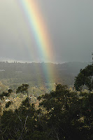
Rainbow over Mittagong.

Rainbow over Mittagong
This afternoon, I had to go to Welby, to renew my car registration. Not wanting to waste all the expensive, fossilised Dinosaur blood (petrol) which I use to power my little vehicle, I decided to drive up to Mt Alexandra, overlooking Mittagong (it is not far from Welby).

In truth I thought it a good opportunity to check out the rocky hillside there, for any likely Greenhood Orchids. I did not find any of those, in flower. I did see some "Wasp Orchid" (Chiloglottis) leaves, but no flowers.


looking north-east
from Mt Alexandra
Lena and I love clambering over the rocky outcrops near the car park, at the end of the official road up Mt Alexandra. I think this place is known as "Katoomba Lookout", but I have never been able to see as far as that. Obviously I have not ever chosen the appropriate weather conditions. I can say, however, that I know that one can see Mt Gibraltar (the next hill to the east) from Echo Point, at Leura, in the Blue Mountains. That is probably 80 Km away. So, I do know it is possible to see that far, across the Lower Blue Mountains, over the Cox's River valley - but only on a clear day (or night).

Today, instead of a distant view, I was rewarded with a wonderful rainbow. It was late afternoon, and a brief shower of rain passed over Mittagong, while the sun was shining strongly behind me. Perfect conditions for rainbows.

This rainbow is seen looking out over Mittagong, towards Mt Gibraltar and the ridge east of that town, where the Old South Road passes along.
reflected rainbow
(top left, to lower right)

Lena was taken with the little rock pools which she thinks were there for her benefit (for "drinkies"). Remember, we have had heavy rain recently, and these natural rock pools hold water very well.
These are reflections on pure, natural water, not oil slicks on contaminated water, as one might see in water near a Mechanic's Garage.

Reflected rainbow
(lower left to mid right)
To me, instead of offering "drinkies", these pools provided wonderful reflections, and I was able to find the right angles to capture the faintest of rainbow reflections in this pool. The different angles show the left and right hand ends of the rainbow - as its arc passed low in the sky, to the left and to the right - on the opposite ends of the rainbow.

Tuesday, December 05, 2006

VICTORIAN ALPS COULD "BURN FOR MONTHS"

The Victoran Alps could "burn for months" according to the Victorian Premier, Mr Steve Bracks. This is reported in "The Age", 4 December 2006.

This is a very early start to the bushfire season in Victoria. It matched what I have been saying for months about the unseasonal heat we have been having. I first commented on this on 12 October this year.

The Victorian Alps are notorious for their severe fires, as they are covered with dense Eucalypt forests, which frankly, can burn with a terrifying ferocity. Lets hope this prophecy is not lived out in reality. Here is a link to historical photographs of the infamous 1939 bushfires in the Victorian Alps.
*****
Fortunately, the fires in the New South Wales Blue Mountains, which I mentioned last week, now appear to be under control. But that is not the same thing as saying they are out.

With that difficult terrain of deep gorges, which are utterly inaccessible by road, fires can burn uncontrolled for weeks on end down there.

But the weather has been mild for the last few days, thank goodness.

*****

UPDATE:
Go to "The Age" for another stunning photo of mountains slowly burning, out of control , in the Victoran Alps.
*****

And now for some light relief.

I love the names that early explorers gave to place names. Usually it is Sailors names I notice, like Cape Tribulation, and other cheerful names. But this group of names, all reported in the one story today about bushfires in the Victorian Alps take on an especially bleak tone today:
Mt. Terrible, Black Range, Mt Despair and Mt Buggery.

But, if it were not for the fire story, you would have to have a chuckle, wouldn't you?

I also add in Mt Despair, which is mentioned in the linked photo gallery of someone's bushwalk to Mt Buggery.

Seriously, I am not kidding you - these are real place names.

Monday, August 14, 2006

A View to Forever

Today I went with Beth Boughton to visit Ros Badgery, at her property, Wanganderry, at High Range. What a location!

When seen from the southern side, Mt Wanganderry appears as a tiny point, sticking up just a little bit higher than High Range. Yet, it is the highest point in the western side of the Wingecarribee Shire.

But, as soon as you pass around the edge of Mt Wanganderry, you realise that it deserves its status as a mountain. It forms a clear divide. Beyond Mt Wanganderry, you look north west - "a View to Forever", over a series of valleys, starting with the Wollondilly (coming from the south, and the Nattai, coming from the east).
This area is known as the Nattai Wilderness, and is part of the Southern Section of the Greater Blue Mountains World Heritage Area.

This wild landscape spans from here, just a little west of Mittagong, all the way to Katoomba, in the main part of the Blue Mountains.

Today was clear, with just a hint of summer haze. But the distinctive blue tinge is real, not "faked up".

I was fascinated by the deeply incised valleys, for although we are looking across to the other side of a vast sandstone plateau, the expected flat-topped profile is far less noticeable than the wildly eroded hills in the middle of the valley.

It is only when you pan around the horizon, that you realise that everything on that vast vista is more-or-less at the same level that the idea of how flat the entire horizon is. Then and only then, does the idea of the vast sandstone plateau make sense.

I hope to paste some of these images together, to give you such a panoramic vista, but that will take me some time.

And as we were on the edge of a plateau, with cliffs just a little distance away, of course we were in Eagle territory.


Two Wedge-tailed Eagles were enjoying the late afternoon breezes, as we prepared to leave the Nattai Wilderness.

Saturday, January 21, 2006

Where the hell is Robertson?

In answer to your question above, dear Reader, I am attaching a series of map/photos which I have adapted from the wonderful Dr Google. You might not be aware that Google Earth allows you a "spy satellite" view of your own back yard (almost). The only problem is that for rural dwellers like us, who are not yet of "strategic interest" to certain "foreign powers", the effective resolution available for us is about 200 m square. Below that, it is very fuzzy. Do remember to double click on these images for larger sized images to open up. I am endebted to Greg for putting me onto "Google Earth" as a resource base.

I made these images up, to send to a friend of mine in Canada. But it occurred to me that they might be of interest to locals and other visitors to this site, as well.

This first photo shows the village of Robertson, the Robertson Nature Reserve, a "pin" marked DJW (you can work that out) and then Cemetary Hill, which is at the end of Missingham Pde. At the Cemetary, you can clearly make out the area of forest which Hugh Waring planted about 50 years ago, which formed the rustic backdrop to the sheep-stealing scenes in "Babe". The discolouration in the bottom half of the photo is "original" from the Google Earth site. I think it shows different levels of imaging available, but I am not sure.

The Railway Station is shown (on Google Earth) as having an elevation of about 2440 feet (743 metres). Robertson is on a line of ancient volcanic activity, which accounts for both its altitude and its soil type. The predominant soil type in the local area is red basalt. The local trees are mostly non-Eucalypt forest (cool-temperate rainforest). Because of its altitude, and proximity to the ocean, it is a high rainfall area. From 1962 onwards the mean annual rainfall has been 1616 mm (or 63.6 inches).

In the second photo you can see the Illawarra Coastal region, with Lake Illawarra in the top right. South from there is the coastline around the Shell Harbour area. Move west, following the patches of bright green land (cleared farming land), and you will come to Robertson. So, on a clear day, (when we get one) the ocean may be seen from any high vantage point around Robertson (if you live on a ridge, and face east - I face west!). It is approximately 45 Km south-west of Wollongong and 99 Km south-west of Sydney.

In the third image, I have sketched in (in fine yellow lines) the edge of the coastal escarpment. This escarpment line is home to a wonderful line of sub-tropical rainforests - the original forests on lower ground were cleared by the early European settlers. Beyond that (west and north) lies the area known as the Illawarra Plateau. It is a relatively flat area of sandstone, covered in dense Eucalypt forest. There are coal deposits underneath the stratas of sandstone, which accounts for the presence of the steel mills in Wollongong.


This sandstone soil area is immensely rich, from the point of view of biodiversity. It is full of native plants and birds and animals. Many of them are endemic to the region and deserve to be protected. Long may it continue to be so!

<>The final image gives you the "big picture" - where we are in relation to the main sandstone plateaux surrounding Sydney. Again I have marked the full extent of the Illawarra Escarpment with a yellow line.You can see Sydney in the relatively low-lying basin. West of it is the Blue Mountains, rising to its highest point at Mount Victoria, west of Katoomba (famous for the huge gorges in the Jamison Valley and sandstone features like the "Three Sisters").


The dark green areas amount to undisturbed "wilderness" (much of it National Parks or reserved areas). It survived settlement by Europeans largely undisturbed, precisely because its soil was relatively infertile for the purposes of cropping and grazing animals.The development which did occur, happened because of specific resource pockets, such as coal or oil-shale deposits, (or a few areas with gold deposits). Certain fertile pockets of soil, in valley bottoms, or on isolated volcanic outcrops, also resulted in patches where the native vegetation was cleared for farming. That is what happened in Robertson and the surrounding area, from the 1850s onwards.