| Locality | Latitude | Longitude | Distance | Bearing |
|---|
| Hasznos, Nógrád County, Hungary | 47° 55' 55" N | 19° 43' 45" E | 2.7km (1.7 miles) | |
| Kövicses Brook Valley, Hasznos, Nógrád County, Hungary | 47° 55' 48" N | 19° 44' 7" E | 3.0km (1.9 miles) | |
| Szalajkás Hill, Mátrakeresztes, Nógrád County, Hungary | 47° 53' 47" N | 19° 47' 25" E | 7.4km (4.6 miles) | |
| Aranyos-bérc & Korlát-bérc, Gyöngyöspata, Gyöngyös District, Heves County, Hungary | 47° 52' 50" N | 19° 47' 49" E | 8.6km (5.3 miles) | |
| Prédikáló-tető, Gyöngyöspata, Gyöngyös District, Heves County, Hungary | 47° 52' 0" N | 19° 46' 59" E | 8.7km (5.4 miles) | |
| Mátrakeresztes, Nógrád County, Hungary | 47° 53' 59" N | 19° 49' 0" E | 9.1km (5.7 miles) | |
| Kányáspuszta, Bátonyterenye, Nógrád County, Hungary | 47° 58' 59" N | 19° 48' 0" E | 10.3km (6.4 miles) | |
| Nagy-Zsunyi Hill quarry (Zunypuszta quarry), Nagylóc, Nógrád County, Hungary | 48° 0' 18" N | 19° 37' 40" E | 10.8km (6.7 miles) | |
| Szorospatak, Bátonyterenye, Nógrád County, Hungary | 47° 56' 57" N | 19° 50' 22" E | 11.0km (6.8 miles) | |
| Nagybátony, Bátonyterenye, Nógrád County, Hungary | 47° 58' 35" N | 19° 49' 13" E | 11.1km (6.9 miles) | |
| Teréz Hill, Mátraszentimre, Gyöngyös District, Heves County, Hungary | 47° 54' 41" N | 19° 52' 10" E | 12.8km (8.0 miles) | |
| Fajzatpuszta, Gyöngyöstarján, Gyöngyös District, Heves County, Hungary | 47° 50' 30" N | 19° 49' 40" E | 13.0km (8.1 miles) | |
| Mátraszentistván, Heves County, Hungary | 47° 55' 16" N | 19° 52' 28" E | 13.1km (8.2 miles) | |
| Szent Imre Mine, Mátraszentimre, Gyöngyös District, Heves County, Hungary | 47° 54' 35" N | 19° 52' 36" E | 13.4km (8.3 miles) | |
| Mátraszentlászló, Heves County, Hungary | 47° 55' 29" N | 19° 52' 45" E | 13.5km (8.4 miles) | |
| Szántás Hill, Bátonyterenye, Nógrád County, Hungary | 47° 56' 1" N | 19° 52' 45" E | 13.6km (8.4 miles) | |
| Károlytáró, Gyöngyösoroszi, Gyöngyös District, Heves County, Hungary | 47° 51' 57" N | 19° 52' 20" E | 14.3km (8.9 miles) | |
| Károlyvár, Gyöngyösoroszi, Gyöngyös District, Heves County, Hungary | 47° 51' 0" N | 19° 52' 59" E | 15.8km (9.8 miles) | |
| Kis-domb, Gyöngyöstarján, Gyöngyös District, Heves County, Hungary | 47° 49' 59" N | 19° 52' 0" E | 15.9km (9.9 miles) | |
| Füledugó Quarry, Gyöngyöstarján, Gyöngyös District, Heves County, Hungary | 47° 49' 19" N | 19° 51' 28" E | 16.2km (10.0 miles) | |
| Szén-patak Cseternás-bérc, Gyöngyössolymos, Gyöngyös District, Heves County, Hungary | 47° 53' 7" N | 19° 54' 51" E | 16.6km (10.3 miles) | |
| Bagolyvár-Furmin, Gyöngyösoroszi, Gyöngyös District, Heves County, Hungary | 47° 51' 0" N | 19° 53' 59" E | 16.9km (10.5 miles) | |
| Alsópálfalva, Salgótarján, Nógrád County, Hungary | 48° 3' 49" N | 19° 47' 55" E | 17.6km (11.0 miles) | |
| Üstökfő, Gyöngyössolymos, Gyöngyös District, Heves County, Hungary | 47° 51' 57" N | 19° 55' 21" E | 17.8km (11.1 miles) | |
| Mogyorós-orom, Gyöngyössolymos, Gyöngyös District, Heves County, Hungary | 47° 55' 2" N | 19° 56' 20" E | 17.9km (11.1 miles) | |
| Nemti, Nógrád County, Hungary | 48° 0' 34" N | 19° 53' 58" E | 18.0km (11.2 miles) | |
| Asztag kő, Gyöngyössolymos, Gyöngyös District, Heves County, Hungary | 47° 51' 29" N | 19° 55' 21" E | 18.1km (11.2 miles) | |
| Rudolftanya, Parádsasvár, Pétervására District, Heves County, Hungary | 47° 55' 13" N | 19° 56' 49" E | 18.5km (11.5 miles) | |
| Nagy Lipót hill, Parádsasvár, Pétervására District, Heves County, Hungary | 47° 54' 27" N | 19° 56' 57" E | 18.8km (11.7 miles) | |
| Adit No. 2, Nagy-Lápafő area, Parádsasvár, Pétervására District, Heves County, Hungary | 47° 54' 27" N | 19° 57' 12" E | 19.1km (11.8 miles) | |


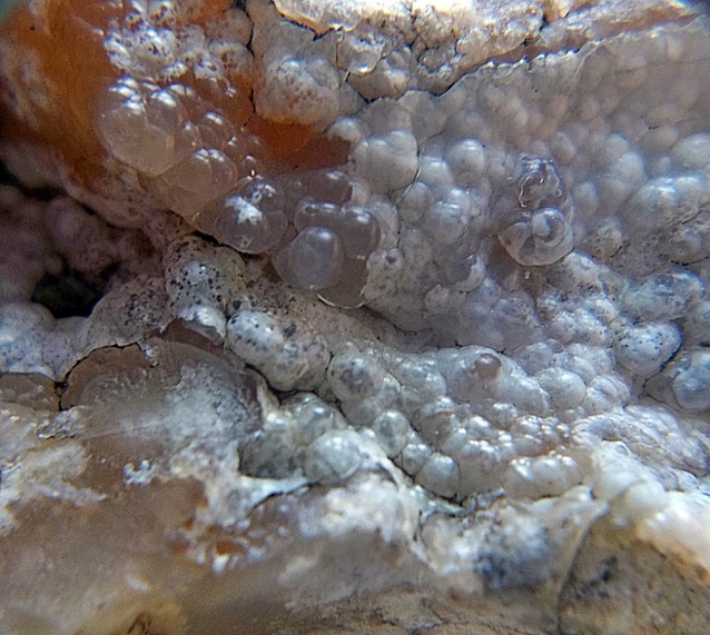

Prédikáló-tető, Gyöngyöspata, Gyöngyös District, Heves County, Hungary