Geospatial Web
- 1. Geospatial Web Dr. Harry Chen CMSC 491S/691S March 24, 2008
- 2. Agenda Digital maps revolution Introduction to GIS Key Geospatial Web technologies
- 3. Our civilizations are built on maps Anglo-Saxon world map (circa 1040 CE) 1883 reconstruction of Eratosthenes ' map (276-194 BC) Babylonian World map (6 th Century BC) Tabula Peutingeriana (4th century) - Britain to the west, India to the East Source: http://en.wikipedia.org/wiki/Ancient_world_maps
- 4. Map is more than a piece of paper Map by itself is a technology Gives a virtual representation of an area Tells a story about of our past history Highlights the symbolic relationships between entities, objects and regions Cartography – the study of map-making
- 5. World Map 1970 Source: National Geographic Ukraine is part of the USSR
- 6. World Map 1994 Source: National Geographic Ukrain is no longer part of the USSR
- 7. Digital Maps Picture a digital map in your head. What do you see?
- 8. Do you see this? Fine. Google Maps is the most popular digital map today. But, there are many other kinds of digital maps before it. Without their innovations, we won’t have Google Maps.
- 10. Disclaimer This is not a geography course lecture. This is not a cartography course lecture. This lecture is not intended to cover the full history or evolution of digital map making. It’s intended for software developers who want to learn geospatial web programming
- 11. Key concepts GIS (Geographic Information Systems) Geospatial Web
- 12. GIS (Geographic Information Systems) No standard definition of what it is In general, it’s the use of computer systems to manage, analyze and display geographical information We use GIS to solve problems e.g., resource management and planning
- 13. Geospatial Web No standard definition of what it is GIS for the Web : Use GIS technology to enhance Web application functions The Web for GIS : Use the Web as a platform for sharing geographic data, enabling collaboration and enriching the capabilities of GIS.
- 14. Emergence of GIS Computing technology advancements helped to establish the GIS foundation Kind of like Paper Maps Digital Maps Pen drawing Click icons Statistical data on paper Saved data in DB
- 15. Popular use of GIS Resource Management Asset Management Urban Planning Marketing Logistics Sales
- 16. Technologies under the hood GIS Foundations Data entry Data display Data management (not covered) Information retrieval and analysis (not covered)
- 17. Data entry There’s the problem of data collection. But, we won’t discuss here. Let’s assume you have the data collected. How do you store this data? How would you store the information about the country border of Ukraine?
- 18. How about the border of Indonesia? So many islands! Irregular shapes!
- 19. How about other kinds of data? Streets? Parcels? Evaluation? Land usage? Custom? restaurants that the Clintons has visited
- 20. Some common representations Raster and Vector data The concept of layers (ESRI)
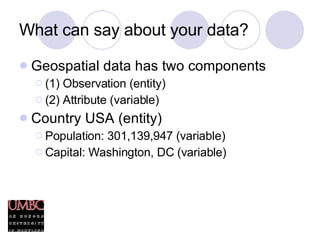
- 21. What can say about your data? Geospatial data has two components (1) Observation (entity) (2) Attribute (variable) Country USA (entity) Population: 301,139,947 (variable) Capital: Washington, DC (variable)
- 22. What else can you say about data? Your data (i.e., entities) has two kinds of location information Absolute location The exact location in a coordinates system (lat/long) Relative location The topological location referred to other entities UMBC (entity) N 39° 15' 19'‘, W 76° 42' 41'‘ (absolute) Located in Baltimore County (relative)
- 23. Data display Concerns how you want to look at the data for what purpose.
- 25. Key Geospatial Web technologies
- 26. Geospatial Web technologies Languages for describing geospatial data on the Web Services for sharing and finding geospatial data on the Web Annotate Web resources with geospatial properties Visualizing the geospatial Web
- 27. GML Geography Markup Language (GML) is an XML language for expressing geographic features Defined by the Open Geospatial Consortium (OGC)
- 28. Describing a Feature using GML http://en.wikipedia.org/wiki/Geography_Markup_Language#Examples
- 29. KML Keyhole Markup Language An XML language for expressing geographical annotation and visualization. Developed by Keyhole, Inc. (which was later acquired by Google) Since GML is taken, I guess they have to stick with KML.
- 30. KML example KML is used by Google Maps and Google Earth Less expressive than GML in terms of kind of geographical information it can describe. But KML is more widely used in Web mashups.
- 31. Web Map Service (WMS) WMS is a specification for implementing a Web service that can dynamically produce maps of spatially referenced data Defined by OGC WMS Geo. Web Application Client Browser Map (JPEG, GIF etc.)
- 32. Web Feature Service (WFS) WFS is a specification for implementing a Web service that can produce descriptions of “Features” Feature is an abstract representation of any geospatial thing in the world. WFS Geo. Web Application Client Browser Feature (GML/XML or ESRI shapefiles)
- 33. Geotag There are many ways a user can annotate Web resources with location information. Flickr machine tags Microformats RDFa GeoRSS
- 34. Visualizing the geospatial Web 2D and 3D maps are changing the way we view information on the Web
- 35. What’s next? We will visit the following topics Google Maps API GML and KML Geonames


