Downloaded 14 times
![Workshop on Workflows on Earth Observation Steven Ramage, OGC [email_address] 21 June 2010, Sir Clive Granger Building, University of Nottingham](https://image.slidesharecdn.com/20100512workflowramage-1277820263339-phpapp02/75/20100512-Workflow-Ramage-1-2048.jpg)


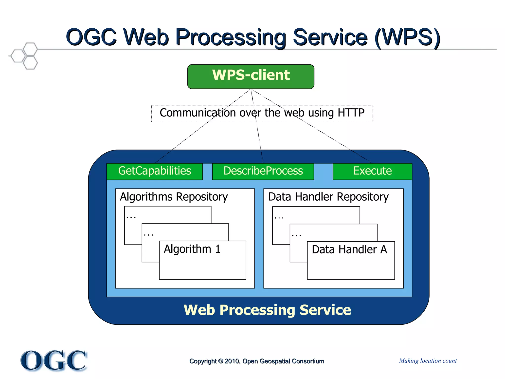


The document discusses the significance of workflows in various fields, particularly in geospatial data processing and automation through standards set by the Open Geospatial Consortium (OGC). It details the OGC web services standards, including WMS, WFS, WCS, and WPS, which facilitate the sharing and processing of geospatial data. Furthermore, it highlights ongoing initiatives like OWS-5 and OWS-6 that focus on developing and integrating automated geospatial workflows, aiming to improve decision-making and analytical processes in emergency management and environmental monitoring.


