INTRODUCTION 
 Wind processes are typically referred to as eolian 
processes, which produce eolian land forms. 
 The term eolian is derived from AEOLUS , the 
Greek god of wind . 
 It is important to understand the role that wind play 
with respect to land form evolution because more 
than one third of the land on our planet is 
characterized as arid or semi arid .
AIM & OBJECT 
 Our aim is to focus on arid Geomorphology & the way that 
the flowing air, moves sadiment and shaps the landscape 
 It provide us a good understanding of desert environments 
& why they occure where they do. 
 Desert & other dry lands are excellent places to study 
geomorphology because the vegetation cover is relatively 
thin & thus features such as rock structure & landforms are 
easy to see.
ARID & SEMI-ARID REGIONS IN THE 
WORLD 
ARID & SEMI-ARID DESERT COVER 1/3 OF THE EARTH’S LAND SURFACE.
WIND ACTION CAN BE DIVIDED INTO THREE 
PARTS:- 
WIND ACTION 
EROSION TRANSPORTATION DEPOSITION
WHY IN HUMID 
REGION EXCEPT 
ALONG SEASHORE 
WIND EROSION IS 
LIMITED?
WHY????
Due to the prevalent cover of 
grass & trees . 
Also by the binding action of 
moisture in the soil.
EROSSION
TYPES OF EROSION 
EROSION 
DEFLACTION ABRASION ATTRITION
DEFLACTION 
DEFLACTIONDEFLACTION 
 The process of lowering the land surface is called 
“Deflaction”. 
 Removal of sediments from a surface by wind action. 
 In latin verb “deflatus” meaning ‘to blow away’.
DEFLACTION CAUSES 
Desert pavement 
Deflation hollow
DESERT PAVEMENT 
 A resistant ,pavement- like suface created when 
fine particles blow away & coarse sediments such 
as pebbles & gravel are left behind. 
 Protect underlying layers of fine particles from 
further deflaction by capping them.
DEFLACTION HOLLOW 
 A depression crested by wind erosion . 
 Most deflaction hollows are small ,some may 
exceed 1.6 km in diameter.
ABRASION 
 It is also known as “CORRASION”. 
 The blown particles strike against up standing 
masses & causes erosion by mechanical wearing of 
rock . 
 Process same as “SANDBLASTING”.
FACTORS ARE---- 
 The strength of the wind . 
 Persistence of wind . 
 Hardness of the blowing sand grains . 
 Angularity of the blowing sand grains . 
 The resistance of the rock being abraded.
FEATURES PRODUCED BY 
ABRASION 
Ventifacts 
Yardangs 
Pedestal rock 
Zeugen
An individual rock that is pitted,grooved or 
streamlined through wind abrasion .
YARDANGS :- 
 Ridges that are sculpted & streamlined by wind 
abrasion and deflaction .
Pedestal rock 
Wide rock-cap standing on a slender rock 
column.
ATTRITION 
 The rock particles not only abrade the exposed 
bad rock but they themseleves are also abraded by 
colliding against one another 
 This produces a rounded appearance of individual 
fragments . 
Adds a “frosted” appearance to sand grains 
Rounding of 
grains 
•
TRANSPORTATION
WAYS IN WHICH EOLIAN SADIMENT IS TRANSPOTED 
TRANSPORTATION 
SALTATION 
MEDIUM SIZED 
PARTICLES 
O.O5 mm TO 2.0 
mm 
THROUGH A 
SERIES OF 
BOUNCES 
SUSPENSION 
FOR SILT & CLAY 
LIGHT & FINE 
LOOSE MATERIAL 
KEPT IN AIR 
DUST CLOUD 
SURFACE CREEP 
PARTICLE OF LARGE 
SIZE 
THROUGH ROLLING & 
CREEPING
WAYS IN WHICH EOLIAN SADIMENT IS 
TRANSPOTED
DEPOSITION
DEPOSITION 
When velocity of wind checked then deposition started . 
Forms aeolian deposits . 
DEPOSITION 
SAND SEAS 
VAST REGION 
ENORMOUS QUANTITIES OF 
SAND RESULT IN A WIDE 
VARIETY OF DUNE TYPE . 
EX.- SAND SEA IN SAHARA 
DESERT 
SAND SHEETS 
HORIZONTAL TO 
SEMIHORIZONTAL BODIES 
OF SAND 
IT EXHIBIT LITTLE OR NO 
SURFACE TOPOGRAHPHY.
SAND DUNE’S COMPONENTS & 
MIGRATION 
BACKSLOPE-The gradual slope of a dune that faces the prevailing winds. 
CREST-The highest point of a dune. 
SLIP FACE- The steep slope that lies on the leeward side of a sand dune.
SAND DUNES & IT’S TYPES 
 A hill made of sand formed by aeolian processes . 
 Form due to intrection with the wind . 
 The area covered by extensive sand dunes is 
known as DUNE FIELD. 
 The valley or the low area between the dunes is 
called a SLACK.
TYPES OF SAND DUNES
TYPES OF SAND DUNES
TYPES OF SAND DUNES
TYPES OF SAND DUNES
TYPES OF SAND DUNES
TYPES OF SAND DUNES
TYPES OF SAND DUNES
TYPES OF SAND DUNES
LOESS 
 Windblown silt and clay Deposits far from their source 
 „ Soils on Loess Deposits are some of the most fertile in the 
world
THE PROCESS OF EOLIAN SORTING
SUMMARY & CONCLUSION 
 Wind processes are typically referred to as eolian processes, 
which produce eolian land forms. 
 one third of the land on our planet is characterized as arid or 
semi arid. 
 Wind action can be divided into three parts EROSION, 
TRANSPORTATION and DEPOSITION. 
 Wind mostly moves loose material 
 Features are –Yardang , Ventifacts ,Pedestal rock , Loess etc... 
 Sand dunes depend on strength and steadiness of wind 
and abundance of sand 
 Windblown silt is called loess
REFERENCES 
 Principle of physical Geology by ARTHUR 
HOLMES. 
 “GEOLOGICA” Earth’s geologycal past. 
 Discovering physical Geography by Alan 
 Introduction to phisical Geology by A.K. Datta. 
 Theory and problems of introductory Geology by 
Richard W Ojakangas.
F.A.Q. 
 1.Where is wind erosion is most effective ? 
 Ans. It is most effective where there is a lake of vegetation and 
moisture. 
 2.What is transported by wind - clay,silt,sand,or gravel ? 
 Ans. the fine grained particles clay and slit are most easily transported 
by wind. Some sand is also moved as evidenced by sand dunes. 
Coarser sediments remains behind. 
 3.What is a lag gravel ? 
 Ans. The coarse sediment left behind where wind has removed the fine 
grain sizes. 
 4. What effect will a lag gravel have on wind erosion ? 
 Ans. It will prevent further removal of fine sediments from beneath the 
gravel layer. 
 5. Are sandstorms common ? 
 Ans. NO . Sand is rarely lifted more than 1 or 2 m off the ground . Most 
sandstorms are rarely duststrome composed of clay and silt sized 
particles.
F.A.Q. 
 6. What causes wind ? 
 Ans. As the sun heats the air in a given area ,it expends and rise . As this this occurs 
,denser and cooler air moves into the area . As it moves in , wind is the result. 
 7. What factor most affect the ability of wind to carry sediment of different grain sizes? 
 Ans. The velocity of the wind . The higher velocity, the larger. The particle that can be 
carried. However the maxium size that can normaly be carried is sand unless tonudo or 
huricane is present. 
 8. What is ventifact? 
 Ans .A ventifact is a stone eroded by the sand-blasting effect of the 
wind.smooth,inclined,and polished face or facets are characteristic. 
 9 . what is a deflation basin? 
 ANS.A deflation basin is a shallow basin eroded by wind in areas of dry ,fine-grained 
sediment.some deflation basin in desert areas can be tens of kilometers long and tens of 
meter deep. 
 10. what is loess,and whats is it composed of ? 
 ANS.Loess is a term applied to widespread,thick deposits of wind-blown silt.It generally is 
made up of quartz and feldspar.Calite is commonly added after deposition.
 11.How far can wind –blown dust be transported? 
 ANS.Very far.Fine volcanic ash,for example,can be thrown several kilometer high by a 
volcanic eruption and can circle the earth for year .when the volcano krakatoa in the east 
indies exploded in 1883,volcanic ash rose to 130,000ft and circled the earth for years 
,even making the days slightly durker then usual. 
 12.where does loess form? 
 ANS.In two main places,either down wind from ablating glaciers or down wind from 
deserts examples of glacial loess are found in the mississippi and missouri. River valleys 
of the upper midwest .Desert related loess exists in north western china,probably derived 
from the gobi desert of central asia. 
 13.How large can sand dunes becomes? 
 ANS.With a sources of abundant sand and stronge, stable wind,dunes can reach heights 
of 250m,as in the saudi arabian deser. 
 14.Are sand dunes stationary? 
 ANS.some are ,if they have been stabilized by vegetation .However,most dunes are 
actively moving down wind,or migrating. Rates vary from lees than a metre a year to tens 
of meters , and some may migrate much faster. 
 15. Is the sand in sans dunes well sorted or poorely sorted? 
 Ans. Well sorted. The fine slit and clay are generaly carried out of the dunes area by the 
wind,and coarser grains are left behind. The sand itself is better sorted than river or beach 
sands and is generaly fine to medium grained sand.
ASSIGNMENTS 
Located the arid & semi arid-region on map of India. 
Located the arid & semi arid-region on map of World.
ASSIGNMENTS 
 Find the place where sand seas occurs in the world . 
 Find out the data about sand dunes on Mars and prepare 
a brief report. 
 Write the name of the major desert present in all over the 
world.
QUIZES 
1.Which of the choices below is not a defining 
characteristic of a desert? 
A)high temperature 
B)precipitation exceeds evaporation 
C)shifting sand dunes 
D)none of the above are defining characteristics of 
deserts. 
2.Which of the following is a common feature of 
desert regions? 
A)flash floods 
B)slow chemical weathering 
C)internal drainage 
D)all of these.
3.A very flat surface underlain by a dry lake bed of hard, 
mud-cracked clay is called 
A)plateau. B)mesa. C)bajada. D)playa. 
4. Rocks with flat, wind-abraded surfaces are called 
A)ventifacts.B)pediments C)blow-outs.D)barchans. 
5. The erosion of sand, silt, and clay from the land surface is 
called 
A)depletion. B)deflation. C)deposition. D)transport. 
6.Which of the following is not a type of sand dune? 
A)Transverse B)Barchan 
C)Parabolic D)all of these are types of sand dunes 
7.A surface layer of closely packed pebbles found in desert 
areas is 
A)ventifact. B)bajada C)desert 
varnish D)desert pavement.
8.Plants living in desert regions 
A)are able to survive when it rains. 
B)are adapted to low moisture levels. 
C)often have small leaves with waxy coatings. 
D)all of these 
9.A sand dune that is convex in the downwind direction is 
A)a transverse dune. B)a parabolic dune. 
C)a barchan dune. D)a longitudinal dune. 
10.Sand dunes have been observed on 
A)Mars. B)Uranus. C)the Moon. D)Venus 
11.Deposits of windblown silt and clay are called 
A)dunes. B)loess. C)clay. D)silt. 
12.Most dunes move only 
A)10 to 15 meters per year. B)30 to 100 meters per year. 
C)1 to 2 kilometers per year. D)none of these
13.In the United States, Death Valley is a desert because 
A)it is the location of a secret flying saucer base. 
B)it is very hot. 
C)it is below sea level. 
D)it is in the rain shadow of the Sierra Nevada mountains. 
14.what is a feature produced by abrasion- 
A) Hamada b) lag deposits c) Yardang d) none of these 
15. which feature has a wide rock cap standing on a slender 
rock ? 
A) ventifacts B)pedistal rock c) sand dunes D)Hamada 
16. The erosion of sediments by mutual collision is known as 
A)attrition B)abrasion C)deflation D)none of these 
17. The methord of transportation through rolling and creeping is 
known as- 
A) Traction B) saltation C)suspension D)none of these
18. what part of the land in the Earth is covered with arid and 
semi arid region ? 
A)1/4 B)1/3 C) 3/4 D)1/2 
19. The highest point of sand dunes is called 
A)crust B)crest C)butte D)pinnacle 
20. the gradual slope of a dune that faces the prevailing winds. 
A) Back slope B)slip face C) lee slope D) NOT

Aeolian process and landform by shivam soni B.Sc student of Department of Applied Geology Dr. Harisingh Gour University, Sagar Universityfinal ppt 2007

  • 2.
    INTRODUCTION  Windprocesses are typically referred to as eolian processes, which produce eolian land forms.  The term eolian is derived from AEOLUS , the Greek god of wind .  It is important to understand the role that wind play with respect to land form evolution because more than one third of the land on our planet is characterized as arid or semi arid .
  • 3.
    AIM & OBJECT  Our aim is to focus on arid Geomorphology & the way that the flowing air, moves sadiment and shaps the landscape  It provide us a good understanding of desert environments & why they occure where they do.  Desert & other dry lands are excellent places to study geomorphology because the vegetation cover is relatively thin & thus features such as rock structure & landforms are easy to see.
  • 4.
    ARID & SEMI-ARIDREGIONS IN THE WORLD ARID & SEMI-ARID DESERT COVER 1/3 OF THE EARTH’S LAND SURFACE.
  • 5.
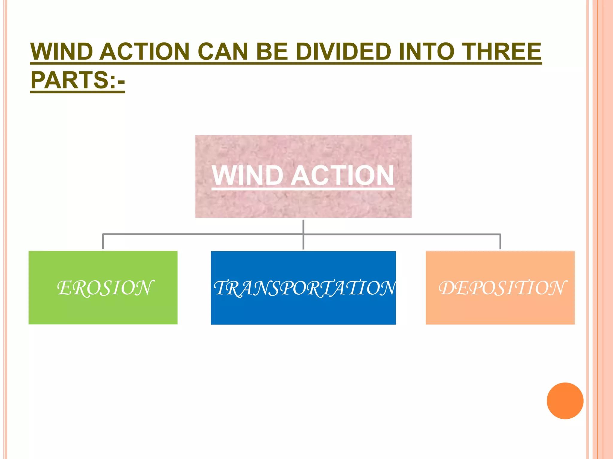
    WIND ACTION CANBE DIVIDED INTO THREE PARTS:- WIND ACTION EROSION TRANSPORTATION DEPOSITION
  • 6.
    WHY IN HUMID REGION EXCEPT ALONG SEASHORE WIND EROSION IS LIMITED?
  • 7.
  • 8.
    Due to theprevalent cover of grass & trees . Also by the binding action of moisture in the soil.
  • 9.
  • 10.
    TYPES OF EROSION EROSION DEFLACTION ABRASION ATTRITION
  • 11.
    DEFLACTION DEFLACTIONDEFLACTION The process of lowering the land surface is called “Deflaction”.  Removal of sediments from a surface by wind action.  In latin verb “deflatus” meaning ‘to blow away’.
  • 12.
    DEFLACTION CAUSES Desertpavement Deflation hollow
  • 13.
    DESERT PAVEMENT A resistant ,pavement- like suface created when fine particles blow away & coarse sediments such as pebbles & gravel are left behind.  Protect underlying layers of fine particles from further deflaction by capping them.
  • 16.
    DEFLACTION HOLLOW A depression crested by wind erosion .  Most deflaction hollows are small ,some may exceed 1.6 km in diameter.
  • 17.
    ABRASION  Itis also known as “CORRASION”.  The blown particles strike against up standing masses & causes erosion by mechanical wearing of rock .  Process same as “SANDBLASTING”.
  • 19.
    FACTORS ARE---- The strength of the wind .  Persistence of wind .  Hardness of the blowing sand grains .  Angularity of the blowing sand grains .  The resistance of the rock being abraded.
  • 20.
    FEATURES PRODUCED BY ABRASION Ventifacts Yardangs Pedestal rock Zeugen
  • 21.
    An individual rockthat is pitted,grooved or streamlined through wind abrasion .
  • 23.
    YARDANGS :- Ridges that are sculpted & streamlined by wind abrasion and deflaction .
  • 24.
    Pedestal rock Widerock-cap standing on a slender rock column.
  • 25.
    ATTRITION  Therock particles not only abrade the exposed bad rock but they themseleves are also abraded by colliding against one another  This produces a rounded appearance of individual fragments . Adds a “frosted” appearance to sand grains Rounding of grains •
  • 26.
  • 27.
    WAYS IN WHICHEOLIAN SADIMENT IS TRANSPOTED TRANSPORTATION SALTATION MEDIUM SIZED PARTICLES O.O5 mm TO 2.0 mm THROUGH A SERIES OF BOUNCES SUSPENSION FOR SILT & CLAY LIGHT & FINE LOOSE MATERIAL KEPT IN AIR DUST CLOUD SURFACE CREEP PARTICLE OF LARGE SIZE THROUGH ROLLING & CREEPING
  • 28.
    WAYS IN WHICHEOLIAN SADIMENT IS TRANSPOTED
  • 30.
  • 31.
    DEPOSITION When velocityof wind checked then deposition started . Forms aeolian deposits . DEPOSITION SAND SEAS VAST REGION ENORMOUS QUANTITIES OF SAND RESULT IN A WIDE VARIETY OF DUNE TYPE . EX.- SAND SEA IN SAHARA DESERT SAND SHEETS HORIZONTAL TO SEMIHORIZONTAL BODIES OF SAND IT EXHIBIT LITTLE OR NO SURFACE TOPOGRAHPHY.
  • 32.
    SAND DUNE’S COMPONENTS& MIGRATION BACKSLOPE-The gradual slope of a dune that faces the prevailing winds. CREST-The highest point of a dune. SLIP FACE- The steep slope that lies on the leeward side of a sand dune.
  • 33.
    SAND DUNES &IT’S TYPES  A hill made of sand formed by aeolian processes .  Form due to intrection with the wind .  The area covered by extensive sand dunes is known as DUNE FIELD.  The valley or the low area between the dunes is called a SLACK.
  • 34.
  • 35.
  • 36.
  • 37.
  • 38.
  • 39.
  • 40.
  • 41.
  • 43.
    LOESS  Windblownsilt and clay Deposits far from their source  „ Soils on Loess Deposits are some of the most fertile in the world
  • 44.
    THE PROCESS OFEOLIAN SORTING
  • 45.
    SUMMARY & CONCLUSION  Wind processes are typically referred to as eolian processes, which produce eolian land forms.  one third of the land on our planet is characterized as arid or semi arid.  Wind action can be divided into three parts EROSION, TRANSPORTATION and DEPOSITION.  Wind mostly moves loose material  Features are –Yardang , Ventifacts ,Pedestal rock , Loess etc...  Sand dunes depend on strength and steadiness of wind and abundance of sand  Windblown silt is called loess
  • 46.
    REFERENCES  Principleof physical Geology by ARTHUR HOLMES.  “GEOLOGICA” Earth’s geologycal past.  Discovering physical Geography by Alan  Introduction to phisical Geology by A.K. Datta.  Theory and problems of introductory Geology by Richard W Ojakangas.
  • 47.
    F.A.Q.  1.Whereis wind erosion is most effective ?  Ans. It is most effective where there is a lake of vegetation and moisture.  2.What is transported by wind - clay,silt,sand,or gravel ?  Ans. the fine grained particles clay and slit are most easily transported by wind. Some sand is also moved as evidenced by sand dunes. Coarser sediments remains behind.  3.What is a lag gravel ?  Ans. The coarse sediment left behind where wind has removed the fine grain sizes.  4. What effect will a lag gravel have on wind erosion ?  Ans. It will prevent further removal of fine sediments from beneath the gravel layer.  5. Are sandstorms common ?  Ans. NO . Sand is rarely lifted more than 1 or 2 m off the ground . Most sandstorms are rarely duststrome composed of clay and silt sized particles.
  • 48.
    F.A.Q.  6.What causes wind ?  Ans. As the sun heats the air in a given area ,it expends and rise . As this this occurs ,denser and cooler air moves into the area . As it moves in , wind is the result.  7. What factor most affect the ability of wind to carry sediment of different grain sizes?  Ans. The velocity of the wind . The higher velocity, the larger. The particle that can be carried. However the maxium size that can normaly be carried is sand unless tonudo or huricane is present.  8. What is ventifact?  Ans .A ventifact is a stone eroded by the sand-blasting effect of the wind.smooth,inclined,and polished face or facets are characteristic.  9 . what is a deflation basin?  ANS.A deflation basin is a shallow basin eroded by wind in areas of dry ,fine-grained sediment.some deflation basin in desert areas can be tens of kilometers long and tens of meter deep.  10. what is loess,and whats is it composed of ?  ANS.Loess is a term applied to widespread,thick deposits of wind-blown silt.It generally is made up of quartz and feldspar.Calite is commonly added after deposition.
  • 49.
     11.How farcan wind –blown dust be transported?  ANS.Very far.Fine volcanic ash,for example,can be thrown several kilometer high by a volcanic eruption and can circle the earth for year .when the volcano krakatoa in the east indies exploded in 1883,volcanic ash rose to 130,000ft and circled the earth for years ,even making the days slightly durker then usual.  12.where does loess form?  ANS.In two main places,either down wind from ablating glaciers or down wind from deserts examples of glacial loess are found in the mississippi and missouri. River valleys of the upper midwest .Desert related loess exists in north western china,probably derived from the gobi desert of central asia.  13.How large can sand dunes becomes?  ANS.With a sources of abundant sand and stronge, stable wind,dunes can reach heights of 250m,as in the saudi arabian deser.  14.Are sand dunes stationary?  ANS.some are ,if they have been stabilized by vegetation .However,most dunes are actively moving down wind,or migrating. Rates vary from lees than a metre a year to tens of meters , and some may migrate much faster.  15. Is the sand in sans dunes well sorted or poorely sorted?  Ans. Well sorted. The fine slit and clay are generaly carried out of the dunes area by the wind,and coarser grains are left behind. The sand itself is better sorted than river or beach sands and is generaly fine to medium grained sand.
  • 50.
    ASSIGNMENTS Located thearid & semi arid-region on map of India. Located the arid & semi arid-region on map of World.
  • 51.
    ASSIGNMENTS  Findthe place where sand seas occurs in the world .  Find out the data about sand dunes on Mars and prepare a brief report.  Write the name of the major desert present in all over the world.
  • 52.
    QUIZES 1.Which ofthe choices below is not a defining characteristic of a desert? A)high temperature B)precipitation exceeds evaporation C)shifting sand dunes D)none of the above are defining characteristics of deserts. 2.Which of the following is a common feature of desert regions? A)flash floods B)slow chemical weathering C)internal drainage D)all of these.
  • 53.
    3.A very flatsurface underlain by a dry lake bed of hard, mud-cracked clay is called A)plateau. B)mesa. C)bajada. D)playa. 4. Rocks with flat, wind-abraded surfaces are called A)ventifacts.B)pediments C)blow-outs.D)barchans. 5. The erosion of sand, silt, and clay from the land surface is called A)depletion. B)deflation. C)deposition. D)transport. 6.Which of the following is not a type of sand dune? A)Transverse B)Barchan C)Parabolic D)all of these are types of sand dunes 7.A surface layer of closely packed pebbles found in desert areas is A)ventifact. B)bajada C)desert varnish D)desert pavement.
  • 54.
    8.Plants living indesert regions A)are able to survive when it rains. B)are adapted to low moisture levels. C)often have small leaves with waxy coatings. D)all of these 9.A sand dune that is convex in the downwind direction is A)a transverse dune. B)a parabolic dune. C)a barchan dune. D)a longitudinal dune. 10.Sand dunes have been observed on A)Mars. B)Uranus. C)the Moon. D)Venus 11.Deposits of windblown silt and clay are called A)dunes. B)loess. C)clay. D)silt. 12.Most dunes move only A)10 to 15 meters per year. B)30 to 100 meters per year. C)1 to 2 kilometers per year. D)none of these
  • 55.
    13.In the UnitedStates, Death Valley is a desert because A)it is the location of a secret flying saucer base. B)it is very hot. C)it is below sea level. D)it is in the rain shadow of the Sierra Nevada mountains. 14.what is a feature produced by abrasion- A) Hamada b) lag deposits c) Yardang d) none of these 15. which feature has a wide rock cap standing on a slender rock ? A) ventifacts B)pedistal rock c) sand dunes D)Hamada 16. The erosion of sediments by mutual collision is known as A)attrition B)abrasion C)deflation D)none of these 17. The methord of transportation through rolling and creeping is known as- A) Traction B) saltation C)suspension D)none of these
  • 56.
    18. what partof the land in the Earth is covered with arid and semi arid region ? A)1/4 B)1/3 C) 3/4 D)1/2 19. The highest point of sand dunes is called A)crust B)crest C)butte D)pinnacle 20. the gradual slope of a dune that faces the prevailing winds. A) Back slope B)slip face C) lee slope D) NOT