GeoCamp 2012 - Open Source WebMapping
Download as ODP, PDF2 likes1,383 views

This document discusses several open source web mapping frameworks: OpenLayers, ExtJS, and GeoExt. OpenLayers is a JavaScript library that supports OGC standards and has a large user and developer community. ExtJS is a JavaScript framework for building rich web applications with user interface components like forms and tables. GeoExt brings together OpenLayers and ExtJS to allow building of spatial rich internet applications with maps integrated with user interface elements like toolbars, legends, and tables.


GeoCamp 2012 - Open Source WebMapping
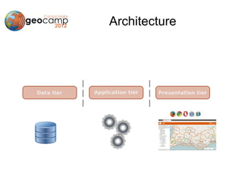
- 2. Architecture
- 3. Architecture
- 4. Architecture
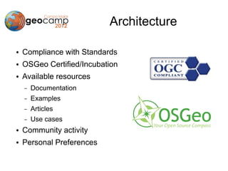
- 5. Architecture ● Compliance with Standards ● OSGeo Certified/Incubation ● Available resources – Documentation – Examples – Articles – Use cases ● Community activity ● Personal Preferences
- 6. Architecture
- 7. Architecture
- 8. OpenLayers ● Javascript API ● Supports OGC Standards ● OSGeo Project ● Big user and developer community
- 9. OpenLayers ● Lots of formats (WMS, WFS, GML, SLD, …) ● Several map controls (Zoom, pan, TOC, Scale, …) ● Spatial editing ● Interaction with 3rd party services (OSM, Google, Yahoo, Bing Maps, Geonames, …) ● Easy to Learn ● Nice and useful example galley USE THE SOURCE
- 10. OpenLayers ● MAP
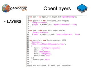
- 11. OpenLayers ● LAYERS
- 12. OpenLayers ● LAYERS
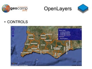
- 13. OpenLayers ● CONTROLS
- 14. OpenLayers ● CONTROLS
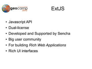
- 15. ExtJS ● Javascript API ● Dual-license ● Developed and Supported by Sencha ● Big user community ● For building Rich Web Applications ● Rich UI interfaces
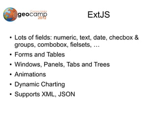
- 16. ExtJS ● Lots of fields: numeric, text, date, checbox & groups, combobox, fielsets, … ● Forms and Tables ● Windows, Panels, Tabs and Trees ● Animations ● Dynamic Charting ● Supports XML, JSON
- 17. ExtJS ● FORMS & FIELDS
- 18. ExtJS ● WINDOWS, TABS, TABLES, TREE
- 19. GeoExt ● OpenLayers is good for maps, though it has few and limited UI components ● ExtJS has lots of UI components and functionality but … mapping is lacking ● GeoExt brings both together to allow easy building of Spatial RIA
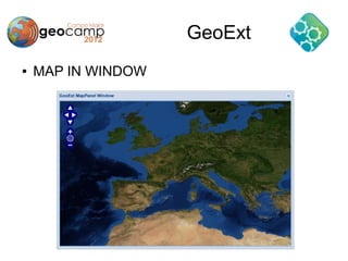
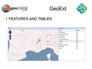
- 20. GeoExt ● Map in windows, panels and tabs ● TOC in a tree ● Map controls in toolbars ● Feature information in forms, tables ● Legend Panel ● Scale Combobox
- 21. GeoExt ● MAP IN WINDOW
- 22. GeoExt ● FEATURES AND TABLES
- 23. GeoExt ● SCALE COMBOBOX AND LAYER TREE
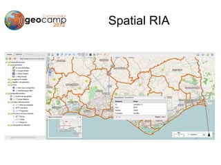
- 24. Spatial RIA
- 25. Spatial RIA
- 26. Conclusions ● Big diversity of Open Source software ● Big modularity is an healthy advantage ● Powerful frameworks available ● It's fun and easy to learn ● The big question is: CAN YOU DO IT???