


This document discusses GIS file formats, conversions between formats, and common vector and raster formats. It provides the following key points: 1. GIS file formats encode geographic information into files, with main formats created by mapping agencies and GIS software developers, including vector and raster formats. 2. The GDAL/OGR libraries support conversions between 142 raster formats and 84 vector formats and are used in many GIS software programs. 3. Common vector formats include ESRI Shapefiles and CSV files, while common raster formats include TIFF and GeoTIFF files.
Overview of GIS file formats by Hans van der Kwast and Jan Hoogendoorn from OpenCourseWare.
GIS file formats encode geographic info, created by governments and developers, including vector and raster formats.
GDAL supports 142 raster formats, OGR supports 84 vector formats; both are open-source and available online.
Major GIS and remote sensing tools employing GDAL/OGR libraries include QGIS, ArcGIS, and Google Earth.
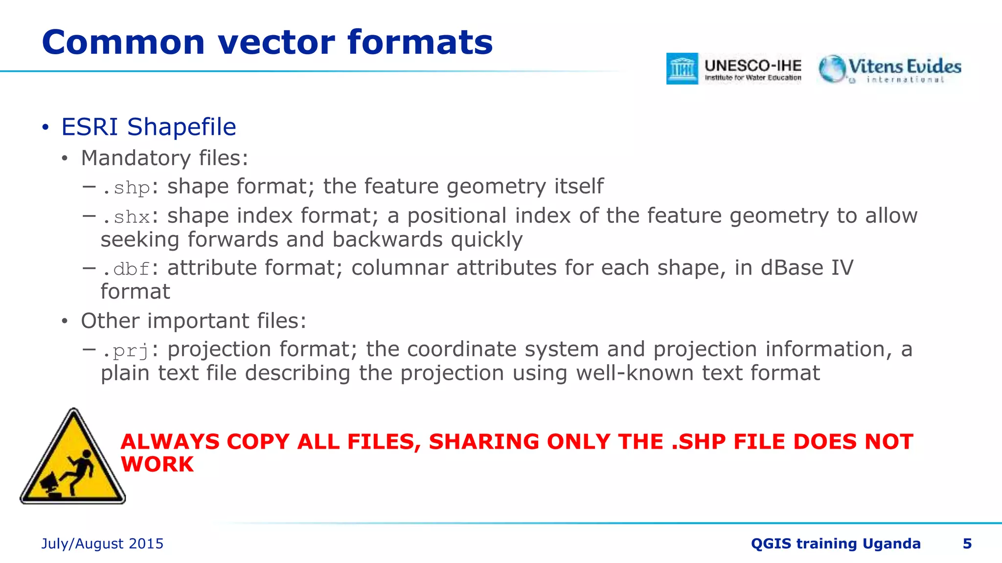
ESRI Shapefile structure includes mandatory and important files; sharing only .shp is insufficient.
CSV files can import/export GIS data with coordinates and are editable in text editors.
TIFF and GeoTIFF are crucial for raster graphics, with embedded georeferencing metadata options.
Introduction to Arc/Info ASCII GRID as an additional common raster format.
Different formats can be converted: raster to raster, vector to vector, and vice versa.
QGIS projects saved as .qgs files link to layers; file paths must remain intact to prevent errors.
Organizational tips for GIS data: avoid desktop saving, use intuitive names, and learn file management.
Organizing GIS data under clear directory structures, with sample naming conventions for exercises.
Instructions for displaying file extensions in Windows to assist in file management.


![SHS_Core_CAE_Q3_LE1 FOR THIRD [FINAL].pdf](https://cdn.slidesharecdn.com/ss_thumbnails/shscorecaeq3le1final-251116055110-e3081055-thumbnail.jpg?width=640&height=640&fit=bounds)


