SlideShare a Scribd company logo
Mgr. Petr Přidal - Klokan
                          info@klokantech.com


          OLDMAPSONLINE.ORG:
OPEN SOURCE AND ONLINE TOOLS FOR OLD MAPS

              Moravian Library Brno: OldMapsOnline.org
      R&D grant of the Czech Ministry of Culture (DC08P02OUK006)


                 FOSS4G 2010 - OSGEO, Barcelona, 6-8 September 2010
OldMapsOnline.org: Open Source & Online Tools for Old Maps
PROJECT OLDMAPSONLINE.ORG

• Research project of Moravian Library in Brno, Czech
  Republic (Bernhard Moll’s Map Collection, 12k+ scans).
• Development of a workflow based on open-source
  software: to assist in the management, manipulation and
  visualization of historical map collections on the web
• Best practices and step-by-step guides for use of the
  free software
• Online tools to explore, georeference, annotate and
  visually integrate online old maps in a Web 2.0 style,
  following OGC standards and known best practices
THE RESULTS?

1.Documentation and links to free software tools, and
  relevant scientific articles. Presentations.
2.We have produced open-source software you can use
  right now for publishing your scanned maps online:
  IIPImage JPEG2000, MapTiler, .. + contributed patches
  in OpenLayers (Zoomify), GDAL (gdal2tiles), GeoTools
3.An online service: Georeferencer.org
HTTP://HELP.OLDMAPSONLINE.ORG/
Map Curators’ Workshop 2009


 From paper to screen:
Putting maps on the web

   Christopher Fleet <c.fleet@nls.uk>
 Klokan Petr Přidal <klokan@klokan.cz>


         Edinburgh, 9-10th September, 2009
THE RESULTS?

1.Documentation and links to free software tools, and
  relevant scientific articles. Presentations.
2.We have produced open-source software you can use
  right now for publishing your scanned maps online:
  IIPImage JPEG2000, MapTiler, .. + contributed patches
  in OpenLayers (Zoomify), GDAL (gdal2tiles), GeoTools
3.An online service: Georeferencer.org
JPEG      PUBLISHING OF THE SCANS
2000
  • Easiest and fastest: Zoomify or DeepZoom/OpenZoom
    via “prerendered tiles”. Step by step tutorial:
    http://help.oldmapsonline.org/publish/
  • Image Server software as an alternative:
    • For collections with thousands of images and their
       own hardware servers connected to the Internet
    • Possibly one image file for both online distribution
       and digital archiving (“open archive”)
    • Save the disk space thanks advanced compression
OPENLAYERS, ZOOMIFY, MOOVIEWER, OPENZOOM
 TILES PREGENERATED OR SERVED BY IIPIMAGE
JPEG           IIPIMAGE JPEG2000
2000
  • Free and open-source software, runs best on a Linux server
  • Compatible with several popular viewers (Zoomify, SeaDragon,
    IIPMooViewer, OpenLayers, PanoJS, ...) and iPhone or Google
    Earth
  • Easy to install (prepared step-by-step tutorial and a Debian
    package)
  • Alternative to commercial products such as Lizardtech
    ExpressServer (MrSID), ERDAS Image Web Server (ECW)
  • Direct distribution of TIFF images (with encoded pyramid)
  • Support for JPEG2000 format (via Kakadu library - non-
    commercial use only, 100% free OpenJPEG library later on)
400 DPI
         9606 x 7322 px


 202 MB uncompressed TIFF
~107 MB JPEG2000 (lossless)

     15 MB JPEG 85%
 ~ 8 MB JPEG2000 (lossy)
JPEG        IIPIMAGE JPEG2000
2000

  • Considering to use JPEG2000 format for archiving?
  • Do you want to publish high resolution images online?
  • Have a look at our open-source project!
  • Documentation, best practice articles related to
    encoding to JPEG2000, software for download:


 http://oldmapsonline.org/jpeg2000/
OldMapsOnline.org: Open Source &amp; Online Tools for Old Maps
PUBLISHING OF THE MAPS

• Easiest and fastest: prerendered tiles via MapTiler:
  http://www.maptiler.org/
• Alternative to map servers, which are harder to install/
  configure/maintain:
  • MapServer, GeoServer, ...
• Available on the OSGeo LiveDVD!
• It generates OSGeo TMS tiles, same like GDAL2Tiles.
THE RESULTS?

1.Documentation and links to free software tools, and
  relevant scientific articles. Presentations.
2.We have produced open-source software you can use
  right now for publishing your scanned maps online:
  IIPImage JPEG2000, MapTiler, .. + contributed patches
  in OpenLayers (Zoomify), GDAL (gdal2tiles), GeoTools
3.An online service: Georeferencer.org
Technology Preview:


    ONLINE SERVICE
GEOREFERENCER.ORG
WHAT IS IT?
• Online tool designed to bookmark, georeference and
  annotate high resolution images of maps on the web.
• Collaborative Web 2.0 online service for all of us!
• You can create your personal virtual map collection and do a
  research and genealogy studies online.
• Share the results of your work with online old maps, compare
  and synthesize maps published at different websites
• Automatic 3D visualization and overlays of Google Maps-like
  base maps
• You need only a web browser to process the maps!
DEMO


http://georeferencer.org/

     Still under development!

   PUBLIC ALPHA VERSION
      AVAILABLE NOW!
OldMapsOnline.org: Open Source &amp; Online Tools for Old Maps
PLANS FOR THE FUTURE:
• Customization for libraries, adding of metadata.
• Clipping, composites of maps, correct merging of map series
• Map projections and custom coordinates (EPSG)
• Reference maps via OGC WMS - from national authorities
• Closer integration with library websites (via a link)
• Improvement of the community services, comments, links to
  research, etc.
• Image analysis: “colored version of ...”, automatic neat line
  detection, cropped maps and derivatives, deduplication
• A free service, hopefully a new grant (MZK + CUNI + MU)
WE NEED YOUR HELP!
• Try it and submit “feedback” via the online button!
• Ideas for improvement? Do you want to collaborate?
• Developers? We have a REST API to access the data.
   Need for JavaScript API for development of external
   tools?

              Please contact us, feedback wanted!


           http://georeferencer.org/
Support for all JPEG images, Zoomify maps and David Rumsey’s maps with and an improved
     georeferencing interdace now! Support for more formats of maps coming soon!
ONE MORE THING...
GEOGRAPHICAL SEARCH

• Intuitive interface: Where, When, Who, What
• Ranking to sort the maps, even in a large catalog
• Tested projects:
  • TimeMap.net - (ECAI.org)
  • Alexandria Digital Library
  • DigMap.eu Lucene GeoTemporal (LGTE)
  • Google GeoSearch API
OldMapsOnline.org: Open Source &amp; Online Tools for Old Maps

More Related Content

Similar to OldMapsOnline.org: Open Source &amp; Online Tools for Old Maps (20)

PPTX
Ariadne Services
ariadnenetwork
 
PPTX
Gisruk2013 addy edit2
Addy Pope
 
PDF
Edinburgh OldMapsOnline Workshop
Petr Pridal
 
PPTX
GIS User to Web-GIS Developer Journey
Tek Kshetri
 
PPTX
OpenStreetMap in 3D - current developments
virtualcitySYSTEMS GmbH
 
PDF
Activities Of The Foss4 G20080122
Toru Mori
 
PDF
Maps4 finland 28.8.2012, pekka sarkola
Olli Rinne
 
PDF
Maps4Finland 28.8.2012, Pekka Sarkola
Apps4Finland
 
PPTX
Introduction to GIS
Hans van der Kwast
 
PDF
Parthenos - Ariadne Common Services
Parthenos
 
PPT
Sharing the Openness of the Maps via FOSS4G and the Web
Hidenori Fujimura
 
PDF
2013 Vendor, MapQuest Plugins for Leaflet by Jonathan Harahush
GIS in the Rockies
 
PDF
Working with arcgis online
zmmin383
 
PPTX
Mapinfo 2014
GeoMedeelel
 
PDF
The Gorbals in Relief: Experiments in OpenStreetMap and Architectural Practic...
duncanbain
 
PDF
Building Maps with Leaflet
Andrew Howard
 
PDF
The User-participated Geospatial Web as Open Platform
Channy Yun
 
PDF
Lessons Learned from CityOpenSource
Marco Montanari
 
PDF
Managing Spatial Information and Services with Drupal: the GEO-MOOD approach
Twinbit
 
PDF
OpenStreetMap integration into Wikimedia projects
avarab
 
Ariadne Services
ariadnenetwork
 
Gisruk2013 addy edit2
Addy Pope
 
Edinburgh OldMapsOnline Workshop
Petr Pridal
 
GIS User to Web-GIS Developer Journey
Tek Kshetri
 
OpenStreetMap in 3D - current developments
virtualcitySYSTEMS GmbH
 
Activities Of The Foss4 G20080122
Toru Mori
 
Maps4 finland 28.8.2012, pekka sarkola
Olli Rinne
 
Maps4Finland 28.8.2012, Pekka Sarkola
Apps4Finland
 
Introduction to GIS
Hans van der Kwast
 
Parthenos - Ariadne Common Services
Parthenos
 
Sharing the Openness of the Maps via FOSS4G and the Web
Hidenori Fujimura
 
2013 Vendor, MapQuest Plugins for Leaflet by Jonathan Harahush
GIS in the Rockies
 
Working with arcgis online
zmmin383
 
Mapinfo 2014
GeoMedeelel
 
The Gorbals in Relief: Experiments in OpenStreetMap and Architectural Practic...
duncanbain
 
Building Maps with Leaflet
Andrew Howard
 
The User-participated Geospatial Web as Open Platform
Channy Yun
 
Lessons Learned from CityOpenSource
Marco Montanari
 
Managing Spatial Information and Services with Drupal: the GEO-MOOD approach
Twinbit
 
OpenStreetMap integration into Wikimedia projects
avarab
 

OldMapsOnline.org: Open Source &amp; Online Tools for Old Maps

  • 1. Mgr. Petr Přidal - Klokan [email protected] OLDMAPSONLINE.ORG: OPEN SOURCE AND ONLINE TOOLS FOR OLD MAPS Moravian Library Brno: OldMapsOnline.org R&D grant of the Czech Ministry of Culture (DC08P02OUK006) FOSS4G 2010 - OSGEO, Barcelona, 6-8 September 2010
  • 3. PROJECT OLDMAPSONLINE.ORG • Research project of Moravian Library in Brno, Czech Republic (Bernhard Moll’s Map Collection, 12k+ scans). • Development of a workflow based on open-source software: to assist in the management, manipulation and visualization of historical map collections on the web • Best practices and step-by-step guides for use of the free software • Online tools to explore, georeference, annotate and visually integrate online old maps in a Web 2.0 style, following OGC standards and known best practices
  • 4. THE RESULTS? 1.Documentation and links to free software tools, and relevant scientific articles. Presentations. 2.We have produced open-source software you can use right now for publishing your scanned maps online: IIPImage JPEG2000, MapTiler, .. + contributed patches in OpenLayers (Zoomify), GDAL (gdal2tiles), GeoTools 3.An online service: Georeferencer.org
  • 6. Map Curators’ Workshop 2009 From paper to screen: Putting maps on the web Christopher Fleet <[email protected]> Klokan Petr Přidal <[email protected]> Edinburgh, 9-10th September, 2009
  • 7. THE RESULTS? 1.Documentation and links to free software tools, and relevant scientific articles. Presentations. 2.We have produced open-source software you can use right now for publishing your scanned maps online: IIPImage JPEG2000, MapTiler, .. + contributed patches in OpenLayers (Zoomify), GDAL (gdal2tiles), GeoTools 3.An online service: Georeferencer.org
  • 8. JPEG PUBLISHING OF THE SCANS 2000 • Easiest and fastest: Zoomify or DeepZoom/OpenZoom via “prerendered tiles”. Step by step tutorial: http://help.oldmapsonline.org/publish/ • Image Server software as an alternative: • For collections with thousands of images and their own hardware servers connected to the Internet • Possibly one image file for both online distribution and digital archiving (“open archive”) • Save the disk space thanks advanced compression
  • 9. OPENLAYERS, ZOOMIFY, MOOVIEWER, OPENZOOM TILES PREGENERATED OR SERVED BY IIPIMAGE
  • 10. JPEG IIPIMAGE JPEG2000 2000 • Free and open-source software, runs best on a Linux server • Compatible with several popular viewers (Zoomify, SeaDragon, IIPMooViewer, OpenLayers, PanoJS, ...) and iPhone or Google Earth • Easy to install (prepared step-by-step tutorial and a Debian package) • Alternative to commercial products such as Lizardtech ExpressServer (MrSID), ERDAS Image Web Server (ECW) • Direct distribution of TIFF images (with encoded pyramid) • Support for JPEG2000 format (via Kakadu library - non- commercial use only, 100% free OpenJPEG library later on)
  • 11. 400 DPI 9606 x 7322 px 202 MB uncompressed TIFF ~107 MB JPEG2000 (lossless) 15 MB JPEG 85% ~ 8 MB JPEG2000 (lossy)
  • 12. JPEG IIPIMAGE JPEG2000 2000 • Considering to use JPEG2000 format for archiving? • Do you want to publish high resolution images online? • Have a look at our open-source project! • Documentation, best practice articles related to encoding to JPEG2000, software for download: http://oldmapsonline.org/jpeg2000/
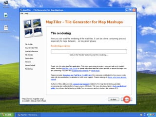
  • 32. PUBLISHING OF THE MAPS • Easiest and fastest: prerendered tiles via MapTiler: http://www.maptiler.org/ • Alternative to map servers, which are harder to install/ configure/maintain: • MapServer, GeoServer, ... • Available on the OSGeo LiveDVD! • It generates OSGeo TMS tiles, same like GDAL2Tiles.
  • 33. THE RESULTS? 1.Documentation and links to free software tools, and relevant scientific articles. Presentations. 2.We have produced open-source software you can use right now for publishing your scanned maps online: IIPImage JPEG2000, MapTiler, .. + contributed patches in OpenLayers (Zoomify), GDAL (gdal2tiles), GeoTools 3.An online service: Georeferencer.org
  • 34. Technology Preview: ONLINE SERVICE GEOREFERENCER.ORG
  • 35. WHAT IS IT? • Online tool designed to bookmark, georeference and annotate high resolution images of maps on the web. • Collaborative Web 2.0 online service for all of us! • You can create your personal virtual map collection and do a research and genealogy studies online. • Share the results of your work with online old maps, compare and synthesize maps published at different websites • Automatic 3D visualization and overlays of Google Maps-like base maps • You need only a web browser to process the maps!
  • 36. DEMO http://georeferencer.org/ Still under development! PUBLIC ALPHA VERSION AVAILABLE NOW!
  • 38. PLANS FOR THE FUTURE: • Customization for libraries, adding of metadata. • Clipping, composites of maps, correct merging of map series • Map projections and custom coordinates (EPSG) • Reference maps via OGC WMS - from national authorities • Closer integration with library websites (via a link) • Improvement of the community services, comments, links to research, etc. • Image analysis: “colored version of ...”, automatic neat line detection, cropped maps and derivatives, deduplication • A free service, hopefully a new grant (MZK + CUNI + MU)
  • 39. WE NEED YOUR HELP! • Try it and submit “feedback” via the online button! • Ideas for improvement? Do you want to collaborate? • Developers? We have a REST API to access the data. Need for JavaScript API for development of external tools? Please contact us, feedback wanted! http://georeferencer.org/ Support for all JPEG images, Zoomify maps and David Rumsey’s maps with and an improved georeferencing interdace now! Support for more formats of maps coming soon!
  • 41. GEOGRAPHICAL SEARCH • Intuitive interface: Where, When, Who, What • Ranking to sort the maps, even in a large catalog • Tested projects: • TimeMap.net - (ECAI.org) • Alexandria Digital Library • DigMap.eu Lucene GeoTemporal (LGTE) • Google GeoSearch API