R spatial presentation
- 2. Who are you? Todd Barr Spatial Statistician/GeoData Sherpa
- 10. Outline • Spatial Libraries • GeoData • Spatial Joins/Cholorpleth Map • Heat Map
- 11. BackgRound on R • Developed in the 90s base on a Proprietary Statistical Language called ‘S’ and S-Plus, by Statisticians for Statistical Models.
- 12. Advantages of R - Spatial • Command Line Interface • Customizable Graphics • Native Spatial Data • Easily Extensible through Libraries • Many Tools to Munge Data, both Spatial and Tabular • Native Modeling and Analysis in Code • Levels the Playing Field
- 13. Disadvantages of R - Spatial • Steepish Learning Curve (even with Rstudio) • Difficult to Visualize Data (lack of interactive canvas in Rstudio) • Difficult to Dynamically Select things from a map • Single Core Processing (can be augmented with Libraries) • Libraries with overlapping functionalities
- 14. R in “Traditional” Spatial/GIS • Spatial • ArcGIS • R interface supported by ESRI Open Project “R Bridge” • QGIS • Imbedded a Functionality • Use R in the Native Script Editor • GeoDA • Native R code, and functionality • gvSIG • R plugin to allow
- 15. R in “Traditional” Spatial/GIS •Kinda Spatial •Tableau •Spotfire
- 16. R in “Traditional” Spatial/GIS • Capable of GeoAnalytics • SAS • SPSS
- 20. 0 10 20 30 40 50 60 70 80 2009 2010 2011 2012 2013 2014 2015 2016 2017 R Spatial Libraries
- 21. Libraries we’re Going to Focus On • ggplot2 - Library for the declarative generation of graphics • ggmap - Library for draping data over a Google, or Statman Basemap • maps - displays data as maps, also contains Spatial Data • mapdata - More Map data, extends maps • rgdal - Access to the Geospatial Data Abstraction Library (GDAL). Creates the ability to read datatypes and change projections • maptools - library for building and manipulating spatial information • rgeos - geometry operations • Cairo - high quality graphic formats for export • scales - assists in determining best place for breaks
- 26. What is Spatial Data • Two Cataglories • Vector • Point / Multipoint • Line/Multiline • Polygon/Multipolygon • Raster • It’s a matrix of pixels and each pixel has numeric attributes • Imagery • Some generated graphics
- 27. Geospatial Data Formats •Data within R packages – map, mapdata or oz •Files or Endpoints with Latitude and Longitude attributes (just Points) •Shapefiles •Geopackage/geoJSON/GML •Google or other cloud-based mapping api's
- 28. Warming up – A Simple Map >library(maps) >library(mapdata) >map(“worldHires”, “Mexico”, xlim=c(-118.4, - 86.7),ylin=c(14.5321,32.71865), col=“purple”, fill=TRUE)
- 30. Cooling Off – Another Simple Map >library(maps) >library(mapdata) >map(“worldHires”,”Canada”, xilm=c(-141,-53),ylim=c(40,85), col=“red”, fill=TRUE)
- 32. Cooling Off – Fixed Zoom In >library(maps) >library(mapdata) >map(“worldHires”,”Canada”, xlim=c(-140,-110),ylim=c(48.64), col=“red”, fill=TRUE)
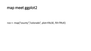
- 34. map meet ggplot2 >co <- map(“county”,”colorado”, plot=FALSE, fill=TRUE)
- 38. Maps and ggplot2
- 39. map and ggplot2 >ggplot(co,aes(long, lat)) + >geom_polygon(aes(group=group), color=“yellow”)
- 41. maps and ggplot2 >ggplot(co,aes(long, lat)) + >geom_polygon(aes(group=group), color=“yellow”, fill=“blue”)
- 43. ggplot and shapefiles and choropleths >library(ggplot2) >library(maptools) >library(rgeos) >library(ggmap) >library(scales) >library(RColorBrewer)
- 44. ggplot and shapefiles and choropleths >setwd(“$Folder_here”) >co.shp<-readShapeSpatial(“ACS1014_county.shp”) >class(co.shp) >names(co.shp)
- 45. ggplot and shapefiles and choropleths >print(co.shp$GEOID) >print(co.shp$NAME)
- 46. ggplot and shapefiles and choropleths >age_40<-data.frame(NAME_CO=co.shp$NAME, id=co.shp$COUNTYFP, prevalence=co.shp$age_40_49) >combine<-fortify(co.shp,region=“COUNTYFP”) >head(combine)
- 48. ggplot and shapefiles and choropleths >merge.shp<-merge(combine, age_40, by=“id”, all.x=TRUE) >final_join<-merge.shp[order(merge.shp$order),]
- 49. ggplot and shapefiles and choropleths >ggplot() + +geom_polygon(data=final_join, aes(x=long, y=lat,group=group, fill=prevalence),color=“black”, size=0.25) + +coord_map()
- 51. ggplot and shapefiles and choropleths >ggplot() + + geom_polygon(data=final_join, aes(x=long, y=lat, group=group, fill=prevalence), color=“black”, size=0.25) + + coord_map + + scale_fill_distiller(name=“Population”, palette=“YlGn”, breaks=pretty_breaks(n=5)) + + theme_nothing(legend=TRUE) + + labs(title=“40-49 year olds by County)
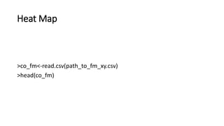
- 57. Heat Map >ggmap(co_map, extent=“device) + + geom_point(aes(x=long, y=lat), color=“red”, alpha=.1, size=2, data=co_fm)
- 59. Heat Map 2.0 >ggmap(co_map, extent = "device") +
- 60. Heat Map 2.0 + geom_density2d(data = co_fm,aes(x = long, y = lat), size = 0.3) +
- 61. Heat Map 2.0 + stat_density2d(data =co_fm, aes(x = lon, y = lat, fill = ..level.., alpha = ..level..), size = 0.01, bins = 16, geom = "polygon") +
- 62. Heat Map 2.0 + scale_fill_gradient(low = "green", high = "red") +
- 63. Heat Map 2.0 + scale_alpha(range = c(0, 0.3), guide = FALSE)


![ggplot and shapefiles and choropleths
>merge.shp<-merge(combine, age_40, by=“id”, all.x=TRUE)
>final_join<-merge.shp[order(merge.shp$order),]](https://image.slidesharecdn.com/rspatialpresentation-171116195103/85/R-spatial-presentation-48-320.jpg)


