SlideShare a Scribd company logo
Satellite systems
1. basic principles
2. Classifications
3. frequency allocation
4. Global positioning systems
satellitesystems.pptx mobile database computing
Global Positioning Systems (GPS)
• Global Positioning Systems, widely known as GPSs, have a great importance since the
days of World War II.
• Although the initial focus was mainly on military targeting, fleet management, and
navigation, commercial usage began finding relevance as the advantages of
radiolocation were extended to (but not limited to) tracking down stolen vehicles and
guiding civilians to the nearest hospital, gas station, hotel, and so on.
• A GPS system consists of a network of 24 orbiting satellites, called NAVSTAR
(Navigation System with Time and Ranging), and placed in space in six different
orbital paths with four satellites in each orbital plane and covering the entire earth
under their signal beams.
satellitesystems.pptx mobile database computing
The orbital period of these satellites is twelve hours.
The satellite signals can be received anywhere and at any time in the world.
The spacing of the satellites is arranged such that a minimum of five satellites are in view
from every point on the globe.
The first GPS satellite was launched in February 1978.
Each satellite is expected to last approx 7.5 years, and replacements are constantly being
built and launched into orbit.
Each satellite is placed at an altitude of about 10,900 nautical miles and weights about 862
kg.
The satellites extend to about 5.2m (17ft) in space including the solar panels. Each satellite
transmits on three frequencies.
The GPS is based on well known concept called the triangulation technique.
satellitesystems.pptx mobile database computing
Beneficiaries of GPS
• At the start, more than 1000 portable commercial GPS receivers
were purchased for military use.
• They were carried by soldiers and attached to vehicles,
helicopters, and aircraft instrument panels.
• GPS receivers were used in several aircrafts, including B-2
bombers and F-16 fighters etc. Navy ships used them for
rendezvous, minesweeping, and aircraft operations.
• GPS has become important for all military operations and
weapons systems. In additions, GPS benefits nonmilitary
operations.
• GPS is used on satellites to obtain highly accurate orbit data and
to control spacecraft orientation.
• GPS has a various applications on land, at sea, and in the air.
• GPS can be used everywhere except indoors and places where a
GPS signal cannot be received because of natural or man-made
obstructions.
• Both military and commercial aircraft use GPS for navigation
purposes. It is also used by commercial fisherman and boaters
to aid in navigation.
• The precision timing capability provided by GPS is used by the
scientific community for research purposes. The GPS enables
survey units to help surveyors to set up their survey sites fairly
quickly.
• GPS is also used for noncommercial purposes by car racers,
hikers, hunters, mountain bikers, and cross-country skiers.
• GPS also helps in providing emergency roadside assistance, by
allowing an accident victim to transmit his or her position to the
nearest response center at the push of a button.
• GPS is also helping to save lives. Many police, fire, and
emergency medical service units are using GPS receivers to
determine the location of a police car, a fire truck, or an
ambulance nearest to an emergency, enabling the quickest
possible response in death or life situations.
• Automobile manufacturers are offering moving map displays,
guided by GPS receivers as an option on new vehicles.
Limitations of GPS
• A major source of error in GPS arises from the fact that the
speed of the radio signals is constant only in a vacuum which
means that distance measurements may vary as the values of
the speed of signal vary in the atmosphere.
• The atmosphere, as we know, is composed of the ionosphere
and the troposphere. The presence of the troposphere
essentially composed of water vapor) is known to cause errors
due to variation of temperature and pressure, and the particles
in the ionosphere are known to cause significant measurement
errors (as would be the case with bad clocks!).

More Related Content

Similar to satellitesystems.pptx mobile database computing (20)

PPT
Gps
Vivek Bajpai
 
DOCX
Global positioning system (GPS)
Gautham Reddy
 
DOCX
Gps and its application
shubham paliwal
 
PDF
sattelittes for-------------navigation.pdf
fs58fryfbyqc
 
DOCX
Radio aids & navigation
Amidee Azizan Stringfellow
 
PPTX
Global positioning system
Arjun Manjooran
 
PPT
gps
manu manoj
 
PPTX
Global positioning system (GPS)
Chandana R
 
PPTX
Map Projections, Datums, GIS and GPS for Everyone
Dr. Geophysics
 
PPTX
Global positioning system(GPS)
Arghaya Goswami
 
PPT
Global positioning system 1
raviteja guggilla
 
PPTX
Global Positioning System (GPS) in Helthcare
Zulfiquer Ahmed Amin
 
PPTX
Global Positioning System
Varun B P
 
PDF
Global position system
Iqbal Khan
 
PPTX
Global positioning system (GPS)
Henil Shah
 
PPTX
Global Positioning System
Himanshu Agrawal
 
PPTX
Gps
Amith Kumar
 
PPT
Gps(global positioning system)
Amit Bshwas
 
PPT
Global positioning system
Jeevan Reddy Mandali
 
Global positioning system (GPS)
Gautham Reddy
 
Gps and its application
shubham paliwal
 
sattelittes for-------------navigation.pdf
fs58fryfbyqc
 
Radio aids & navigation
Amidee Azizan Stringfellow
 
Global positioning system
Arjun Manjooran
 
Global positioning system (GPS)
Chandana R
 
Map Projections, Datums, GIS and GPS for Everyone
Dr. Geophysics
 
Global positioning system(GPS)
Arghaya Goswami
 
Global positioning system 1
raviteja guggilla
 
Global Positioning System (GPS) in Helthcare
Zulfiquer Ahmed Amin
 
Global Positioning System
Varun B P
 
Global position system
Iqbal Khan
 
Global positioning system (GPS)
Henil Shah
 
Global Positioning System
Himanshu Agrawal
 
Gps(global positioning system)
Amit Bshwas
 
Global positioning system
Jeevan Reddy Mandali
 

More from ssuser77162c (14)

PPTX
REGULAR EXPRESSION FOR NATURAL LANGUAGES
ssuser77162c
 
PPTX
FINALEXAMCHAPTER3.pptx remote sensing diagram
ssuser77162c
 
PPT
CHAPTER2.ppt DATABASES FOR MULTIMEDIA COMPUTING
ssuser77162c
 
PPTX
UNIT-3.pptx GIS INFORMATION SYSTEMFOR COMPUTING
ssuser77162c
 
PPTX
chapter21-parallel processing. computing
ssuser77162c
 
PPT
RTET-2024_52.ppt research presentation for
ssuser77162c
 
PPTX
FSA.pptx natural language prsgdsgocessing
ssuser77162c
 
PPTX
chapter4.pptx natural language processing
ssuser77162c
 
PPTX
Chapter 5-Numpy-Pandas.pptx python programming
ssuser77162c
 
PPT
Semantic natural language processing ppt
ssuser77162c
 
PPTX
arthimetic operator,classes,objects,instant
ssuser77162c
 
PPTX
Chapter1 python introduction syntax general
ssuser77162c
 
PPT
intro.ppt
ssuser77162c
 
PPT
8034.ppt
ssuser77162c
 
REGULAR EXPRESSION FOR NATURAL LANGUAGES
ssuser77162c
 
FINALEXAMCHAPTER3.pptx remote sensing diagram
ssuser77162c
 
CHAPTER2.ppt DATABASES FOR MULTIMEDIA COMPUTING
ssuser77162c
 
UNIT-3.pptx GIS INFORMATION SYSTEMFOR COMPUTING
ssuser77162c
 
chapter21-parallel processing. computing
ssuser77162c
 
RTET-2024_52.ppt research presentation for
ssuser77162c
 
FSA.pptx natural language prsgdsgocessing
ssuser77162c
 
chapter4.pptx natural language processing
ssuser77162c
 
Chapter 5-Numpy-Pandas.pptx python programming
ssuser77162c
 
Semantic natural language processing ppt
ssuser77162c
 
arthimetic operator,classes,objects,instant
ssuser77162c
 
Chapter1 python introduction syntax general
ssuser77162c
 
intro.ppt
ssuser77162c
 
8034.ppt
ssuser77162c
 
Ad

Recently uploaded (20)

PPTX
How to Create a Customer From Website in Odoo 18.pptx
Celine George
 
PPTX
Cultivation practice of Litchi in Nepal.pptx
UmeshTimilsina1
 
PPTX
DIGITAL CITIZENSHIP TOPIC TLE 8 MATATAG CURRICULUM
ROBERTAUGUSTINEFRANC
 
PPTX
HUMAN RESOURCE MANAGEMENT: RECRUITMENT, SELECTION, PLACEMENT, DEPLOYMENT, TRA...
PRADEEP ABOTHU
 
PPTX
PPT-Q1-WEEK-3-SCIENCE-ERevised Matatag Grade 3.pptx
reijhongidayawan02
 
PPTX
TRANSLATIONAL AND ROTATIONAL MOTION.pptx
KIPAIZAGABAWA1
 
PDF
Characteristics, Strengths and Weaknesses of Quantitative Research.pdf
Thelma Villaflores
 
PDF
The Constitution Review Committee (CRC) has released an updated schedule for ...
nservice241
 
PPTX
EDUCATIONAL MEDIA/ TEACHING AUDIO VISUAL AIDS
Sonali Gupta
 
PDF
Vani - The Voice of Excellence - Jul 2025 issue
Savipriya Raghavendra
 
PPTX
Universal immunization Programme (UIP).pptx
Vishal Chanalia
 
PPTX
Controller Request and Response in Odoo18
Celine George
 
PPTX
DAY 1_QUARTER1 ENGLISH 5 WEEK- PRESENTATION.pptx
BanyMacalintal
 
PDF
Android Programming - Basics of Mobile App, App tools and Android Basics
Kavitha P.V
 
PDF
Exploring the Different Types of Experimental Research
Thelma Villaflores
 
PPTX
How to Set Up Tags in Odoo 18 - Odoo Slides
Celine George
 
PPTX
How to Manage Allocation Report for Manufacturing Orders in Odoo 18
Celine George
 
PPTX
CATEGORIES OF NURSING PERSONNEL: HOSPITAL & COLLEGE
PRADEEP ABOTHU
 
PDF
Council of Chalcedon Re-Examined
Smiling Lungs
 
PPTX
Identifying elements in the story. Arrange the events in the story
geraldineamahido2
 
How to Create a Customer From Website in Odoo 18.pptx
Celine George
 
Cultivation practice of Litchi in Nepal.pptx
UmeshTimilsina1
 
DIGITAL CITIZENSHIP TOPIC TLE 8 MATATAG CURRICULUM
ROBERTAUGUSTINEFRANC
 
HUMAN RESOURCE MANAGEMENT: RECRUITMENT, SELECTION, PLACEMENT, DEPLOYMENT, TRA...
PRADEEP ABOTHU
 
PPT-Q1-WEEK-3-SCIENCE-ERevised Matatag Grade 3.pptx
reijhongidayawan02
 
TRANSLATIONAL AND ROTATIONAL MOTION.pptx
KIPAIZAGABAWA1
 
Characteristics, Strengths and Weaknesses of Quantitative Research.pdf
Thelma Villaflores
 
The Constitution Review Committee (CRC) has released an updated schedule for ...
nservice241
 
EDUCATIONAL MEDIA/ TEACHING AUDIO VISUAL AIDS
Sonali Gupta
 
Vani - The Voice of Excellence - Jul 2025 issue
Savipriya Raghavendra
 
Universal immunization Programme (UIP).pptx
Vishal Chanalia
 
Controller Request and Response in Odoo18
Celine George
 
DAY 1_QUARTER1 ENGLISH 5 WEEK- PRESENTATION.pptx
BanyMacalintal
 
Android Programming - Basics of Mobile App, App tools and Android Basics
Kavitha P.V
 
Exploring the Different Types of Experimental Research
Thelma Villaflores
 
How to Set Up Tags in Odoo 18 - Odoo Slides
Celine George
 
How to Manage Allocation Report for Manufacturing Orders in Odoo 18
Celine George
 
CATEGORIES OF NURSING PERSONNEL: HOSPITAL & COLLEGE
PRADEEP ABOTHU
 
Council of Chalcedon Re-Examined
Smiling Lungs
 
Identifying elements in the story. Arrange the events in the story
geraldineamahido2
 
Ad

satellitesystems.pptx mobile database computing

  • 1. Satellite systems 1. basic principles 2. Classifications 3. frequency allocation 4. Global positioning systems
  • 15. Global Positioning Systems (GPS) • Global Positioning Systems, widely known as GPSs, have a great importance since the days of World War II. • Although the initial focus was mainly on military targeting, fleet management, and navigation, commercial usage began finding relevance as the advantages of radiolocation were extended to (but not limited to) tracking down stolen vehicles and guiding civilians to the nearest hospital, gas station, hotel, and so on. • A GPS system consists of a network of 24 orbiting satellites, called NAVSTAR (Navigation System with Time and Ranging), and placed in space in six different orbital paths with four satellites in each orbital plane and covering the entire earth under their signal beams.
  • 17. The orbital period of these satellites is twelve hours. The satellite signals can be received anywhere and at any time in the world. The spacing of the satellites is arranged such that a minimum of five satellites are in view from every point on the globe. The first GPS satellite was launched in February 1978. Each satellite is expected to last approx 7.5 years, and replacements are constantly being built and launched into orbit. Each satellite is placed at an altitude of about 10,900 nautical miles and weights about 862 kg. The satellites extend to about 5.2m (17ft) in space including the solar panels. Each satellite transmits on three frequencies. The GPS is based on well known concept called the triangulation technique.
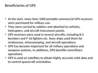
  • 19. Beneficiaries of GPS • At the start, more than 1000 portable commercial GPS receivers were purchased for military use. • They were carried by soldiers and attached to vehicles, helicopters, and aircraft instrument panels. • GPS receivers were used in several aircrafts, including B-2 bombers and F-16 fighters etc. Navy ships used them for rendezvous, minesweeping, and aircraft operations. • GPS has become important for all military operations and weapons systems. In additions, GPS benefits nonmilitary operations. • GPS is used on satellites to obtain highly accurate orbit data and to control spacecraft orientation.
  • 20. • GPS has a various applications on land, at sea, and in the air. • GPS can be used everywhere except indoors and places where a GPS signal cannot be received because of natural or man-made obstructions. • Both military and commercial aircraft use GPS for navigation purposes. It is also used by commercial fisherman and boaters to aid in navigation. • The precision timing capability provided by GPS is used by the scientific community for research purposes. The GPS enables survey units to help surveyors to set up their survey sites fairly quickly. • GPS is also used for noncommercial purposes by car racers, hikers, hunters, mountain bikers, and cross-country skiers. • GPS also helps in providing emergency roadside assistance, by allowing an accident victim to transmit his or her position to the nearest response center at the push of a button.
  • 21. • GPS is also helping to save lives. Many police, fire, and emergency medical service units are using GPS receivers to determine the location of a police car, a fire truck, or an ambulance nearest to an emergency, enabling the quickest possible response in death or life situations. • Automobile manufacturers are offering moving map displays, guided by GPS receivers as an option on new vehicles.
  • 22. Limitations of GPS • A major source of error in GPS arises from the fact that the speed of the radio signals is constant only in a vacuum which means that distance measurements may vary as the values of the speed of signal vary in the atmosphere. • The atmosphere, as we know, is composed of the ionosphere and the troposphere. The presence of the troposphere essentially composed of water vapor) is known to cause errors due to variation of temperature and pressure, and the particles in the ionosphere are known to cause significant measurement errors (as would be the case with bad clocks!).