Web-service based Mobile Geospatial Application Development using Python
Download as PPT, PDF0 likes531 views

The document discusses the development of mobile geospatial applications using Python to enable location- and orientation-aware services on smartphones. It covers topics such as spatial databases, geospatial information retrieval, and the challenges of information overload related to mobile location-based services. Various technologies and frameworks are mentioned, including RESTful web services, GDAL for elevation model generation, and Python bindings for geospatial analysis.


Web-service based Mobile Geospatial Application Development using Python
- 1. Strat egic Research in A dvanced G eotechnologies Junjun Yin, DMC - DIT
- 2. www.StratAG.ie Junjun Yin Digital Media Centre Dublin Institute of Technology Web-service based Mobile Geospatial Application Development using Python
- 3. Location- and orientation aware Smart Phones
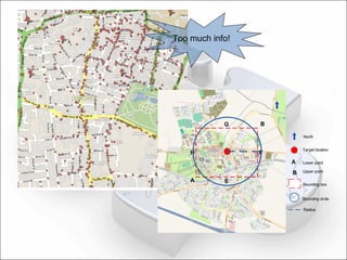
- 4. GeoSpatial Information Retrieval for Mobile Devices Mobile Location Based Service (LBS) User’s current location (latitude/longitude) User’s facing direction (azimuth) Geospatial Queries in relation to user’s current locatio Proximity query (Nearest-Neighbours) All the cafés around All the point-of-interests around … Information over load problem
- 7. GeoWands via Mobile Spatial Interaction Mobile Spatial Interaction Spatial databases Spatial data storage Spatial index for rapid data access Spatial operators Topological operations Intersection, contain, touch, etc. Human Interaction Gesture Visibility (field of view)
- 8. Figure. The overall diagram for the system
- 9. Python for Web Service and Spatial Database Python for Web Service SOAP Restful style URL based Http request XML/JSON (GeoJSON) output Turbo Gears/ Django
- 10. Example: http://threedq.webhop.org/POI/format=JSON&lat= 53.3387 &lng= 6.2675 heading=44.0&tilt=20.8 {“Result”:{ name:”Jacobs factory” coordinate:{ lat:” 53.3321” lng:” -6.2668”} } }
- 11. Python for spatial databases CX_Oracle GEOS python bindings Other open sources ported python bindings via SWIG VisiLibity framework for visibility calculations GDAL for Digital Elevation Model (DEM) surface generation GEOS for geospatial objects topological relationship determination
- 12. Other python merits PyS60 for Symbian devices A previous example use python on Navigator 6210 Customized map tiles from OpenStreetMap (OSM) for offline and stylish usage And many more …
- 13. A case study on iPhone
- 15. Thanks!